Savannah Rapids Park to North Augusta Boat Ramp
Gauge Conditions
Runnable: 5,000.0 – 100,000.0 CFS
Data from American Whitewater & USGS
Run Map
Run Time Estimate
Select put-in and take-out to estimate time.
Plan This Trip
See wind-adjusted speed maps, forecast planning, and detailed time estimates.
Sign in to generate an AI timing estimate for this run.
Whitewater timing varies with scouting, portages, and group pace. Use as a planning baseline.
Description
This section of the Savannah offers easy access and lots of areas to explore. It is easy enough that it gets heavy use by recreational kayakers in flat water and touring boats. However, the numerous wide shoals offer plenty of potential for whitewater practice and play spots. The Augusta Canal parrallels most of this section and offers additional flat water boating.
Put in:
The easiest and most popular put in is just below the Augusta Canal Headgate / Savannah Rapids Pavilion. This county park has a visitor center, picnic areas and plenty of free parking. As you enter the park, turn right to the lowest parking lot. A pedestrian bridge leads across the canal. Fairly wide stairs climb over a low wall then descend to the river.
Previous descriptions suggested putting in at Steven's Creek dam, but as of 2011 there is no public road access to that dam. There is a public launching area 6 miles upstream of Steven's Creek dam on Betty's Branch at German Island. There is also public access 12 miles upstream at the base of Strom Thurmond Dam. The river is flat water above the Augusta Canal Diversion Dam and above Steven's Creek dam. The only whitewater is below the canal diversion dam to Hammond Rapids.
Take Out:
1) There is a developed public boat launching area on river left at the North Augusta Boat Landing. The landing is on Hammonds Ferry Rd. at Riverview Park, North Augusta, SC. There are limited, primitive campsites nearby which require reservations. Call 803.441.4300 begin\_of\_the\_skype\_highlighting803.441.4300end\_of\_the\_skype\_highlighting begin\_of\_the\_skype\_highlighting803.441.4300end\_of\_the\_skype\_highlighting
2) Boaters can also take out by paddling up the Rea's Creek channel towards Lake Olmstead. Take out under the railroad bridge. It looks like you may be able to drive a car to this location. However, it is probably faster to just carry boats to the canal trail and then across a pedestrian bridge to a parking area at Milledge Rd and Lakeshore Loop.
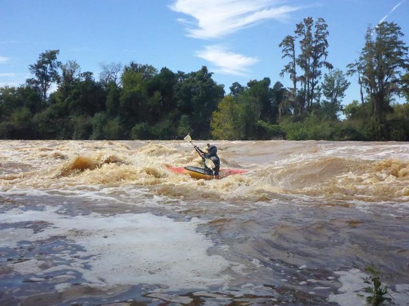
From Edward Leahy"...Put in below the Steven's Creek dam. Following that is about a mile of flat water to the Augusta canal diversion dam. There is some whitewater starting below this dam. The portage is on the Georgia side just below the dam and is accessed via the canal path below the Savannah Rapids pavilion. It is 5 miles to the North Augusta boat ramp. This section is class I-II with one borderline III, Hammond Rapid on the South Carolin side just downstream from the Augusta waterworks (which is on the Ga side. Optimal flow is 8,000- 15,000 CFS. The guage is downstream and the canal usually diverts around 3,000 CFS. After Hammond rapid, there is no more whitewater on the Savannah."
FUN FACTS:
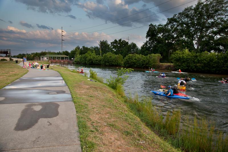
Augusta area kayakers have a 30 year tradition of playing kayak football in the Augusta Canal just upstream of the 13th Street gates. Most Wednesday evenings, boaters in whitewater kayaks, recreational kayaks, sit on tops, surf skiis and canoes, show up to throw a ball around in the water. The rules are basically kayak water polo, but to score, the ball must be thrown and caught across the goal line, just like a football touchdown. The ball can not be carried across the goal line and if it is thrown into the water across the goal line, the defenders get posession.
Historically, the Savannah River was quite rocky upstream of Augusta. River men brought bails of cotton downriver to Augusta in very large but manuverable canoes, called Petersburg Boats. These rapids are now completely hidden by a series of very long reservoirs which generate hydro-electric power for the region.
Other Information Sources:
Augusta Canal National Heritage Area
Savannah Rapids Park
Savannah Rapids Visitor Center
Augusta Canoe and Kayak Club
Rapids in this Run (1)
Waterfalls (1)
Playspots (1)
Hazards & Portages (2)
Caution: The following locations may require scouting or portaging. Always check current conditions.
Difficulty
Class II(III)
Length
5.3 mi
Rapids
1
1 Hazard
1 Portage
Access Points
Difficulty Classes
I Easy
II Novice
III Intermediate
IV Advanced
V Expert/Extreme
VI Unrunnable
Current Conditions
5-Day Forecast
Whitewater data from
American Whitewater
American Whitewater