Sawyers Bar to Gallia Mine River Access Wild
Gauge Conditions
Data from American Whitewater & USGS
Run Map
Interactive run map
Loads as you approach this section.
Put-in
Take-out
Rapids/Hazards
Wild
Recreational
Run Time Estimate
Select put-in and take-out to estimate time.
Plan This Trip
See wind-adjusted speed maps, forecast planning, and detailed time estimates.
Sign in to generate an AI timing estimate for this run.
Whitewater timing varies with scouting, portages, and group pace. Use as a planning baseline.
Description
The scenic four-mile section beginning in Sawyers Bar is one of the best sections of class II/III whitewater in the region yet is virtually unknown to paddlers despite its ease of access and prominent visibility along Sawyers Bar Road. Most boaters just drive by, headed for more famed and difficult sections elsewhere in the watershed. But this is worthy as a stand-alone run for boaters seeking class II/III challenge, and it can be added onto the Idlewild Run for some additional miles on the North Fork's magical green waters.
The rapids begin right away at the put-in and alternate with long, slow pools. Bestville Boulder and Little North Fork rapids stand out as the two that are more difficult than the rest and there's one section just upstream of Jackass Gulch where the willows have encroached the channel and require some route-finding to find the clearest passage through. Be sure to spin your boat to take in the upstream view of the high peaks of the Salmon Mountains in the Russian Wilderness Area in the first half of this run. Views of Crapo Mountain dominate the middle of the run in the downriver direction. The confluence of the Little North Fork is gorgeous.
The take-out is unmarked along the river and could be easily missed, so scout it before paddling so you don't end up on the class IV+ Canyon Run that lurks downstream.
Logistics
_Put-in_
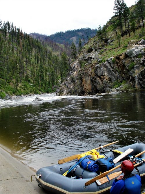
The put-in is near the downriver end of the small town of Sawyers Bar. Park at the small clearing next to the historic Catholic Church in the upriver direction. From here, walk across Sawyers Bar Road and back downriver about 150 feet. You'll see an unmarked trail that heads through the tailings piles and goes to a sandy beach on the river with a tree house nearby. This is the only public river access in Sawyers Bar and it is also the nicest. Be sure to download the Salmon River Restoration Council's map of this river access site.
_Take-out_
The take-out is at the old Gallia Mine site. It is not marked or obvious from the river so scout the take-out before paddling. To reach it by vehicle, take the dirt road marked with a _River Access/Engine Fill_ sign that is just upriver of the 10-mile marker on Sawyers Bar Road (about the 10.25-mile mark). Follow the road downhill to a small parking area near the river. If you miss the take-out, you'll end up on the class IV/V North Fork Canyon Run.
Flows
Boatable at a wide range of flows, this run is at a medium level between 3000 and 6000 cfs on the Somes Bar gage.
Additional Information
Salmon River Restoration Council's Whitewater Recreation Page \- great overview and detail on the whitewater of the Salmon River drainage
Salmon River Hazard Map \- map of known hazards in the river and tributaries
Rapids in this Run (16)
Rapid
III
Bestville Boulder
Rapid
II+
Jackass
 Rapid
II+
Rapid
II+
Unnamed Rapid
Rapid
II+
Unnamed Rapid
Rapid
II
Unnamed Rapid
Rapid
II
Unnamed Rapid
Rapid
II
Shiltos
Rapid
II
Kellys Bar
Rapid
II
Unnamed Rapid
 Rapid
II
Rapid
II
Unnamed Rapid
Rapid
II
Unnamed Rapid
Rapid
III
Little North Fork Rapid
Rapid
Little North Fork Confluence
Rapid
II+
Unnamed Rapid
Rapid
III-
Unnamed Rapid
 Rapid
II
Rapid
II
Unnamed Rapid
Difficulty
Class II+(III)
Length
4.2 mi
Rapids
16
Access Points
Difficulty Classes
I Easy
II Novice
III Intermediate
IV Advanced
V Expert/Extreme
VI Unrunnable
Current Conditions
5-Day Forecast
Whitewater data from
American Whitewater
American Whitewater