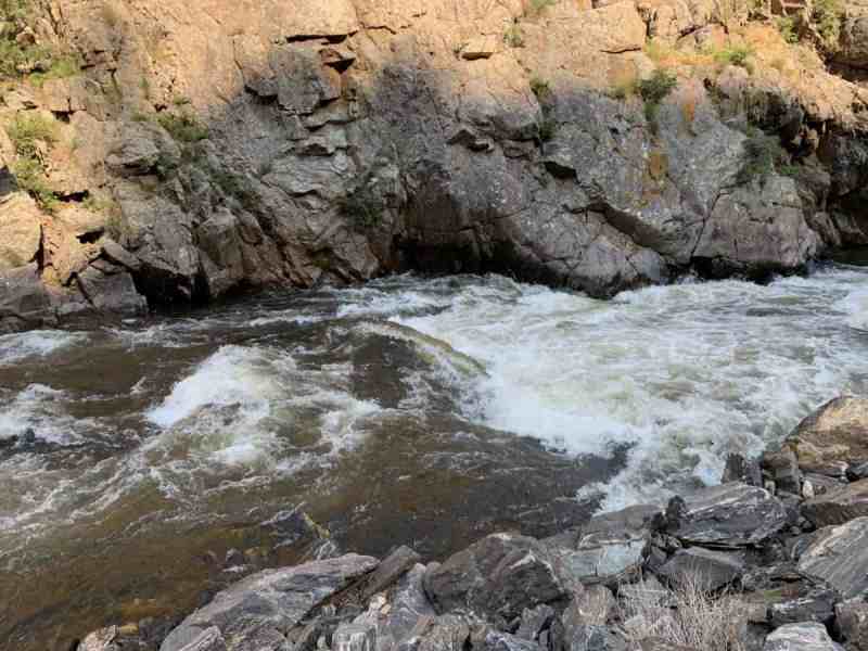
Second Bridge to North Umpqua
Gauge Conditions
Runnable: 3.7 – 5.0 FT
Data from American Whitewater & USGS
Run Map
Interactive run map
Loads as you approach this section.
Run Time Estimate
Select put-in and take-out to estimate time.
Plan This Trip
See wind-adjusted speed maps, forecast planning, and detailed time estimates.
Sign in to generate an AI timing estimate for this run.
Whitewater timing varies with scouting, portages, and group pace. Use as a planning baseline.
Description
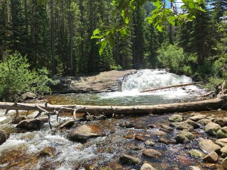
This run is steep and active, consistently Class IV. One of the best class IV runs Oregon has to offer. There is a fun/clean 15 foot waterfall in the middle of the lower section.
Description:
This run splits conveniently into two sections.
_Upper Section_
Check out the description, with pictures and shuttle directions, in Jason Rackley's excellent Oregon Kayaking site. This section feels a bit more adventurous, especially if you put on high enough to add on Paul Bunyan Falls. Paul Bunyan still has wood in it, but has been run on the left.
_Lower Section_
Look over the put-in bridge at the first drop. This is about average difficulty of the run. You will be required to do things more difficult than this.
The next drop is not visible from the put-in and is worth a look. This is as hard as it gets (except for the waterfall and logs).
There is a good trip report from Nate Pfiefer on this section here: http://wheelsandwater.blogspot.com/2010/06/copeland-creek-060610.html
Helmet cam view of the run
Shuttle:
To get to the take-out: Take I5 to Roseburg exit 124 and follow the signs to state highway 138 east. Go east just past MP 51 to Copeland Creek. It is well marked. Take out under the bridge or down on the North Umpqua.
To get to the mid point put-in: Go up Copeland Creek Road (USFS 28) two miles to the first bridge. Cross the bridge and park. Put in at the 'pump chance' WO 30307.
To get to the put-in: Stop at the mid point put-in and gaze at the rapid downstream. Go back accross the bridge and continue up river left on the dirt road (Copeland Creek Road USFS 2801). Bear left at all intersections. After two and a half miles turn left at USFS 2801-300. Cross the bridge and park in the hunters camp. Carry down to the creek from here. A much nicer put-in is 0.2 miles downstream at 'pump chance' WO 3040.
Rapids in this Run (1)
Waterfalls (2)
Difficulty
Class IV(V)
Length
5.5 mi
Gradient
120 ft/mi
Rapids
1
Access Points
Difficulty Classes
I Easy
II Novice
III Intermediate
IV Advanced
V Expert/Extreme
VI Unrunnable
Current Conditions
5-Day Forecast
Whitewater data from
American Whitewater
American Whitewater