Shaw's to Weymouth Landing
Gauge Conditions
Runnable: 170.0 – 450.0 CFS
Data from American Whitewater & USGS
Run Map
Run Time Estimate
Select put-in and take-out to estimate time.
Plan This Trip
See wind-adjusted speed maps, forecast planning, and detailed time estimates.
Sign in to generate an AI timing estimate for this run.
Whitewater timing varies with scouting, portages, and group pace. Use as a planning baseline.
Description
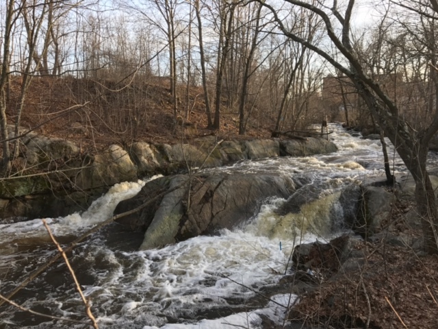
The Monatiquot river takes a 5 mile course through the city of Braintree as it makes it way to the ocean at Weymouth Landing. The river has 3 distinct rapids located at the Put-in, Mckusker Drive, and Shaw Street separated by lots of flatwater and narrow class I-II. Where the river flows out of Hollingsworth Pond near the Braintree RMV is where the first real rapid is. There is an old mill that obstructs driving directly to the put-in, so access is a bit tricky, however there are plans being made to removal the mill which may improve things in the future. Park behind Shaw’s or The Chateau and hike up over the railroad tracks up river right to put-in above the first rapid. This rapid is the best feature of the run and would warrant park and huck laps given the amount of flatwater after it. It is a fairly straightforward 100 yards of class III with 2 options left or right with 3-4 foot drops at the end. This rapid requires the most water compared to other features on the run and you should look for >200 cfs to run it, however could be scraped down as low as 170 or so. From here you’ll go under the railroad through an old stone bridge where the river flows behind Shaw’s through a narrow wooded area consisting of fast moving class I-II, however be on the lookout for river wide trees and over hanging brush given the constricted nature of the run and fast moving current.
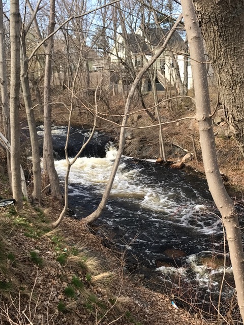
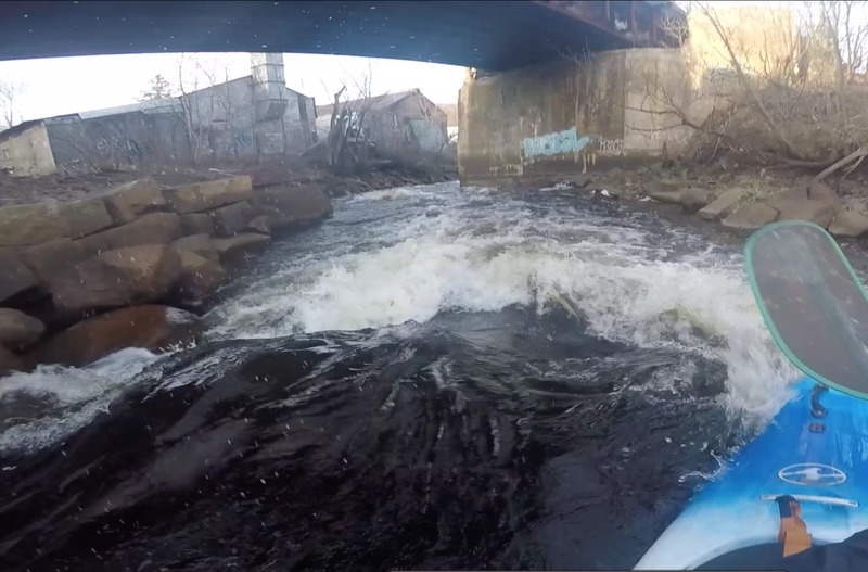
Once the river goes under John Mahar Highway it is meandering flatwater that takes you through marshlands under route 3 and runs adjacent to route 3 on the east side for a while. As you approach the River Street Bridge current picks up and is back to class I-II boogie water. You’ll pass under a railroad bridge and the Middle Street overpass, however the first Adams Street Bridge directly after Middle Street is too low to clear so plan to portage. The other dozen or so bridges you pass under all have plenty of room with normal runnable flows. Moving downstream is more flatwater and intermittent class I-II until you get to the Mckusker Drive rapid at the entrance for Braintree Village apartments. This rapid has a nice river-wide ledge drop to start with fast moving constricted class II that follows taking you under the bridge. More boogie water takes you to the last rapid after you pass by the gauge at Commercial Street. The Shaw Street rapid is probably only there with low tide as high tide more than likely causes it to be washed out. It is a straightforward class II rapid with a small surf wave at the end. The takeout is at the boat launch off of Commercial Street on river right.
This is far from a world class run, but if you live in Southeastern MA and are looking for a close after work river it’s worth checking out. The river could benefit from some wood removal as there are currently (4/2017) several portages through thick brush and some overhanging limbs that require ducking and face protection.
https://www.youtube.com/watch?v=ksPs7zTQ3OU
Rapids in this Run (3)
Difficulty
Class II-III
Length
3.9 mi
Rapids
3
Access Points
Difficulty Classes
I Easy
II Novice
III Intermediate
IV Advanced
V Expert/Extreme
VI Unrunnable
Current Conditions
5-Day Forecast
Whitewater data from
American Whitewater
American Whitewater