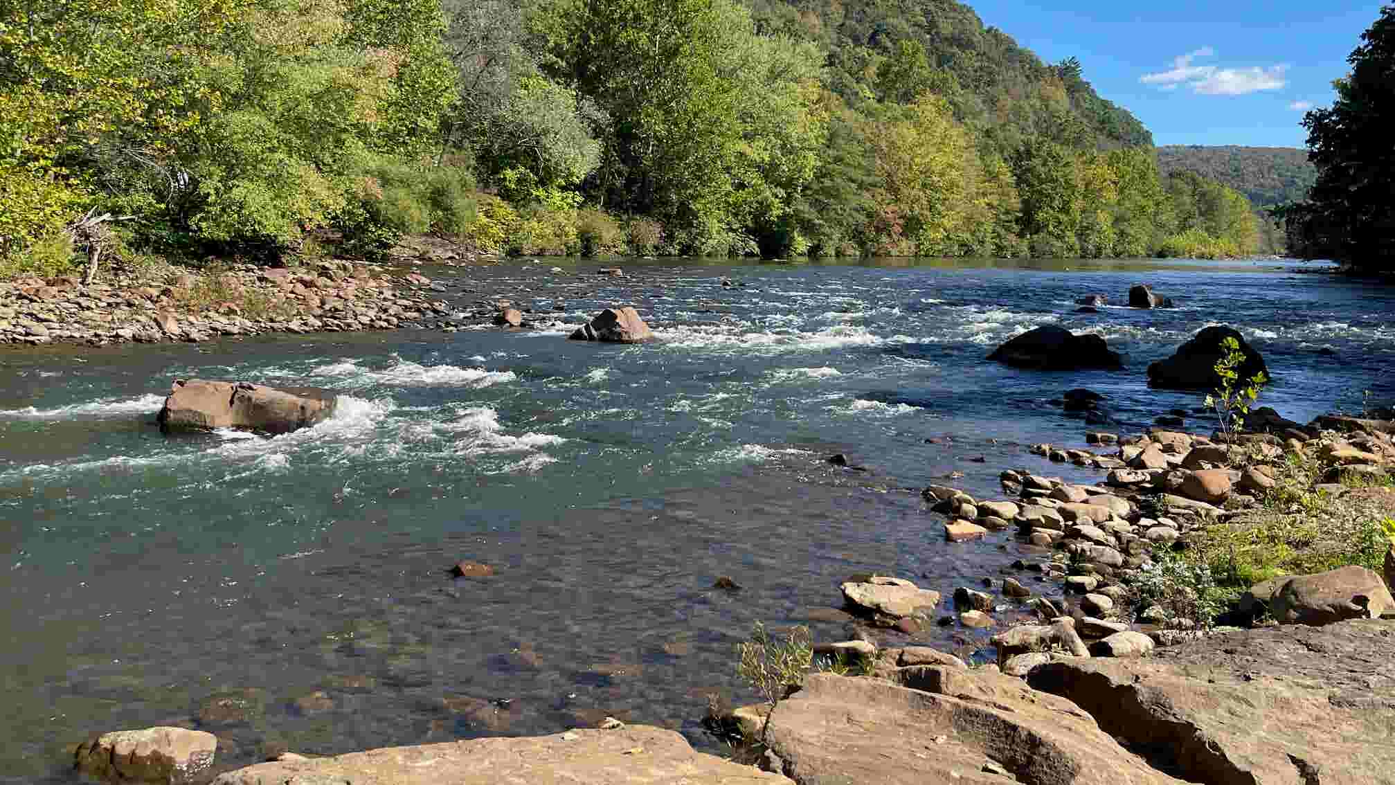
South Fork to Johnstown
Gauge Conditions
Runnable: 8.7 – 12.5 FT
Low runnable to a decent flow. Echo may be approaching the highest it can be run safely.
Data from American Whitewater & USGS
Run Map
Run Time Estimate
Select put-in and take-out to estimate time.
Plan This Trip
See wind-adjusted speed maps, forecast planning, and detailed time estimates.
Sign in to generate an AI timing estimate for this run.
Whitewater timing varies with scouting, portages, and group pace. Use as a planning baseline.
Description
Description: This run starts in South Fork or on one of two other Little Conemaugh reaches (North or South) taken down into Mineral Point, onto Johnstown. This is the riverway which the great flood of 1889 took decimating the city. It is a pretty nice beginner/intermediate river, mainly a scenic class II river, with a few Class III rapids on it and with one major class V in Echo right past Mineral Point. For historic reasons, putting in along the South branch will take you on the path of the 1889 flood. The river itself is damaged due to Acid Mine Drainage but it is currently being cleaned up with some fish returning in sections up above. A brand new AMD clean up plant has started on the South Branch with plans to clean the North Branch as well. Claimed to be one of the best fishing rivers pre-mining. The Little Conemaugh's headwaters begin in Cresson, PA (North Branch). Along the river you will see a dam, trains and the infamous Conemaugh Viaduct that was rebuilt in 1889 after the flood damaged the first one. If you are lucky you will see a train go over it as you run the rapid beforehand and under the tunnel.
THE ONLY REASON WHY IT IS CLASS 2-3 (V):
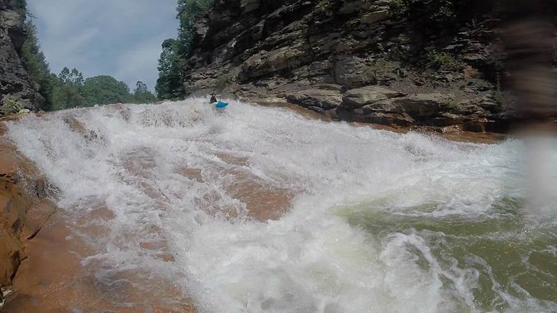
The Little Conemaugh originally ran around the mountain in which it flows through now near Echo in East Conemaugh, but after the flood the mining companies decided to cut through the rock creating Echo Rapid around 1920. Echo rapid is comprised of a straightforward path above the actual drop, then goes to a 5-8 foot waterfall, into a rockslide, into a hole with a rather large pool afterwards. The hole at the bottom can get rather chompy so make sure you scout this thing before you run it. You can tell the rapid is coming up by looking for a green bridge that connects the top of the canyon together, used as an old coal tram. You will also notice some boney piles on the right, and essentially a mountain cut down the middle. Portage to river left through the forest over a train track (just be careful) and around the mountain or through the canyon on a lower day, or up the mountain on the right. Be aware that this hike does suck pretty bad.
Put in can be on any of the other two branches, or in South Fork, take out is in Franklin in Johnstown, walk under clapboard run to roads, or take out in Mineral Point at the bridge, which is the last take out point before the Echo rapid. I would advise to take out in Mineral Point. Mineral Point is traditionally the take out.
I personally suggest running the South Fork branch from park of 1889 in St. Michael down to Mineral Point. After Mineral Point there really isn't much other than a few class II rapids and you then have to deal with Echo.
When to paddle: The Little Conemaugh river's season ranges from March - June. It is runnable however all year long after rainfall, but does not hold water as well as the Stonycreek. It is typically best to go off of a "CFS" range as there are two major branchs to this river with the gauge in Johnstown well after they both adjoin.
Release timing: There are no releases on this river, however there are 3 major resevoir's upstream on various sections that would allow for future releases if possible.
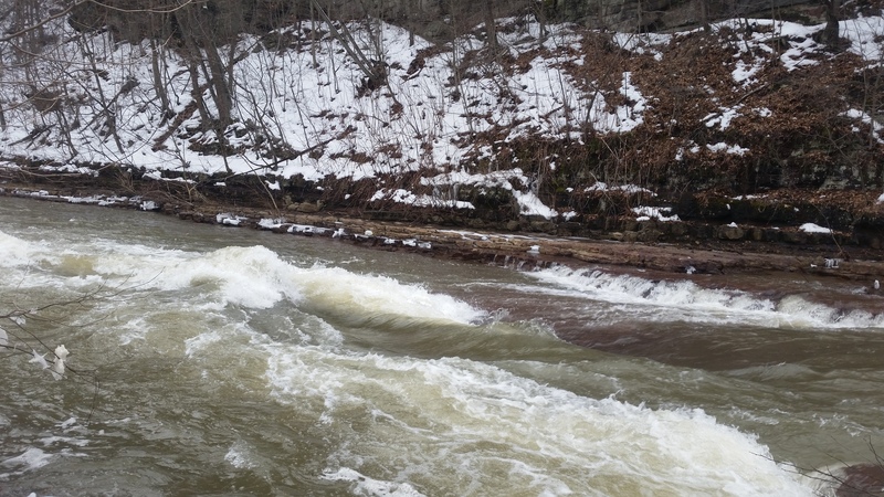
Hazards: Aside from the major pollution (Acid Mine Drainage) and industry polution (few car parts and metal beams which aren't really an issue at all), there is a dam shortly after the confluence of the North and South branches. The dam is runnable at lower levels (under 600 cfs) on far river left, or there is a portage route around it a few hundred yards before, or you can paddle up to the dam and get out on the left at the dam. Their is also a rapid just after Mineral Point take out known as Echo. This can be ran, but is a whole different ballgame than the rest of the river. Once you pass under the viaduct, you will be at Mineral Point. The typical takeout is on the right. If you continue to Johnstown you will have to deal with Echo. It can be portaged but is tricky.
Events: There is a group event, "The Path of the Flood," paddle that I would love to see come into fruition during the week or weekend of May 31st, marking the anniversary (May 31st, 1889) of the great Johnstown Flood.
Directions: This river can be ran via the North and South Branch. I recommend starting at the park of 1889 and running the South branch due to it's history and smaller class 3's that it adds to the run shortly after the Rager's Hill Bridge. There main put in for this section is in South Fork off of River Street. Take Rte. 219 north from Johnstown, or south from Ebensburg to exit: PA53 south to South Fork. Once in South Fork, turn by Kick's / Fabo's Garage onto Maple Street, then left onto River St. just after the post office. Appears to be parking near post office, weekend's in the lot that is here, or down near riverside.
Shuttle: Shuttle can be run two ways with two different take outs, though Mineral Point is traditional takeout.
A: Turning back to 53, head north to Summerhill. Take a left onto Main Street once in Summerhill and head over the railroad bridge and around making a left onto Jackson Street. Follow Jackson Street (SR3043) and turn left onto Mineral Point Rd. Follow Mineral Point Rd, to Mineral Point for 3 miles, turn left onto Front St. There is a old church and across the way from that is a parking area with a picnic table. Obtained permission to park here as well, the family is nice.
B: Turning back to Maple street, turning right at the Kicks/Fabo intersection onto Lake St, follow until it becomes Rager's Hill Rd. Continue on Ragers Hill for a while up the hill to Clapboard Run Rd. An alternate route to Mineral Point can be taken here on the right onto Beech Hill Rd. Follow Beech Hill Rd to Mineral Point turning right onto Front St and following that to the above location at the church lot. If you are taking out in Johnstown instead (reminder you will have to deal with Echo), do not take Beech Hill Rd. and continue down until you get into the Franklin section of Johnstown, you will know it. Turn immediately right after you cross Clapboard Run stream into a park where you can park your car and check the fench to see if it still has an opening in it. You can park at the park and river access is down the stream through a tunnel to the river.
Coordinates:
South Fork Putin: 40.364161, -78.794977
Dam: 40.368828, -78.805386
Mineral Point Take-Out: 40.377004, -78.833163
Echo: 40.360915, -78.859768
Johnstown Take-Out: 40.346384, -78.880584
Elevation Profile:
Put In: 1464
Mineral Point Take Out: 1364
Johnstown Take Out: 1217.8
Total Drop: 1464 - 1217.8 = 246.2ft
Loop Elevation Drop 1431.2 - 1386.0 = 45.2ft
Mile 1: 1464 - 1445.1 = 18.9ft
Mile 2: 1445.1 - 1419.3 = 25.8ft
Mile 3: 1419.3 - 1388.9 = 30.4ft
Mile 4: 1388.9 - 1366.5 = 22.4ft
Mile 5: 1366.5 - 1349.1 = 17.4ft
Mile 6: 1349.1 - 1323.2 = 25.9ft
Mile 7: 1323.2 - 1274.7 = 48.5ft
Mile 8: 1274.7 - 1250.2 = 24.5ft
Mile 9: 1250.2 -1217.8 = 32.4ft
Other Information:
80 cfs = 7.81 ft
200 cfs = 8.40 ft
250 cfs = 8.56 ft
300 cfs = 8.70 ft (actual cfs is 301)
800 cfs = 9.69 ft (actual cfs is 802)
1000 cfs = 9.96 ft (actual cfs is 998)
1500 cfs = 10.51 ft
2000 cfs = 10.94 ft
2500 cfs = 11.31 ft
3000 cfs = 11.64 ft
3500 cfs = 11.93 ft
4000 cfs = 12.18 ft (actual cfs is 4010)
Video:
1000 CFS: https://www.youtube.com/watch?v=so6C4pPOi48
2000 CFS: https://www.youtube.com/watch?v=e9hK6iPULZg
Mission Echo: https://www.youtube.com/watch?v=qlFCAjrEX54
For other streams in this watershed, check out:
Stony Canyon (III-IV)
Stony Gorge (IV)
Roaring Fork (IV)
Shade Creek (III-IV)
Paint Creek (V)
Dark Shade Creek (IV-V)
Clear Shade Creek (III)
Quemahoning Creek (III)
Little Conemaugh River - North (II-III)
Little Conemaugh River - South (II-III)
Trout Run (IV)
300 cfs = 8.70 ft (actual cfs is 301)
800 cfs = 9.69 ft (actual cfs is 802)
1000 cfs = 9.96 ft (actual cfs is 998)
1500 cfs = 10.51 ft
2000 cfs = 10.94 ft
2500 cfs = 11.31 ft
3000 cfs = 11.64 ft
3500 cfs = 11.93 ft
4000 cfs = 12.18 ft (actual cfs is 4010)
Rapids in this Run (6)
Waterfalls (1)
Playspots (1)
Hazards & Portages (1)
Caution: The following locations may require scouting or portaging. Always check current conditions.
Difficulty
Class II-III(V)
Length
9.1 mi
Gradient
27 ft/mi
max 49
Rapids
6
1 Hazard
Access Points
Shuttle Info
From Johnstown, take 219 north to route 53 southfork/portage exit.
Take 53 west into South Fork and make a right past the gas station Kicks and Fabo's. Find a place to park and this is where all the north and south branch meet.
Shuttle can be run two ways with two different take outs, though Mineral Point is traditional takeout.
A: Turning back to 53, head north to Summerhill. Take a left onto Main Street once in Summerhill and head over the railroad bridge and around making a left onto Jackson Street. Follow Jackson Street (SR3043) and turn left onto Mineral Point Rd. Follow Mineral Point Rd, to Mineral Point for 3 miles, turn left onto Front St. There is a old church and across the way from that is a parking area with a picnic table. Obtained permission to park here as well, the family is nice.
B: Turning back to Maple street, turning right at the Kicks/Fabo intersection onto Lake St, follow until it becomes Rager's Hill Rd. Continue on Ragers Hill for a while up the hill to Clapboard Run Rd. An alternate route to Mineral Point can be taken here on the right onto Beech Hill Rd. Follow Beech Hill Rd to Mineral Point turning right onto Front St and following that to the above location at the church lot. If you are taking out in Johnstown instead (reminder you will have to deal with Echo), do not take Beech Hill Rd. and continue down until you get into the Franklin section of Johnstown, you will know it. Turn immediately right after you cross Clapboard Run stream into a park where you can park your car and check the fench to see if it still has an opening in it. You can park at the park and river access is down the stream through a tunnel to the river.
Difficulty Classes
I Easy
II Novice
III Intermediate
IV Advanced
V Expert/Extreme
VI Unrunnable
Current Conditions
5-Day Forecast
Whitewater data from
American Whitewater
American Whitewater