through Gates of the Arctic National Park
No live gauge linked. This run does not currently have a verified USGS or CDEC source for runnability. Difficulty and route details are not current water conditions.
Run Map
Run Time Estimate
Select put-in and take-out to estimate time.
Plan This Trip
See wind-adjusted speed maps, forecast planning, and detailed time estimates.
Sign in to generate an AI timing estimate for this run.
Whitewater timing varies with scouting, portages, and group pace. Use as a planning baseline.
Description
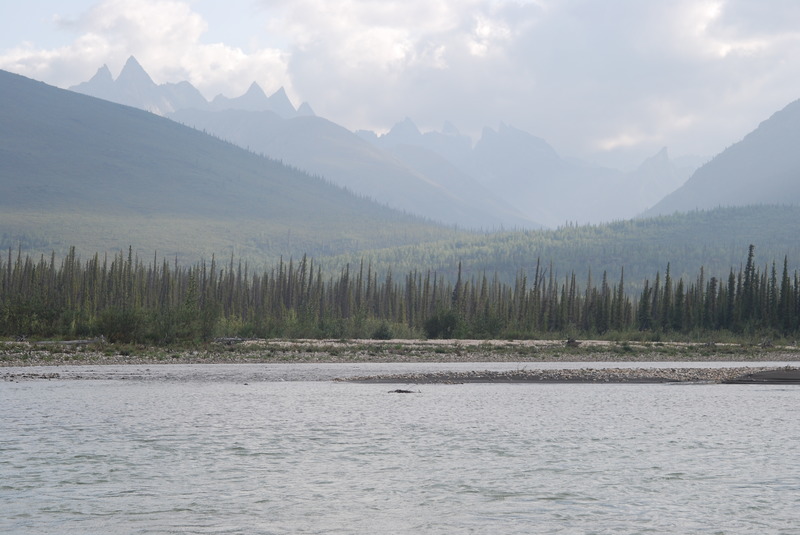
This federally-designated Wild and Scenic river orginates near the headwaters of the Noatak, in Gates of the Arctic National Park. This is one of the most remote wilderness regions on the planet and the river is the best means of experiencing the landscape. The river meanders through the Endicott mountains and through a boreal forest and taiga before it ends at the village of Allakaket, located at the river's confluence with the Koyukuk River.
There are some more challenging sections upstream of the confluence of Arrigetch Creek including a short stretch of class III above Ram Creek that you can portage. The pace of the river mellows considerably once you reach Arrigetch Creek which is one popular option as a starting point for river trips. The river valley provides excellent opportunities for hiking and camping. Just be aware of the fact that the river can rise quickly.
Logistics
Take a commerical flight from Fairbanks to Bettles and then arrange a bush plane for a flight into the park. You will also need to arrange a pick-up. The listed put-in coordinates are a lake at the headwaters of the river in Gates of the Arctic National Park. The takeout coordinates are at the town of Allakaket on the Koyukuk River just downstream of the Alatna confluence.
Brown Bears are common in this area. Food storage and cooking must be separate from sleeping areas. Bear spray and guns are required for self protection.
Additional Information
Gates of the Arctic National Park
Alatna River: Gates of the Arctic
American Whitewater Journal, Sept/Oct - 2010
Alaska Impressions - Alatna River 2011: Youtube slide show
Alatna 2009, Slideshow.pdf
Rapids in this Run (2)
Difficulty
Class I(II)
Length
200.0 mi
Gradient
12 ft/mi
max 40
Rapids
2
Access Points
Difficulty Classes
I Easy
II Novice
III Intermediate
IV Advanced
V Expert/Extreme
VI Unrunnable
Current Conditions
5-Day Forecast
Whitewater data from
American Whitewater
American Whitewater