Tinker's Gorge in Bedford Reservation
Gauge Conditions
Data from American Whitewater & USGS
Run Map
Interactive run map
Loads as you approach this section.
Run Time Estimate
Select put-in and take-out to estimate time.
Plan This Trip
See wind-adjusted speed maps, forecast planning, and detailed time estimates.
Sign in to generate an AI timing estimate for this run.
Whitewater timing varies with scouting, portages, and group pace. Use as a planning baseline.
Description
**\*Wood Alert\* Every paddler entering this creek should be on alert for new wood. Always scouting your lines in boat or out. Wood here comes and goes just as often as it rains. Wood and strainers can even become a semi-permanent feature, or can come and go within the hour.
Gauging Flows
This creek can jump 1000 cfs in an hour in certain conditions. For this reason, the safest approach is to watch the gauge during and after rainfall, then put on while its dropping into your comfort range of flows. Keep in mind that forecasted rainfall can cause additional spikes while on the water.
Notice: A Sept 2020 rain event flooded the river to 5000 cfs causing significant changes to the rapids immediately below the Tunnel. The most notable changes occurred in Tight Slotz, Regional (Rockpile), and S-Turn. The rapids became less technical but opened up multiple lines.
Description
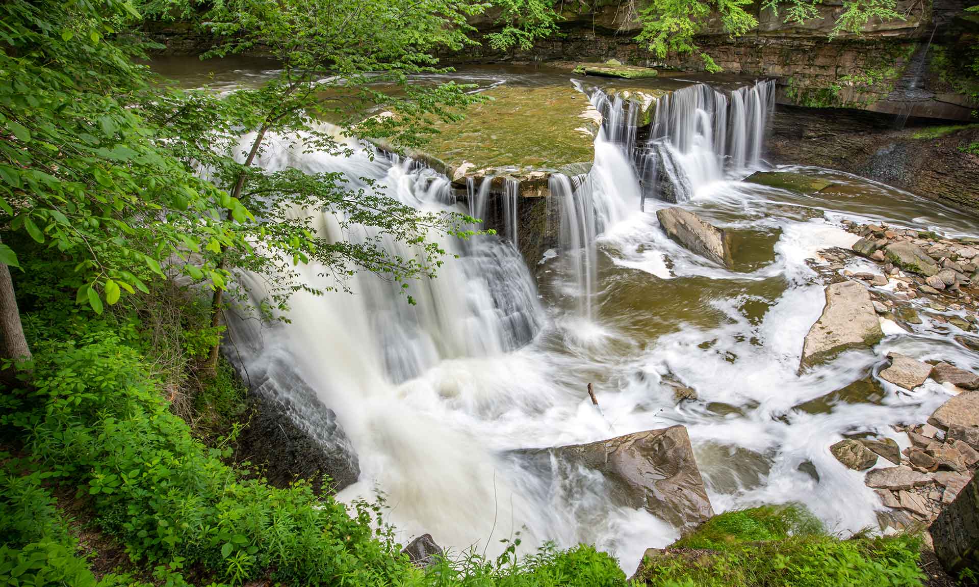
Tinker's Creek requires heavy rainfall, and can spike and fall quickly. The beginning is a half mile warmup section, offering some surf, wave trains, and playful eddies. As a paddler approaches the Great Falls, the scenery starts to change quickly - entering into a deep tight gorge of shale and sandstone. Once at The Tunnel, a paddler is now committed to a half mile of continuous whitewater called The Meat (approx 80ft of gradient in 0.5 miles, 100ft if running the falls). After the meat, the gorge opens up into a wide view of scenic cliffs and ravines. The creek then offers up a lot of class 1-2 waves, holes, surf, and stunning views for the last 3 miles all the way to the takeout.
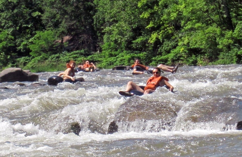
Runnable after heavy rain. Technical and playful, this is some of the funnest stuff in Ohio when it's running. AW Article from 5-6/1999, with pictures Careful on this crick; there are pinning spots and strainers in unpredictable places. Important: the park rangers are very polite and friendly. They won't give you a hard time _if_ your boat is registered in Ohio. If you _aren't_ registered, they can deny you access. Registration is a dumb idea, in this humble StreamKeeper's opinion, but it's about $30 bucks for three years. If it prevents a hassle at the putin for the best whitewater in Ohio, it's well worth it.
Put Ins & Takeouts
Full Run -Put In at the Broadway Trailhead on Hawthorn Pkwy. Takeout is on Gorge Parkway, just before the Dunham Road bridge. There is roadside parking on the south side of the Creek. The alternative full run takeout is the Hemlock Creek Picnic area, slightly upriver and on the north side at the end of Button Road.
Put In Pin: Put In - Broadway Trailhead Google Maps Pin
Takeout Pin: Takeout - Gorge Pkwy Google Maps Pin
Alternative Takeout Pin: Hemlock Creek Picnic Area - Google Maps Pin
Great Falls of Tinkers Creek
Park & Huck - Viaduct Park in/out
Viaduct Park - Google Maps Pin
Meat Laps
Paddlers can opt to run only the major rapids (Great Falls/The Tunnel to S-Turn)
Put In, Park at Willis Picnic area and hike to Viaduct Park. Takeout, immediately after S-Turn on river right at the steep small creek cutting through the shale cliff. Hike up the creek and connect with the unmarked trail that heads East towards the Willis Picnic area ball field.
Willis Picnic Area - Google Maps Pin
Optional Put In/Takeout - Google Maps Pin
Lower Tinkers
Paddlers can opt to run the lower section only, skipping the meat but still enjoying the waves and surf for the last 2 miles. This is a fun time at medium and higher flows 600+
Put In, park at Willis Picnic area, hike into the woods to the West and follow the unmarked trail to the tiny creek, putin immediately after S-Turn. Takeout, same as Full Run. Alternative Put Ins for Lower Tinkers involve hiking the mapped bridal trails. Bridal Trail access from either the end of Powers Road for the north side, or Egbert Picnic Area from the South Side. The hiking is significantly longer than Willis Picnic area putin, and you miss some fun waves and features.
Parking: Willis Picnic Area - Google Maps Pin
Optional Put In Creek Access point: Optional Put In/Takeout - Google Maps Pin
Takeout: Takeout - Gorge Pkwy Google Maps Pin
Fun Fact: There are lots of deer here. Many have a mottled 'piebald' coat.
Fun Fact II: The First Descent of Tinker's Creek, as near as anyone can determine, was by Keelhaulers Chuck Singer and Jon Reising in February, 1972. Because of the Tunnel, and all the strainers, they never ran it again. Tinker's main pioneers were probably Craig and Brian Homberg and Jim and Jeff Snyder, also in the 1970's.
Other related nearby streams: Lower Cuyahoga (Class I-II) Lower Cuyahoga Gorge (Class III) Upper Cuyahoga Gorge (Class V) Chagrin River, Aurora Branch (Class III-IV) Chagrin River (Class I) Chagrin River, East Branch (Class II)
Conservation Organization:** check out the Friends of the Crooked River, who've been working on cleaning up the Cuyahoga (and its tributaries) and educating the public for decades.
For historical / local info, check out Tinker's Creek Viaduct Park.
Rapids in this Run (5)
Waterfalls (1)
Hazards & Portages (6)
Caution: The following locations may require scouting or portaging. Always check current conditions.
Difficulty
Class III-V(V+)
Length
4.3 mi
Gradient
55 ft/mi
max 235
Rapids
5
6 Hazards
Access Points
Shuttle Info
**Directions: to putin:** From I-271, take the Exit 23 (Route 14, Broadway Ave). Head West (left, if you're coming from the South) at the light. At the third light on Broadway (Union Ave., 0.5 mi. from I-271), bear right to stay on Broadway. Another half a mile down, take a right onto the park road just after the brick road. Pull into the parking area. If you get to the lights at Union Street, you've gone too far.
**To takeout:** cross Broadway Ave (onto Egbert Road). The road twists a little, then intersects with Union Street. Cross Union, and take the next Right at the sign saying "Park Entrance, Bedford Reservation" onto Gorge Parkway. Follow this road as it twists and turns around. Don't drive too fast!, especially on that downhill that's marked as 20 MPH. Just before the T intersection with Dunham Road, pull off and park on the right.
The map below directs you along Dunham and Egbert Roads. That's probably the quick and prudent way to go. [For the scenic route through Bedford Reservation, click here.](http://maps.google.com/maps?f=d&hl=en&geocode=6521544463664248095,41.373234,-81.577812%3B539448183498995133,41.384998,-81.523041&saddr=41.3732338n,81.5778122w&daddr=41.370174,-81.553574+to:41.3849983n,81.5230408w&mra=dpe&mrcr=0&mrsp=1&sz=14&via=1&sll=41.373325,-81.55136&sspn=0.02673,0.058365&ie=UTF8&z=14)
Alternate takeout: just before the Canal Road structure upstream of the Ohio Canal. _Make sure that you scout this takeout carefully,_ because you don't want to blunder into the structure. There's a good eddy-beach on river right. To get there, cross Dunham Road and head down Tinker's Creek Road on river right. Hang a left onto Canal Road. This takeout is not preferred, because it adds a couple of miles of flatwater in the floodplain. I've done it once, out of curiosity, and I'm in no hurry to do it again. [Click here for the shuttle for this longer run.](http://maps.google.com/maps?f=q&hl=en&geocode=&q=from:+41.367018n,81.610651w+to:+41.3849983n,81.5230408w&sll=37.0625,-95.677068&sspn=28.943777,59.765625&ie=UTF8&z=13)
**To the gauge:** On Broadway, continue past the putin road. Take a Left onto Taylor Road. (If you get to the lights at Union St., you've gone too far.) Cross Union Street and park in the lot at the Moonglow Cafe. You can see the gauge clearly through the trees from this parking lot. Stop in at the Moonglow for a beer if you haven't breathed your fill of secondhand cigarette smoke lately.
Difficulty Classes
I Easy
II Novice
III Intermediate
IV Advanced
V Expert/Extreme
VI Unrunnable
Current Conditions
5-Day Forecast
Whitewater data from
American Whitewater
American Whitewater