Toledo Bend Spillway (0.5 mile)
Gauge Conditions
Runnable: ? – ? CFS
Approximate reading: This gauge is 0.3 miles away on Sabine River. Use as a general reference only.
Data from American Whitewater & USGS
Run Map
Run Time Estimate
Select put-in and take-out to estimate time.
Plan This Trip
See wind-adjusted speed maps, forecast planning, and detailed time estimates.
Sign in to generate an AI timing estimate for this run.
Whitewater timing varies with scouting, portages, and group pace. Use as a planning baseline.
Description
NOTICE: THE SPILLWAY RECREATION AREA IS CURRENTLY CLOSED DUE TO EXTENSIVE DAMAGE.
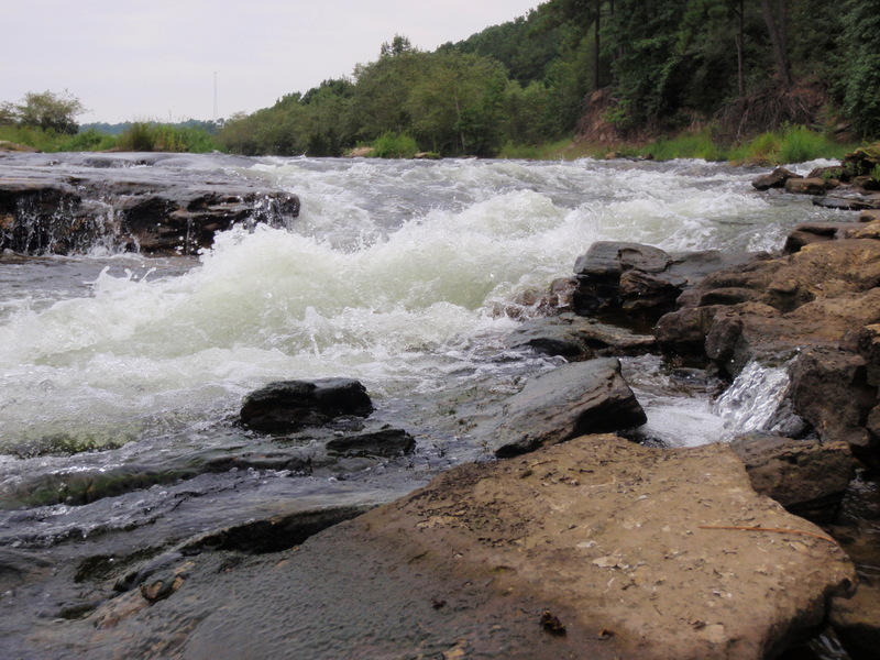
The Toledo Bend Spillway is the premier whitewater location in Louisiana. The class I and II rapids here can be accessed by road and run nearly year round. It is an ideal training ground for both beginning paddlers learning the ropes and expert paddlers honing their skills. It is also a popular location for fishing, swimming, and tubing.
To check the status of the spillway gates, visit the Sabine River Authority. Please comment if you experience any access problems.
This reach is near the Toledo Bend Dam in Texas.
This release schedule is expected to go into effect in September of 2016.

Waterfalls (1)
Playspots (2)
Difficulty
Class I-II
Length
0.5 mi
Rapids
0
Access Points
Shuttle Info
This rapid can be accessed from a road off of Hwy 191. The gated road runs off to the east on the south side of the spillway. There is a parking area with a trail that runs alongside the rapids.
Difficulty Classes
I Easy
II Novice
III Intermediate
IV Advanced
V Expert/Extreme
VI Unrunnable
Current Conditions
5-Day Forecast
Whitewater data from
American Whitewater
American Whitewater