Trace Branch to Poor Fork of the Cumberland (4 miles)
Gauge Conditions
Runnable: 600.0 – 1,000.0 CFS
Data from American Whitewater & USGS
Run Map
Description
I first paddled Cloverlick creek in December 2008. Someone told me that there was a creek near the city of Cumberland Ky, that would be worth doing if the water was up. After a good rain I went to check it out. While Driving up College Road you can scout 80% of the creek. All the major rapids are viewable on the drive up. This creek is mostly exposed bedrock, but has a long section that has been channeled off by boulders. When the creek is running, it is fast paced and a load of fun. There is not a specific gauge for this creek so I use the one for the Poor Fork In Cumberland. The higher this one reads the better the Cloverlick will be.
The put-in is a little tricky because of minimal space for parking. There is enough room for two or three cars to squeeze in this road side area. The first rapid is at the put in, and I believe has been the spot local churches uses to baptize their congregation. Its is a narrow bedrock slide that has been eroded out to form a channel. There is a initial drop of three to four feet and a second that is smaller.
After this little warm up there is a short section of swift flat water and small shoals that will bring you to the second rapid. It consists of two bedrock slides the first one drops about 2' and the second 5'. They both form holes at the bottoms, that can be easily paddled through or surfed.
After these slides is a short pool for preparation for the most significant drop on the creek. It starts as a huge slab of raised bedrock channels off the river form about 20' to 10". A hole forms at the top of the rapid that leads into a slide drop followed by a more holes. After the slab of bedrock there is a good sized eddy.
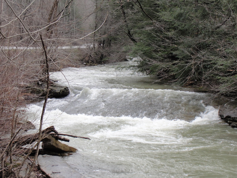
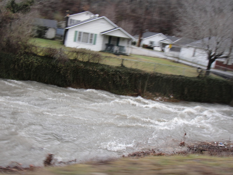
The next rapid is the longest on the creek, lasting about 200 yards. This rapid starts at the pylons on a deconstructed bridge. After the pylons there is a fast slide ending with a river-wide hole, or small ledge, depending on the level. After this hole the river is significantly channeled by boulders. It is a nonstop ride, with small eddies here and there. This stretch of the creek is full of large holes, waves and many pin-spots. You can scout this section by car. There is a 4ft dam after the Drag Strip that can be paddled extreme river left, it has a hydraulic in the middle. After the Dragstrip the river begins to calm down into smaller rocks and less drop. You will pass under a few bridges that in extremely high water would have to be portaged. Always check these bridges for wood. The Cloverlick creek merges with the Poor fork of the Cumberland and it is a short distance to the last rapid and the take-out.
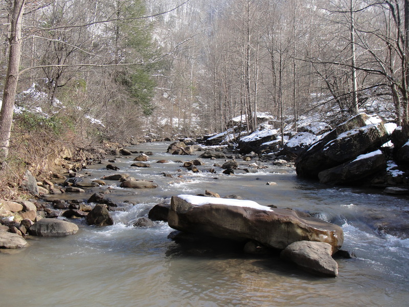
The last rapid occurs underneath Billips Avenue bridge. This drop is river-wide. On river right and left there are 3 to 4 foot ledges and in the middle of the river is a rocky slide. The Billips Avenue Bridge is currently under construction. The take out is directly after the bridge rapid on the river right bank. The scenery at the Cloverlick Creek is pretty nice. There are high mountain ridges along the uppermost part,and the creek is clearer than most in the area.
There is also a steeper section of the cloverlick creek a few miles up the road from the put-in. It takes a little more water to get it runnable, but it is good to paddle. Bigger steeper slides and a few drops with a lot of boogie water. This section is visable from the road and the put in would be at the end of the pavement.
Some other runs in Harlan county are the Martins fork (V), and the Clover Fork (II+III), among many other runs not documented on AW, like the looney creek in Benham/Lynch, Ky. There are a couple places to camp near Cumberland, Kingdom Come state park, Cumberland, Ky, or the Harlan County Campground in Putney, Ky. If you have any questions, shoot me an e-mail jakeboggs@hotmail.com. Enjoy!
Check out the following video (from YouTube) of Jake running the Squeeze:
Rapids in this Run (4)
Difficulty
Class II(IV)
Length
3.7 mi
Gradient
53 ft/mi
Rapids
4
Access Points
Difficulty Classes
I Easy
II Novice
III Intermediate
IV Advanced
V Expert/Extreme
VI Unrunnable
Current Conditions
5-Day Forecast
Whitewater data from
American Whitewater
American Whitewater