Tracy Brook to Clare Rd.
Gauge Conditions
Runnable: 1,000.0 – 6,000.0 CFS
lower section is creeky wil lots of bumping and scraping but fun boulder gardners
Data from American Whitewater & USGS
Run Map
Description
Description:
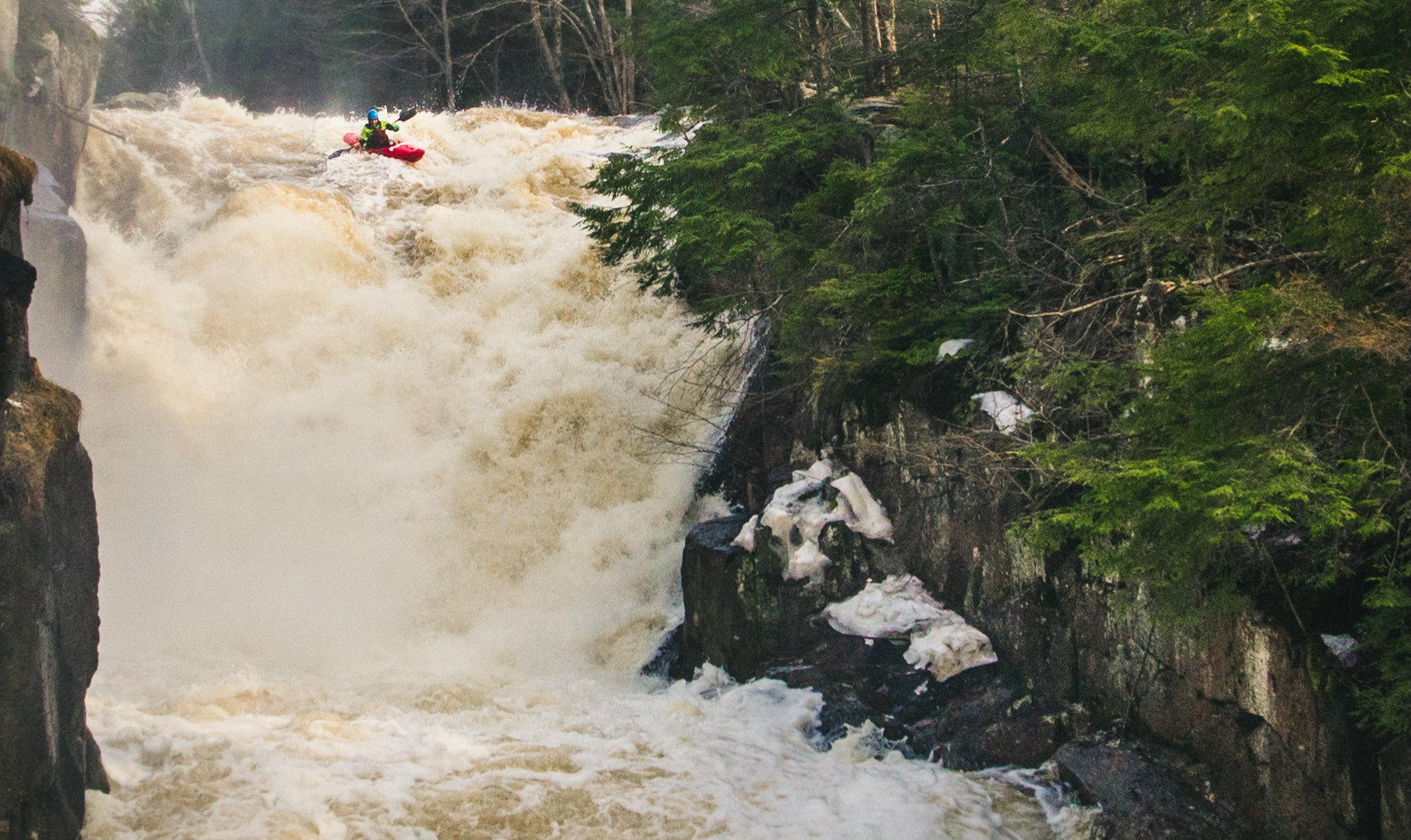
Upper Section: Shortly after reaching the Grass from Tracy Brook, the river starts dropping into some nice boat scoutable slides. The first mile or two below Tracy Brook is the best part. From then on there's a lot of flatwater, some sections of continuous class II-III stuff, a few nice small slides, a couple of easily recognized big class V slides, and one super sweet long(1/8 mile?) low angle slide. Both of the big slides would go, but the first is kinda junky looking and the second has a pretty bad hole on the bottom right, but a nice 10ft boof on the bottom left. Overall, this section has some fun parts, but doesn't match up to some of the area's other options; however, this is a great option if you get to the South Branch and it's a little beefy for your liking
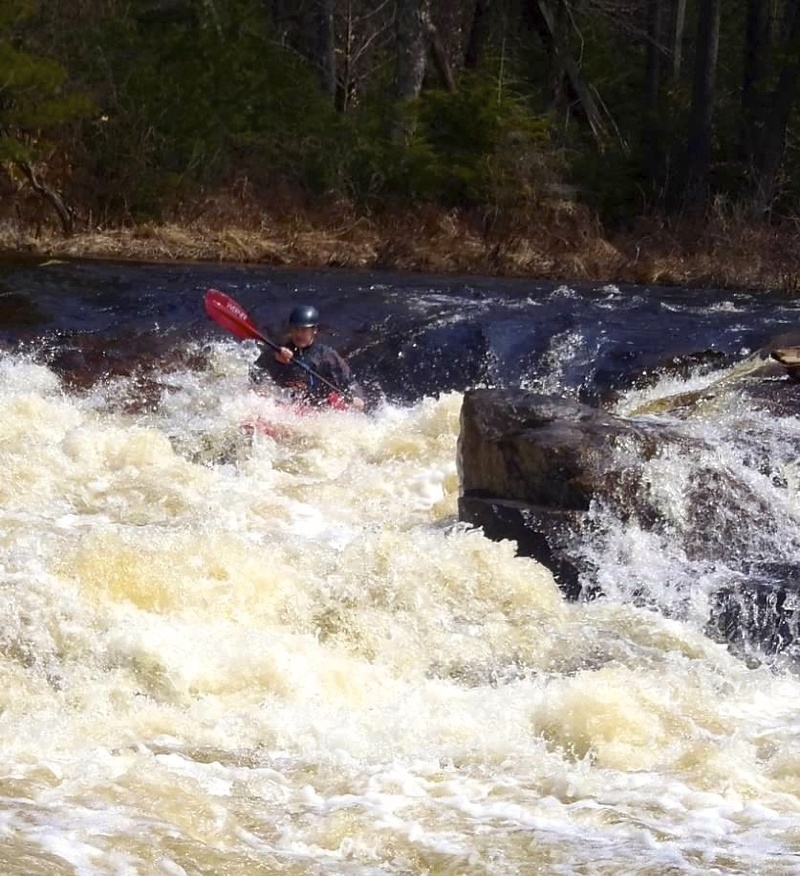
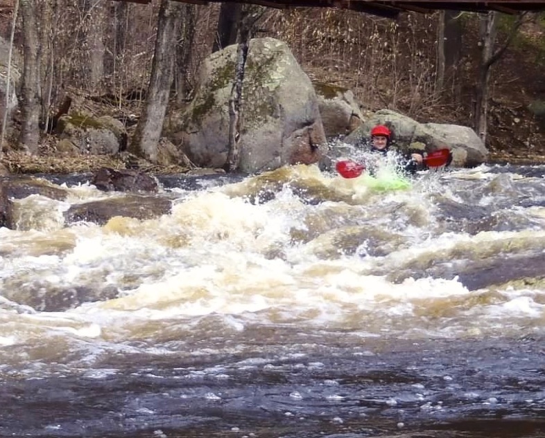
Lower Section: This section is class 3 almost the entire time, it is a fun section for intermediate boaters, and open boaters who want to explore some of the great features the Grasse has to offer. As the water changes the run evolves from big holes and defined lines to low level creeking with lots of rock gardens to find micro eddys and play around in to develope skills. The rapids are easy to scout and set safety. This section can easily be run in under 2 hours including shuttle time.
The river has a conservation easement and is open to boating all year except from October 1-November 15, or hunting season. There are multiple hunting clubs in the area, which may not always be super friendly.
Access: Head north out of Degrasse on Claire Rd. and continue a couple of miles past the South Grasse take out. Turn right on Dean Rd. just after crossing the Middle Grasse and park in the shoulder on the right side of the road or continue up the road for about 1.75 miles to the bridge crossing over the river, on the right there will be a parking lot with a DEC information billboard. Taking out at the bridge will miss 1 rapid but also a long flatwater section.
The Put-in, continue up Dean Rd. for about 10 miles. You'll notice lots of hunting clubs and even drive through one camp. When you see the DEC sign for Stone Damn, park and start hiking up the road unless the gate is open as you can continue to drive up the road to another DEC gate if you park here, you will be able to see and hike down to the river. If the Stone Damn gate is closed, It's a little more than a mile to Tracy Brook, which you can reach the put-in and brushwack to the Middle Branch.
The second putin is about midway on the river, this limits most of the hassel of getting to the upper section, however, you miss all of the large slides. After passing the Stillwater club, drive about .5 miles up the road, you will see the river again on the left as you go around a large bend. Park on the side of the road near a DEC conservation easement poster. (see pictures)
Canton - Cranberry Lake Area Reaches
Boland Creek Elm Creek
Grass (1. Lampsons Falls to Downerville) Grass (2. Downerville to Russell)
Grass (3. Morley to Massena)Grass (4.Woods Bridge Road to Route 47)
Grass, Middle BranchGrass, North Branch
Grass, Upper South BranchGrass, Lower South Branch (Twin Falls)
Oswegatchie, E. Branch (2.)Oswegatchie, E. Branch (3.)
Oswegatchie, W. BranchPlumb Brook
Google Map of New York Whitewater
New York Whitewater Paddlers Facebook Group
Rapids in this Run (4)
Difficulty
Class III-IV(V)
Length
10.0 mi
Gradient
38 ft/mi
Rapids
4
Access Points
Shuttle Info
Access: Head north out of Degrasse on Claire Rd. and continue a couple of miles past the South Grasse take out. Turn right on Dean Rd.
**Take-out 1-** Just after crossing the Middle Grasse and park in the shoulder on the right side of the road this is the longer of the two and has large amounts of flatwater
**Take-out 2:** Continue up Dean rd. for about 1.75 miles to the bridge crossing over the river, on the right, just before the bridge there will be a parking lot with a DEC information billboard. Park here.
**Put-in** **1 (Upper Section)**, continue up Dean Rd. for about 10 miles. You'll notice lots of hunting clubs and even drive through one camp. When you see the DEC sign for Stone Damn, park and start hiking up the road unless the gate is open as you can continue to drive up the road to another DEC gate if you park here, you will be able to see and hike down to the river. If the Stone Damn gate is closed, It's a little more than a mile to Tracy Brook, which you can reach the put-in and brushwack to the Middle Branch.
**Put-in 2( Lower Section)-** is about midway on the river, this limits most of the hassel of getting to the upper section, however, you miss all of the large slides. After passing the Stillwater club, drive about .5 miles up the road, you will see the river again on the left as you go around a large bend. Park on the side of the road near a DEC conservation easement poster. (see pictures)
Difficulty Classes
I Easy
II Novice
III Intermediate
IV Advanced
V Expert/Extreme
VI Unrunnable
Current Conditions
5-Day Forecast
Whitewater data from
American Whitewater
American Whitewater