Tracy City section
Gauge Conditions
Runnable: ? – ? CFS
Approximate reading: This gauge is 6.9 miles away on Big Fiery Gizzard Creek. Use as a general reference only.
Data from American Whitewater & USGS
Run Map
Run Time Estimate
Select put-in and take-out to estimate time.
Plan This Trip
See wind-adjusted speed maps, forecast planning, and detailed time estimates.
Sign in to generate an AI timing estimate for this run.
Whitewater timing varies with scouting, portages, and group pace. Use as a planning baseline.
Description
Local expert (Ron Stewart, Box 1337, Chattanooga, TN 37401)
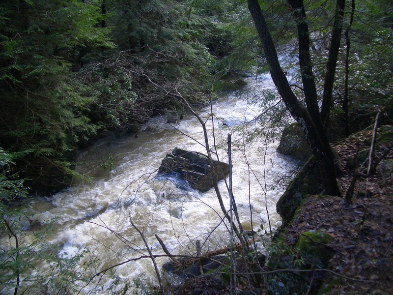
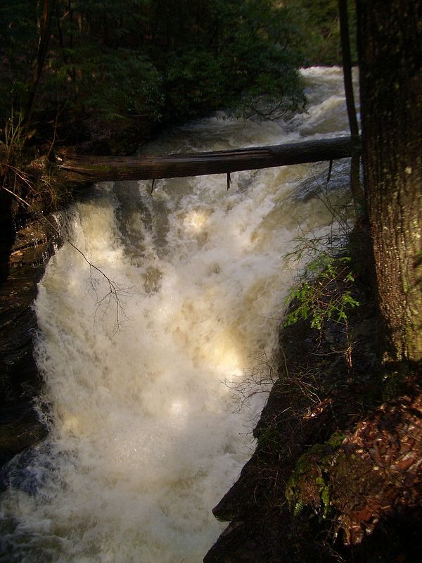
Lat/longitude coordinates given are for a ~12-mile section from above Tracy City to the road near the Little Gizzard confluence, but you won't paddle 12 miles. This is a paddle down, then hike-out run. As others have noted, the run suffers from pollution of sewage material, and there is a warning at Hwy. 41 with that message. At low water, the creek is almost clear, but at high-water, it pulls a great deal of sediment and, apparently, sewage-laced runoff.
Here's what Chris Guptill said back in 2002, and I think it's still a good description:
_Here's a little info about some of Fiery Gizzard's rapids in a .75-1 mile stretch right near Tracy City._
_The put-in is at the park off 41, with a hike down to the creek of about a half mile or so. The put-in is a short seal launch, with some class II stuff near the beginning. There is rumored to be a nice waterfall upstream, but may have wood blocking it._
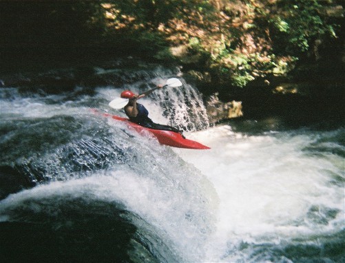
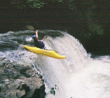
_Most of the creek is short-drop class II-III, with two larger drops. The first is a 10-12-foot vertical about halfway down. It's a fairly easy drop, but should be run off the highest point on river right. The landing zone on the left looks to have a lot of rocks just beneath the surface, and the hole there is much more powerful. The right side is better anyway, because the rock shelf form a nice launch pad. Still, it's best to scout this one. Take out on river right a little ways up from the drop and hike over the bridge and down beside the pool for a good look._
_You'll continue down a little further through some more II-III stuff, until you hit a nice slide on river left. It's a little drop onto a slide, with no good place to pull out and scout, but as long as you stay straight, you can get through without much problem._
_Continue down a ways further, and look for the confluence of another decent-sized creek. IMMEDIATELY after the confluence catch the eddy on river left, because a class V is about ten feet downstream. We (at the University of the South) like to call this 'Monkey' due to its similarity to Gorilla on the Green. As of Easter 2002, Monkey was blocked (at both top and bottom) by logs and a strainer, respectively. Thus, I've never run it, but there is a nasty undercut at the bottom._
_That's about the end of the run. About a mile further down there's another largish drop, but the water between Monkey and that is pretty flat, and the hike out doesn't make it worth it, really._
_The nice part about this run is no shuttle, but you will have to hike along the Fiery Gizzard trail to get back to the parking area._
Rapids in this Run (1)
Difficulty
Class III-V
Length
9.9 mi
Rapids
1
Access Points
Difficulty Classes
I Easy
II Novice
III Intermediate
IV Advanced
V Expert/Extreme
VI Unrunnable
Current Conditions
5-Day Forecast
Whitewater data from
American Whitewater
American Whitewater