Troy Grove Blacktop to Little Vermilion (2.8 +4.7 miles)
Gauge Conditions
Runnable: ? – ? CFS
Approximate reading: This gauge is 5.9 miles away on Tomahawk Creek. Use as a general reference only.
Data from American Whitewater & USGS
Run Map
Run Time Estimate
Select put-in and take-out to estimate time.
Plan This Trip
See wind-adjusted speed maps, forecast planning, and detailed time estimates.
Sign in to generate an AI timing estimate for this run.
Whitewater timing varies with scouting, portages, and group pace. Use as a planning baseline.
Description
Quick Facts:
Location: Northcentral IL, about 5 miles NE of LaSalle.
Shuttle Length: 5.6 miles. (See details in 'Directions' Tab.)
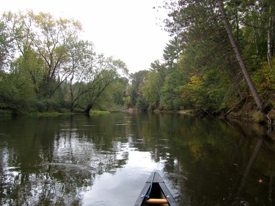
Character: Rural wooded corridor (with a few estate backyards).
Put-in is approximately 598' elevation.
Confluence with Little Vermilion is approximately 528' elevation.
Thus elevation change on Tomahawk is approximately 70' (average gradient, 25 FPM).
Take-out is approximately 450' elevation.
Thus total elevation change is approximately 148' (average gradient, 20 FPM).
Google Maps has excellent resolution aerials of this reach. We highly recommend going to the 'Map' tab, clicking 'Satellite', double-clicking near (not on, but near) the put-in location icon, zooming to the maximum resolution (without losing image), and doing a 'virtual tour' to 'walk' down the reach.
---
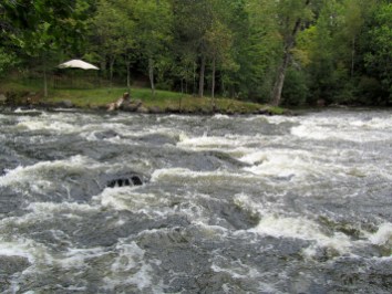
Ask permission at farm house to put on. Beware low bridge 0.7 miles down, and dam (run at own risk) at 2.3 miles.
Running this creek brings you into mile 1.8 of the Little Vermilion, where you will finish with 4.7 miles of that run, including its 'mini-canyon'.
Richard DeGroat, Sugar Grove provides (2009-04-24):
*I've run this many times and each time I do, I have alot of fun. It has a lot to offer for the almost intermediate paddler (II) to the solid intermediate (III), and I presume would be fun for the more advanced at higher water. Check out Bob Tylers description as it is more exhaustive.*
*There is a dam about a mile before the confluence with the Little V which I just ran this last past week. Extremely fun slide to about a 5 and a half foot boof provides alot of excitement for those prepared and those willing. There is also another fun slide a bit more downstream that can be challenging for a beginner.*
Rapids in this Run (1)
Hazards & Portages (2)
Caution: The following locations may require scouting or portaging. Always check current conditions.
Difficulty
Class II
Length
7.6 mi
Gradient
25 ft/mi
max 40
Rapids
1
2 Hazards
Access Points
Difficulty Classes
I Easy
II Novice
III Intermediate
IV Advanced
V Expert/Extreme
VI Unrunnable
Current Conditions
5-Day Forecast
Whitewater data from
American Whitewater
American Whitewater