Unknown/unnamed logging road to Maple Creek Road (up to 1.8 miles)
Gauge Conditions
Runnable: ? – ? CFS
Approximate reading: This gauge is 7.8 miles away on Maple Creek. Use as a general reference only.
Data from American Whitewater & USGS
Run Map
Run Time Estimate
Select put-in and take-out to estimate time.
Plan This Trip
See wind-adjusted speed maps, forecast planning, and detailed time estimates.
Sign in to generate an AI timing estimate for this run.
Whitewater timing varies with scouting, portages, and group pace. Use as a planning baseline.
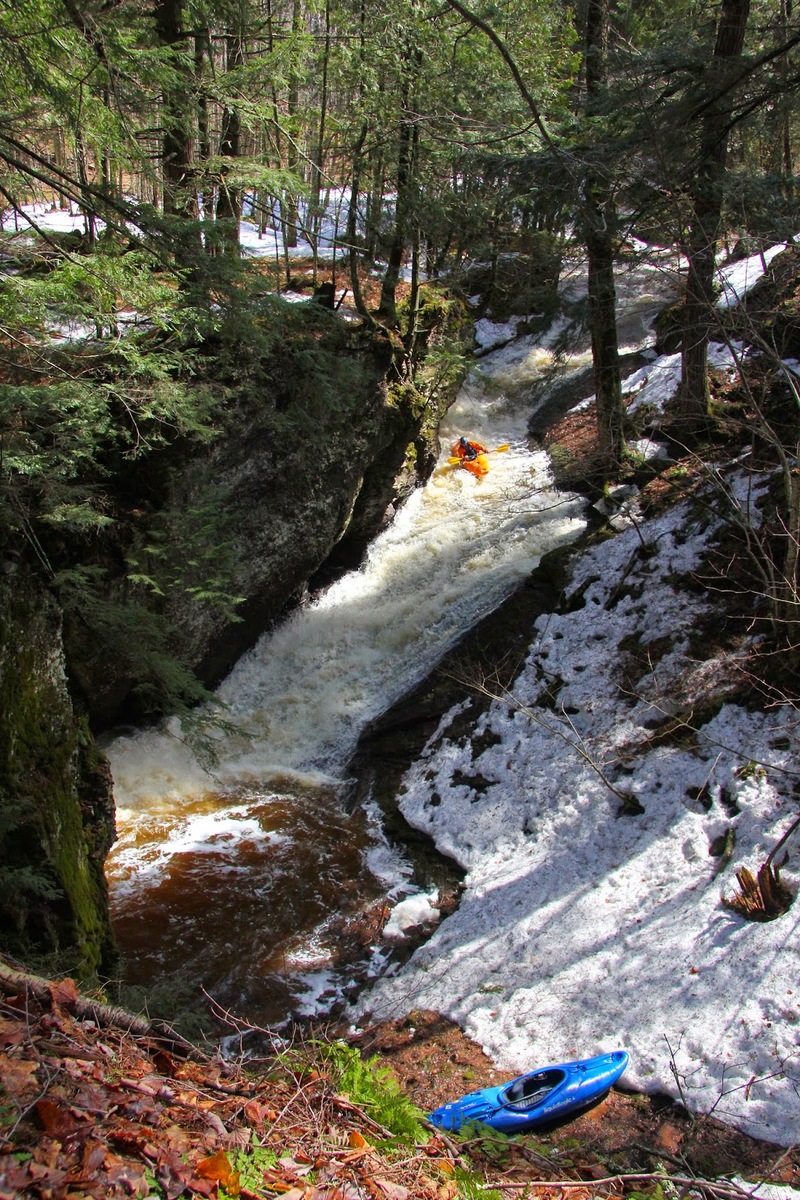
Description
A named falls, and gradient throughout make quite an interesting micro-creek run. When the Presque and Black are running large, this may be a great option. Keep in mind that It is small enough to have serious problems with deadfall and snags.
The following helmetcam footage (via YouTube from Jonathan Sisley) will give you a great feel for what is here: _Maple Creek_
We welcome any additional comments or reports to help out your fellow boaters with more details (especially regarding logistics and access) for this run!
Rapids in this Run (1)
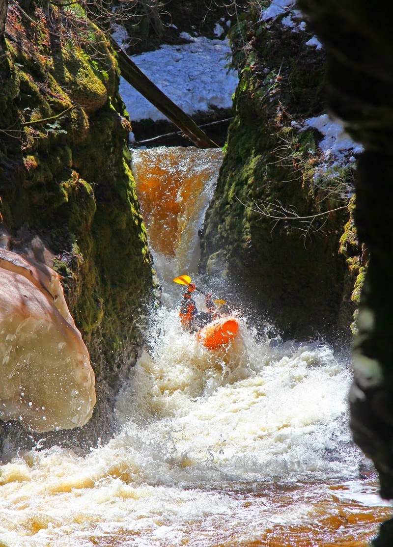
Waterfalls (1)
Difficulty
Class IV
Length
1.8 mi
Gradient
211 ft/mi
Rapids
1
Access Points
Difficulty Classes
I Easy
II Novice
III Intermediate
IV Advanced
V Expert/Extreme
VI Unrunnable
Current Conditions
5-Day Forecast
Whitewater data from
American Whitewater
American Whitewater