Unnamed road to Peshekee River ( 2-4.7 miles)
Linked via: Nhdplus gnis 95% confidence Synced 5mo ago
Gauge Conditions
Primary
Runnable: 80.0 – 300.0 CFS
Likely low, posibly boatable. (150-200cfs). (Help your fellow boaters with a comment or report of gauge reading and runnability/difficulty of this run.)
Data from American Whitewater & USGS
Run Map
Run Time Estimate
Select put-in and take-out to estimate time.
Unlock Advanced Trip Planning
See wind-adjusted speed maps, forecast planning, and detailed time estimates.
Sign in to generate an AI timing estimate for this run.
Whitewater timing varies with scouting, portages, and group pace. Use as a planning baseline.
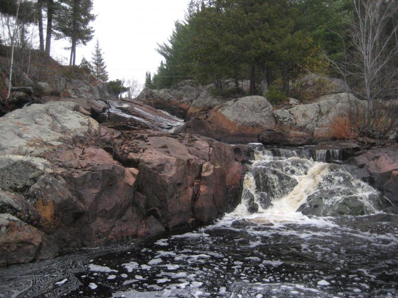
Description
A named falls on the West Branch Peshekee is the highlight of this run. Access at/around the falls may be disputed due to private property. If roads are clear and not gated/posted against trespass, it may be possible to drive to the falls. More likely you may have to hike in and possibly use our listed upper put-in and (mostly) flatwater access paddle. There are some additional rapids in the two-miles from Dee Lundeen to the (main stem) Peshekee, including a fine looking quarter-mile narrows/dells.
At the confluence, you may paddle across to what appears likely to be a stub road (likely fords the stream at low flows) where you can leave your shuttle vehicle, or (at least as likely) paddle down the final bit of the (main stem) Peshekee to one of the bridge take-outs.
We need better first-hand info on this one! Anyone with awareness of the access situation (and anything about the rest of the run) is encouraged to add a comment or report (ideally with additional photo/video) to help out your fellow boaters!
Rapids in this Run (5)
Waterfalls (1)
Difficulty
Class II-IV
Length
4.3 mi
Rapids
5
Access Points
Difficulty Classes
I Easy
II Novice
III Intermediate
IV Advanced
V Expert/Extreme
VI Unrunnable
Current Conditions
5-Day Forecast
Whitewater data from
American Whitewater
American Whitewater