Upper Gorge
Gauge Conditions
Runnable: 7,500.0 – 25,000.0 CFS
Data from American Whitewater & USGS
Run Map
Run Time Estimate
Select put-in and take-out to estimate time.
Plan This Trip
See wind-adjusted speed maps, forecast planning, and detailed time estimates.
Sign in to generate an AI timing estimate for this run.
Whitewater timing varies with scouting, portages, and group pace. Use as a planning baseline.
Description
Park n Creek. **\*\*\*WATCH OUT FOR ATV's\*\*\* When running this reach use caution while walking up the road to put in. The local ATV riders use this area as their playground.
Some of this creek is accessed by private property, until now it has not been a problem, but some No Tresspassing signs recently showed up on trees along the lower end near the takeout.
This creek has a decent sized watershed, but is more of a HIGH water run when everything else is too high for a sane run.
Since the "shuttle" is so short from put in to take out, it is best to just park one vehicle at the take out due to limited parking. It is less than 3/4 mile between the two. We usually drive to the put in and not even bother with a vehicle at the take out.
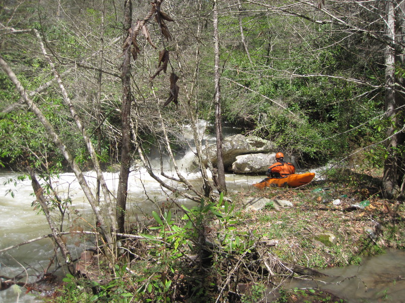
At the put in you will notice an impressive little stream barrelling its way to Stock Creek, head down to the creek there and go up as far as you want. It is best to scout well before putting on due to the continuous nature of the creek. There is one rapid of note that can be seen easily from the road and should be scouted/portaged on the left. This is called Reactor.
Directions:**
From US 23 in Duffield VA, turn onto RT 871 at the traffic light and drive toward Natural Tunnel State Park. Just after you cross the bridge over the railroad, turn left onto RT 653 and follow this until you come to the Mabe community. Just after the sign for Mabe you will be approaching a creek, turn left onto the gravel road (RT 722 Maple Gap Rd) and slowly make your way up to the put in.
You can also reach the put in during certain times of the year via Maple Gap road from the South Fork of the Powell. When you reach the top of the mountain at Maple Gap, bear right onto a dirt road. Follow this road until it forks again and bear left. It takes about 20-25 minutes for this drive. Use caution closer to the bottom due to a very rough road. The dirt/gravel has been eroded away to sheer bedrock in places.
Hazards & Portages (1)
Caution: The following locations may require scouting or portaging. Always check current conditions.
Difficulty
Class III-IV+(V)
Length
1.0 mi
Rapids
0
1 Hazard
Access Points
Difficulty Classes
I Easy
II Novice
III Intermediate
IV Advanced
V Expert/Extreme
VI Unrunnable
Current Conditions
5-Day Forecast
Whitewater data from
American Whitewater
American Whitewater