USFS Campground to Turner's Corner
Gauge Conditions
Runnable: 1,500.0 – 20,000.0 CFS
Data from American Whitewater & USGS
Run Map
Description
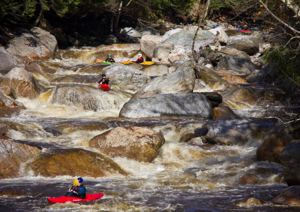
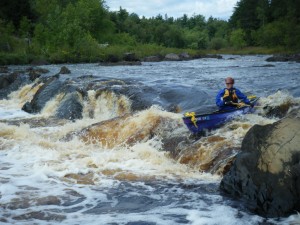
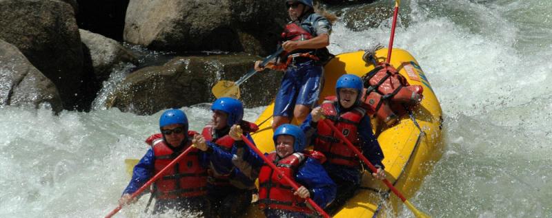
A steep and narrow roadside creek similar to Dick's Creek, but without the waterfalls or killer rapids. The rapid flow and nearly constant rapids keep boredom from being a problem. Takes a good bit of water, but less than Dick's, Blood Mountain or Frogtown Creek. Fairly large drainage area so the water stays up for a day or two after the rain ends.
The 1500 cfs minimum is a guess: as far as Streamkeeper has been able to determine, no minimum or maximum has been established before now. Initial evaluation was 01/18/06, the day after a fairly heavy rain, with Chestatee gauge at about 1150 cfs/3.6 feet. That level looked like it would be pretty scrapy, especially in the upper parts of the creek.
The upper section of Boggs Creek (1.8 miles) is within the Chattahoochee National Forest and is scoutable from the road (USFS 443) on the way to the put-in, but some of the most challenging portions (the gorges and Right-N-Left) are not road-scoutable and should be scouted before running. Boat scouting is difficult due to the speed of the flow and the lack of eddies or calm pools, but the banks (especially river right) are usually accessible. The road is never far from the creek, but not easily reachable from the gorges.
Since the creek and the road run through a USFS camping area, there are amenities, including several latrine buildings. The area is undoubtedly crowded during warmer parts of the year and presents a potential hazard unusual for boaters - cross traffic. There are several pedestrian and/or vehicle fords along the run that allow access to campsites on river left, so boaters need to remain alert.
Above the put-in is another one-third mile or so of USFS 443, accessible by fording an unnamed stream or by crossing a wooden pedestrian bridge, built as an Eagle Scout project, beside the road. This upper section of road runs through the upper campground to where Cowrock Creek and another unnamed stream coverge to form Boggs Creek. Streamkeeper has not yet explored Cowrock Creek, which is straight up the hill (Hogpen Mountain). The unnamed stream, approaching from the left of the road, is very narrow, rocky and woody and would probably be Class III-IV when the water level is high enough. A path paralleling the unnamed stream on river right provides good access. If you run the unnamed stream, don't forget that Eagle Scout's pedestrian bridge. Below the confluence of Cowrock Creek and the unnamed stream, Boggs Creek is fairly shallow (appeared to be too shallow at 1150 on the Chestatee gauge) with several strainers and fairly constant rapids up to Class II or II+.
The lower section of Boggs Creek (approximately 1.4) miles runs under and then beside U.S. Highway 19/129. Immediately upriver of the Highway 19/129 bridge, the creek is separated from the highway by a campground/trailer park. This is private property: trespassing should be avoided except in case of emergencies.
DIRECTIONS:
Take-out is from the Chestatee River, along the southwest side of U.S. Highway 19/129, just north of Turner's Corner (where Highways 19 and 129 meet).
Put-in 1.9 miles from Highway 19/129 on USFS 443. Take Highway 19/129 one mile north from Turner's Corner and turn right on USFS 443. Pay the required fee as you enter the Chattahoochee National Forest and follow the road to where it fords an unnamed stream running from left to right. You can put in there or try the section above by either fording the unnamed stream or using the wooden pedestrian bridge (see above). Locate and use one of the many "Day Use" parking areas: please do not irritate the campers by parking on or in front of a campsite.
There are several spots along USFS 443 where the creek is accessible for put-in or take-out if you prefer a shorter run or in case of emergency.
Rapids in this Run (1)
Hazards & Portages (14)
Caution: The following locations may require scouting or portaging. Always check current conditions.

Difficulty
Class II-III+
Length
2.3 mi
Gradient
40 ft/mi
Rapids
1
14 Hazards
Access Points
Difficulty Classes
I Easy
II Novice
III Intermediate
IV Advanced
V Expert/Extreme
VI Unrunnable
Current Conditions
5-Day Forecast
Whitewater data from
American Whitewater
American Whitewater