How's Your
River
×
Explore
Explore Map
Water Bodies
Gauges
Access Sites
Tidal Stations
Whitewater
Pricing
Login
Sign Up
Hazard Warning:
Hazard information may be user-submitted and unverified. Conditions change frequently. Always scout rapids and obstacles yourself.
Whitewater
Tennessee
Little Clear Creek - Hwy 62 to Lily
4 ft Ledge
Waterfall
TN
Class III+
4 ft Ledge
Little Clear Creek - Hwy 62 to Lily (TN)
Monitor this Rapid
Water Body
This Run
Map
Other Rapids
Gauge
Weather
Directions
Gauge Conditions
Clear Creek at Lilly Bridge near Lancing, TN
Downstream
Primary
Runnable: 1,200.0 – 4,000.0 CFS
Data from
American Whitewater
&
USGS
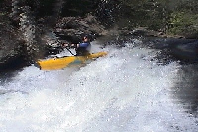
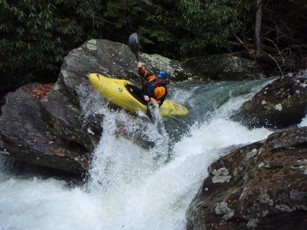
Photo
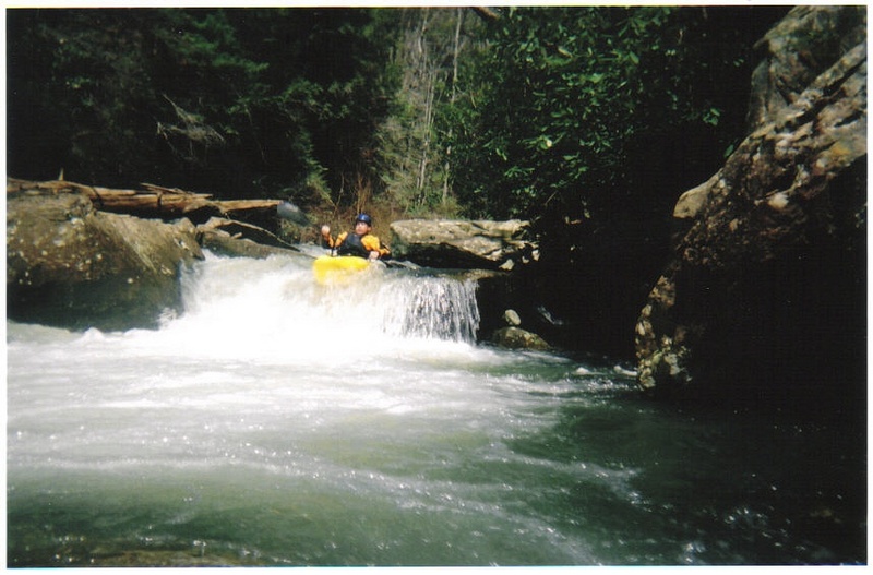
Photo courtesy of
American Whitewater
Description
The entrance starts on the right then s-turns to the left then back right for the boof. The boulder on river right has a deep cave under it. Not sure what would happen with a hole surf at high water.
Location
Radar
Counties
Cell
Verizon
AT&T
T-Mobile
Dark
Satellite
Terrain
Other Rapids on This Run (7)
Rapid
N/A
Put In
0.0 mi
Hazard
N/A
Mandatory Portage
2.4 mi
Waterfall
IV
Triple Drop
2.5 mi
Hazard
IV
Novacaine
2.6 mi
Waterfall
IV
Boofalicious
2.6 mi
Rapid
IV
Oh Yeah!
2.7 mi
Rapid
III
Lilly Bridge/Rapid
3.0 mi
Type
Waterfall
Difficulty
Class III+
Mile Marker
2.6 mi
Directions
Navigate
View Full Run
Hwy 62 to Lily
Little Clear Creek
III-IV+
2.6 mi
Current Conditions
5-Day Forecast
Whitewater data from
American Whitewater
4 ft Ledge