Put-in
WA
Boundary Bridge Put In
Save this feature with the run it belongs to.
No sufficiently local live gauge linked. 1 automated match was excluded because locality could not be verified. Use the parent run and local sources before making a trip decision.
Photo
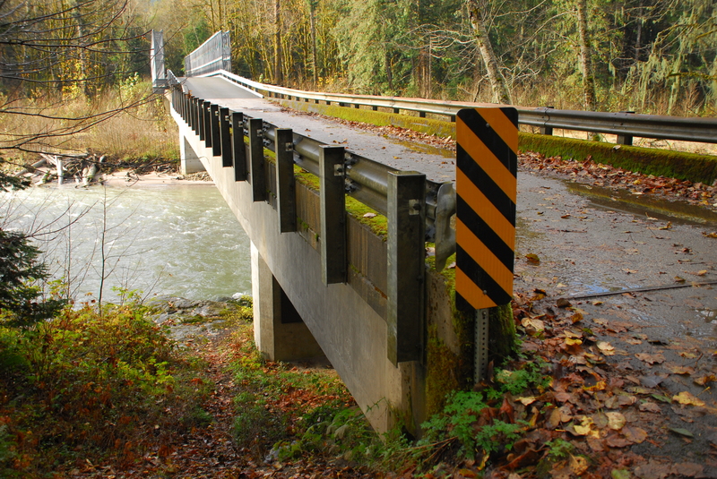
Photo courtesy of American Whitewater
Description
The historic access on the downstream river left side of the bridge washed away in a flood event. The best option now is on the upstream river right side of the bridge. The Forest Service has an easement that extends 33' on either side from the centerline from the bridge. Despite the no trespassing signs you may see on the trees, you can access the river on the upstream river right side of the bridge and still be well within this public easement.
Location
Interactive river map
Loads as you approach this section.
View Full Run
2. Rat Trap (FR 25) Bridge to Sauk River
Suiattle
II-III
12.9 mi
Current Conditions
5-Day Forecast
Whitewater data from
American Whitewater
American Whitewater