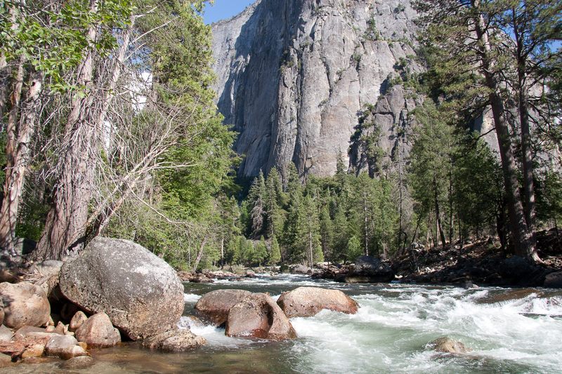
Bridalveil Rapid
Save this feature with the run it belongs to.
Gauge Conditions
Range for best boatability uncertain. Please help your fellow paddlers by providing a comment or report.
CDEC Flow Data California
Photo
Description
A gentle sweeping bend around El Cap Meadow drops you straight into the top of Bridal Veil Rapid Class III+/ IV, the longest rapid on the section. The first half of rapid picks its way through a boneyard of rocks and channels. Higher flows offer a more defined line. Half way through the rapid the majority of the river flow starts to shift river left. Look for large rocks on the left bank with stranded timbers. A small series of ledges make up the final third of the rapid. At high flows large powerful hydraulics develop. The exit to the rapid is split into three distinct channels with a large recovery pool at the bottom. The easiest option is to run river right. Scout from is from river right. This rapid can also be scouted as you run your shuttle. Parking at the far end of the Bridal Veil Falls viewing area gives you a great spot to view this rapid.
Location
Other Rapids on This Run (4)
Current Conditions
5-Day Forecast
American Whitewater