Rapid
MI
Confluence, Darling Creek
Save this feature with the run it belongs to.
Gauge Conditions
Runnable: ? – ? CFS
Approximate - nearest available gauge. Use as general reference only.
Data from American Whitewater & USGS
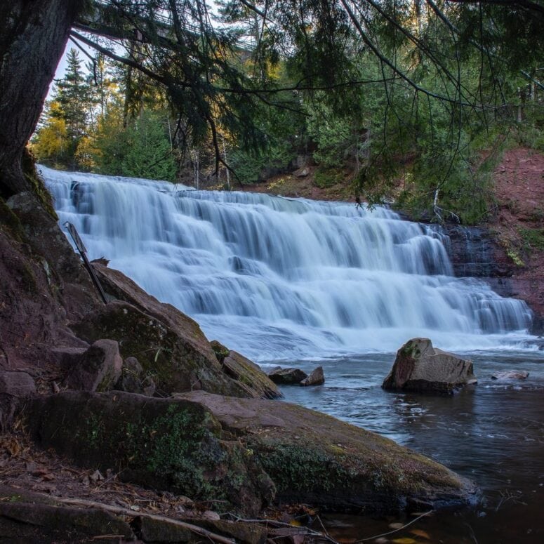
Photo

Photo courtesy of American Whitewater
Description
At the confluence of Darling Creek with the Middle Branch Ontonagon River, paddlers encounter a potentially complex river junction with potential debris and shifting water dynamics. The rapid's characteristics may vary seasonally, requiring careful navigation and awareness of current water levels and potential submerged obstacles. Local scouting and knowledge of the specific seasonal conditions are recommended before attempting this river section.
Location
Other Rapids on This Run (20)
Rapid
N/A
USGS samping site
Rapid
N/A
Hwy.28 Wayside
 Waterfall
N/A
Waterfall
N/A
Agate Falls
 Rapid
N/A
Rapid
N/A
Put In
Rapid
N/A
Log Jam
Rapid
II+
Wave/hole
 Rapid
N/A
Rapid
N/A
Confluence, Payne Creek
Rapid
N/A
Ledge/wave?
 Rapid
N/A
Rapid
N/A
Confluence, Tom Creek
Rapid
N/A
Log Jam 2 / Meto Creek
Rapid
N/A
Possible access/egress?
Rapid
N/A
Log Jam Concern #3
Rapid
N/A
Log Jam Concern #4
Rapid
N/A
Log Jam Concern #5
Rapid
N/A
Confluence Trout Creek
Rapid
N/A
Powerline Clearing
Rapid
N/A
Rapids
Rapid
N/A
Possible/apparent set of ledges/waves/holes
 Rapid
N/A
Rapid
N/A
Apparent rapids
 Rapid
N/A
Rapid
N/A
Confluence, Longtime Creek
View Full Run
C) below Agate Falls (Hwy.28) to Hwy.45 (28.7 miles)
Ontonagon, M.Br.
I-III
25.7 mi
Current Conditions
5-Day Forecast
Whitewater data from
American Whitewater
American Whitewater