Put-in
PA
Folley's End Campground
Save this feature with the run it belongs to.
Gauge Conditions
Runnable: 4.7 – 5.5 FT
Lower Elk pretty accurately reflects the flow of Walnut Creek, 5 hours later. So, if you see a spike on the Walnut gauge, expect Girard to peak about 5 hours l
Data from American Whitewater & USGS
Photo
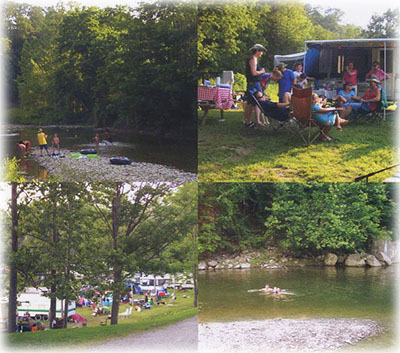
Photo courtesy of American Whitewater
Description
Folley's End Campground rapid features a tight, technical entry with multiple submerged boulder clusters that create unpredictable hydraulics and require precise boat positioning. The primary line runs river right, threading between two large mid-channel rocks, with a consequential hole at high water that can easily flip or hold boats. Paddlers should scout carefully and be prepared for quick maneuvering, as the rapid's gradient and rock placement demand active route selection and immediate corrective strokes.
Location
Interactive river map
Loads as you approach this section.
Other Rapids on This Run (2)
View Full Run
3.) Route 98 to Lake Erie
Elk Creek (Lake Erie trib.)
I-II
13.2 mi
Current Conditions
5-Day Forecast
Whitewater data from
American Whitewater
American Whitewater