Rapid
CA
Fraser Flat campground
Save this feature with the run it belongs to.
Gauge Conditions
Runnable: ? – ? CFS
Approximate - nearest available gauge. Use as general reference only.
Data from American Whitewater & USGS
CDEC Flow Data California
Data from California Data Exchange Center (CDEC)
Photo
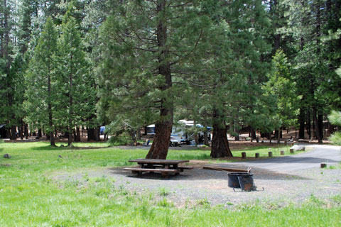
Photo courtesy of American Whitewater
Description
Fraser Flat is a relatively mellow stretch of river with minimal technical challenges, primarily serving as an access point and campground for paddlers on the South Fork Stanislaus. The river section around the campground features gentle water flow with scattered boulders and minimal gradient, making it more suitable for put-in/take-out logistics than challenging whitewater. Paddlers should be aware of potential shallow areas and submerged rocks during low water periods.
Location
Interactive river map
Loads as you approach this section.
View Full Run
Hwy 108 Bridge to Lyons Reservoir
Stanislaus, S. Fork
IV-V
11.7 mi
Current Conditions
5-Day Forecast
Whitewater data from
American Whitewater
American Whitewater