Long Shoals
Save this feature with the run it belongs to.
Gauge Conditions
Runnable: 3.0 – 9.0 FT
3.05 on this gauge when it was dropping very slowly following a large rain event was just above the minimum for this run.
Data from American Whitewater & USGS
Photo
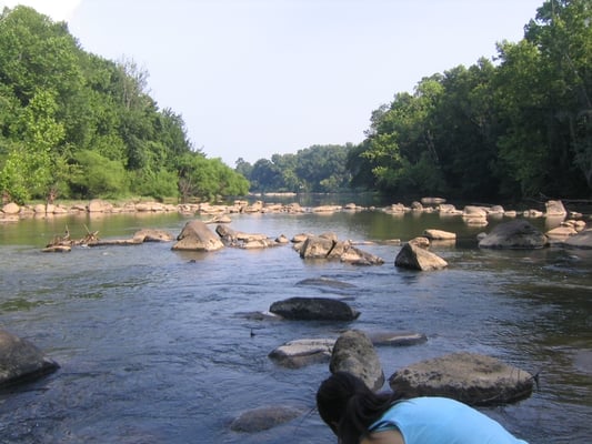
Photo courtesy of American Whitewater
Description
Long Shoals is a sustained Class II+ rapid featuring a series of technical rock gardens and diagonal wave trains that demand precise boat positioning and paddle control. Paddlers must navigate a complex boulder field with multiple potential routes, requiring quick decision-making and the ability to read and react to changing water features, with the primary line typically favoring the right side but offering alternative paths depending on water level and flow.
Location
Interactive river map
Loads as you approach this section.
Other Rapids on This Run (3)
View Full Run
5: Long Shoals Rd to Hwy 288 (Pumpkintown Rd)
Saluda, Middle
II-III
2.5 mi
Current Conditions
5-Day Forecast
Whitewater data from
American Whitewater
American Whitewater