Take-out
MT
Meadow Creek Trailhead Accessing Take-out
Save this feature with the run it belongs to.
Gauge Conditions
Runnable: 5.0 – 15.0 FT
Flow range for best boatability uncertain. Please help your fellow boaters with a comment or report.
Data from American Whitewater & USGS
Photo
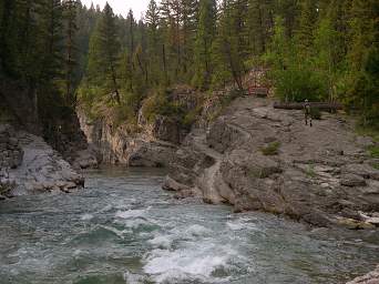
Photo courtesy of American Whitewater
Description
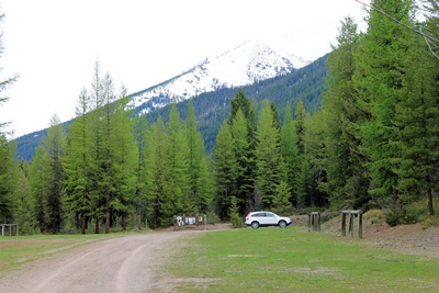
Trips end here with a hike out of the Bob Marshall Wilderness accessed from this trailhead. You can also use this as the place to start a trip if you are not doing the whole run or want to avoid the shuttle; just start your trip by hiking upstream from the bottom.
Location
Interactive river map
Loads as you approach this section.
Other Rapids on This Run (11)
 Rapid
Rapid
Lodgepole Creek Trailhead - Access Trail to Put-in
 Rapid
Rapid
Pyramid Pass Trailhead - Access Trail to Put-in
 Rapid
Rapid
Youngs Creek - Danaher Creek Confluence
 Rapid
Rapid
Big Prairie Pack Bridge and Work Center
 Rapid
Rapid
White River confluence
 Rapid
Rapid
Salmon Forks Guard Station
 Rapid
Rapid
Black Bear Pack Bridge and Guard Station
 Rapid
Rapid
Black Bear Creek confluence
 Rapid
II
Rapid
II
Rapid
 Rapid
Rapid
Mid Creek confluence
 Rapid
Rapid
Mid Creek Take-out
View Full Run
1. Youngs Creek to Mid Creek
Flathead, South Fork
II+
37.0 mi
Current Conditions
5-Day Forecast
Whitewater data from
American Whitewater
American Whitewater