Rapid
MI
North Country National Scenic Trail
Save this feature with the run it belongs to.
Gauge Conditions
Runnable: ? – ? CFS
Approximate - nearest available gauge. Use as general reference only.
Data from American Whitewater & USGS
Description
This could provide emergency access, or possible access/egress.
Not far above this bridge is where "Three Rapids" is marked on topo maps. However, there is virtually nothing apparent on aerial views. (OK, very very minor waves.)
Location
Other Rapids on This Run (20)
Rapid
N/A
USGS samping site
Rapid
N/A
Hwy.28 Wayside
 Waterfall
N/A
Waterfall
N/A
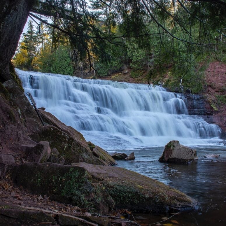
Agate Falls
 Rapid
N/A
Rapid
N/A
Put In
Rapid
N/A
Log Jam
Rapid
II+
Wave/hole
 Rapid
N/A
Rapid
N/A
Confluence, Payne Creek
Rapid
N/A
Ledge/wave?
 Rapid
N/A
Rapid
N/A
Confluence, Tom Creek
Rapid
N/A
Log Jam 2 / Meto Creek
Rapid
N/A
Possible access/egress?
Rapid
N/A
Log Jam Concern #3
Rapid
N/A
Log Jam Concern #4
Rapid
N/A
Log Jam Concern #5
Rapid
N/A
Confluence Trout Creek
Rapid
N/A
Powerline Clearing
Rapid
N/A
Rapids
Rapid
N/A
Possible/apparent set of ledges/waves/holes
 Rapid
N/A
Rapid
N/A
Apparent rapids
 Rapid
N/A
Rapid
N/A
Confluence, Longtime Creek
View Full Run
C) below Agate Falls (Hwy.28) to Hwy.45 (28.7 miles)
Ontonagon, M.Br.
I-III
25.7 mi
Current Conditions
5-Day Forecast
Whitewater data from
American Whitewater
American Whitewater