Skillet Falls
Save this feature with the run it belongs to.
Photo
Description
From the listed put-in, you pass through a cow pasture (probably encountering and having to deal with two fences), before a sharp bend to the left as you enter wooded banks and rocky bottom and shores. A short distance downstream, you pass under a private driveway bridge, and the river turns sharply right (westerly), then sharply right again (northerly). At this point, you will see a horizon line, and a house and yard beyond. You will probably want to get out to scout (river-left).
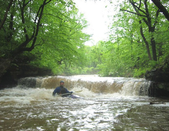
The first pitch is a wide and stepped, sliding drop. A very brief pool, and a twist to the left, and the river drops across a short uniform ledge into another brief pool. (The photo shows this ledge, not the main first pitch.) At some high flows, this one might become playable, or could develop a bit of a hydraulic. Last in this sequence, there is a sweet low-angle slide (like an off-ramp) before this stretch of gradient eases back.
Location
Other Rapids on This Run (3)
Current Conditions
5-Day Forecast
American Whitewater