Take Out
Save this feature with the run it belongs to.
Gauge Conditions
Description
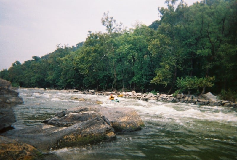
The first takeout ('Potoma Wayside') is on the Virginia side immediately before the lower (MD) 340 bridge. There is space for loading and unloading here, but there are only three parking spaces where you can leave a car. The Harpers Ferry Adventure Center has a take-out just downstream that can sometimes be used during the week (Mon-Thurs) by prior arrangement (It depends upon who you talk to and what they think about their constraints). Other parking options near Potoma Wayside are very limited and/or expensive. The whole parking and traffic situation on the VA side can be somewhat daunting because of the narrowness of the shoulder and the speed of the heavy two lane traffic.
The second takeout ('Weverton') is 1 1/2 miles of flat and moving water downstream from the US 340 bridge on the Maryland side. This take-out is hard to see from the river and requires a long walk through the woods and down the tow-path, but it does have an authorized on foot at-grade railroad crossing.
Other takeouts include: ('Brunswick' [also on the Maryland side]) requires an additional 5 miles of paddling, with the last 3 1/2 miles consisting of flatwater; however, there is an authorized at-grade railroad crossing for vehicles and a boat ramp offers the convenience of easy access and close parking. ('Sandy Hook') is on the MD side and is 1/2 mile downstream from the confluence of the Shenandoah River on river left immediately before the US 340 bridge at Sandy Hook. To reach this takout from Rt. 340, take the last left as you approach the 340 bridge from the MD side, then take the first right to the bottom of the hill where the road approaches the railroad tracks. The takeout trail crosses posted railroad property and involves crossing two sets of very active tracks. This once very popular takeout has been closed by the railroad.
The same takeouts can also be used to run the Millville/Bull Falls/Staircase section of the Shenandoah. This is a longer and somewhat more interesting run, but there are times that low water levels would make the Potomac the better option.
Location
Current Conditions
5-Day Forecast
American Whitewater