Take-out
WV
Take Out
Save this feature with the run it belongs to.
Gauge Conditions
Data from American Whitewater & USGS
Photo
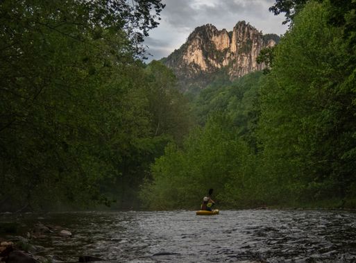
Photo courtesy of American Whitewater
Description
Take Out rapid marks the terminus of the upper Seneca Creek section, characterized by a tight constriction between large boulders that creates complex hydraulics and limited maneuvering space. Paddlers must carefully negotiate a technical line through narrow channels, with potential for pin hazards and limited downstream visibility, making precise boat control essential for safe passage.
Location
Interactive river map
Loads as you approach this section.
Other Rapids on This Run (1)
View Full Run
1. (Upper) Judy Springs to Forest Service Campground
Seneca Creek
IV-V+
10.0 mi
Current Conditions
5-Day Forecast
Whitewater data from
American Whitewater
American Whitewater