Gauge Conditions
Runnable: ? – ? CFS
Approximate - nearest available gauge. Use as general reference only.
Data from American Whitewater & USGS
CDEC Flow Data California
Data from California Data Exchange Center (CDEC)
Photo
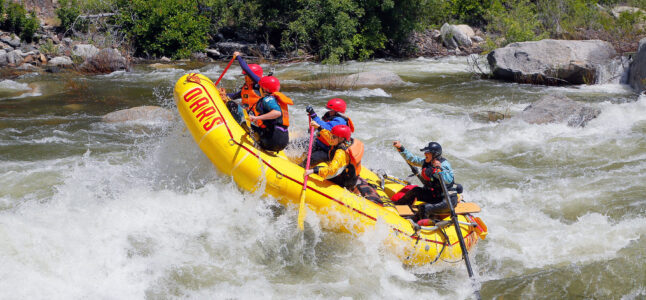
Photo courtesy of American Whitewater
Description
Take Out marks the final challenging section before the river's confluence, characterized by scattered boulder gardens and potential shallow water depending on flow levels. Careful boat positioning and precise navigation are critical to avoid pin hazards and potential boat damage, especially during lower water conditions when rocks become more exposed.
Location
Other Rapids on This Run (1)

View Full Run
Greeley Hill Road to Merced confluence
Merced, N. Fork
IV-V(V+)
19.7 mi
Current Conditions
5-Day Forecast
Whitewater data from
American Whitewater
American Whitewater