Take Out Rapid
Save this feature with the run it belongs to.
Gauge Conditions
Runnable: ? – ? CFS
Approximate - nearest available gauge. Use as general reference only.
Data from American Whitewater & USGS
Photo
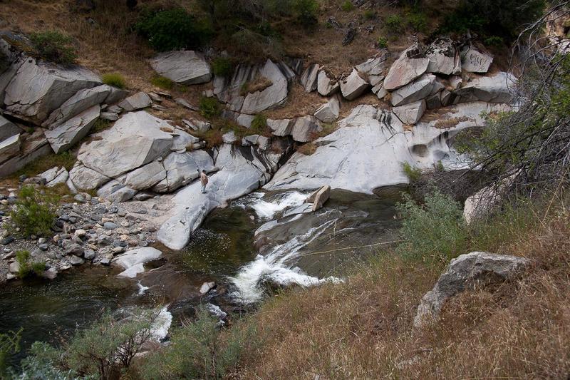
Photo courtesy of American Whitewater
Description
The final rapid is the biggest of the run. The first half is steep and bouldery, but the final part is bedrock. The main ledge could have a bad reversal. It can be avoided around to the river right.
One can take out above this rapid and walk the level road to your car.
One can take out above this rapid and walk the level road to your car.
Location
Interactive river map
Loads as you approach this section.
Other Rapids on This Run (2)
View Full Run
Maxson Road to Trimmer Springs Road
Sycamore Creek
III-IV(V)
2.8 mi
Current Conditions
5-Day Forecast
Whitewater data from
American Whitewater
American Whitewater