"The Wall"
Save this feature with the run it belongs to.
Gauge Conditions
Runnable: 400.0 – 3,000.0 CFS
Upper limit for best boatability uncertain. Please help your fellow boaters with a comment or report.
Data from American Whitewater & USGS
Photo
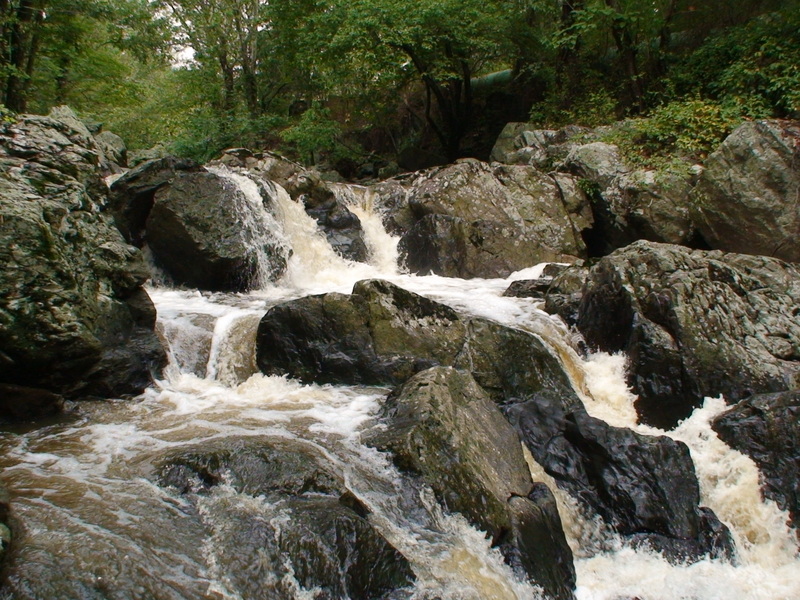
Photo courtesy of American Whitewater
Description
The rock at the top to the left in the picture is the wall. You would want to boof off the left corner with a little more water.
Location
Interactive river map
Loads as you approach this section.
Other Rapids on This Run (3)
View Full Run
"Gilpin Falls" section. "Gilpin Falls" covered bridge next to MD 272 to town of Northeast, MD
Northeast Creek
V
4.2 mi
Current Conditions
5-Day Forecast
Whitewater data from
American Whitewater
American Whitewater