06. Bedrock to Gateway
Gauge Conditions
Runnable: 800.0 – 5,000.0 CFS
Acceptable flow range for rafts - other crafts may enjoy flows outside this range ((See Dolores 2011 Flow-Evaluation Report for more information).
Data from American Whitewater & USGS
Run Map
Run Time Estimate
Select put-in and take-out to estimate time.
Plan This Trip
See wind-adjusted speed maps, forecast planning, and detailed time estimates.
Sign in to generate an AI timing estimate for this run.
Whitewater timing varies with scouting, portages, and group pace. Use as a planning baseline.
Description
SEASON: April to early June depending on snowpack and release from McPhee Dam and inflow from the San Miguel River.
ISSUES: Recreational users have traditionally been the last to be considered in the management plan for McPhee Dam. A proposal to construct additional diversions designed to capture even more of the spring melt will only make the situation worse. Check with the San Juan Citizen's Alliance for the latest information on this issue.
LOGISTICS: The put-in at Bedrock is on river left just upstream of the Highway 90 Bridge. There have been reports of car vandalism at this access site. From the put-in take Highway 90 east and turn north onto Y11 Road as it parrallels the river. Once you reach the confluence with the San Miguel River the road turns east and up the San Miguel along river left where it crosses the river and joins Highway 141. You may be able to find an alternate launch site here when the Dolores is too low. Follow Highway 141 back downstream along the San Miguel on river right. This road follows the river all the way to the take-out at Gateway. Access from Highway 141 to the river is limited by the steep canyon walls, but there are a couple potential spots (obtain permission from land owners).
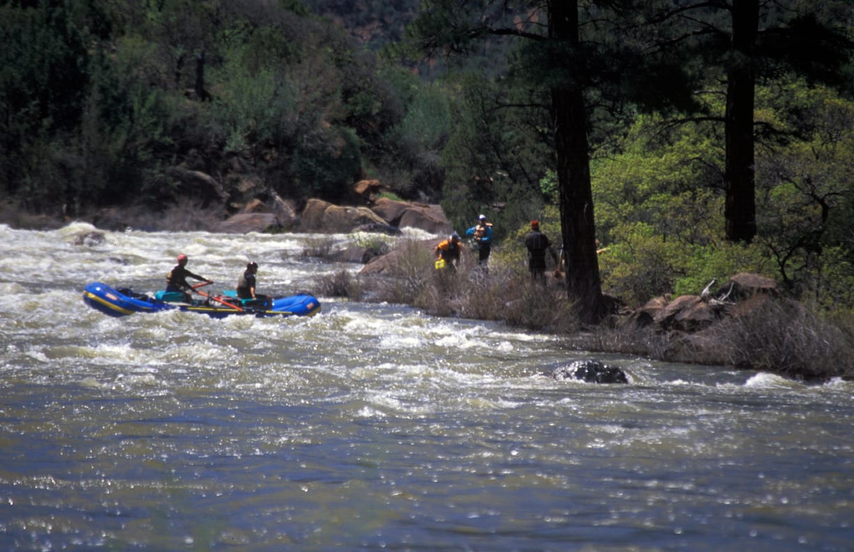
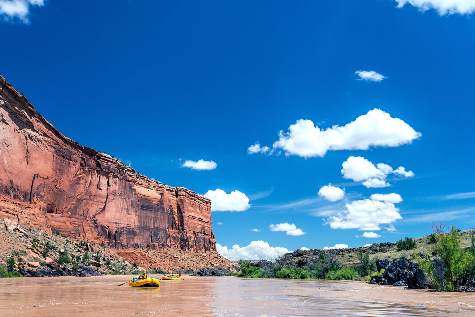
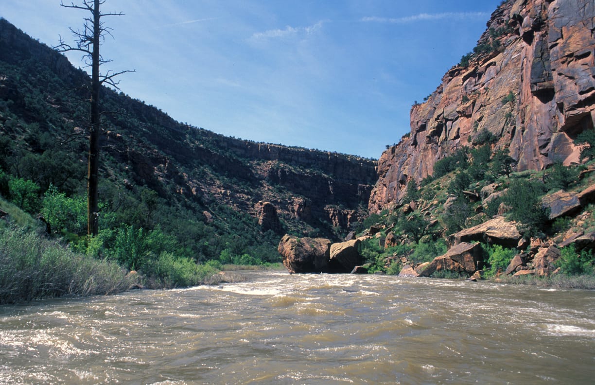
DESCRIPTION: This section is the Paradox and Mesa Canyon section of the Dolores and for the most part you're here for the scenery. This section is most often paddled as part of a longer trip on the Dolores. Evidence of past mining activity can be seen from the river and there is a road along much of the run.
While McPhee dam upstream limits the days the San Miguel River joins the Dolores providing supplemental flows in the spring. In some years your only opportunity for paddling the Dolores is to launch below the confluence of the San Miguel. The Dolores is managed by the BLM and they maintain a web page with information on the river. Although permits are not currently required, you will still need your firepan, portable toilet, and dishwater strainer.
From the Bedrock Launch site at mile 97 the river passes under the Highway 90 bridge and continues as a lazy float for about 7 miles until you enter Paradox Canyon. There are a couple campsites in the canyon and a bit of class III. At mile 108 the San Miguel joins the Dolores and the river enters the scenic Mesa Canyon. Launching upstream on the San Miguel may be a possibility when the Dolores is too low, but there's a fair amount of private land around here.
The river passes in and out of scenic river canyons all the way to the Gateway access at mile 141. There are some good campsites along this reach but a river guide is helpful to plan your stopping points. Although a couple sections along this reach aren't visible from the road, most of it is and can be scouted from the road.
Boaters can start from further upstream or continue their trip downstream by taking advantage of boating opportunities on the following sections of the Dolores and Colorado:
- 1) Dolores River, Bradfield Launch to Dove Creek Pump Station, 19 miles, II-III
- 2) Dolores River, Dove Creek Pump Station to Slickrock, 28 miles, II-III+(IV)
- 3) Dolores River, Slickrock to Bedrock, 50 miles, II+(III)
- 4) Dolores River, Bedrock to Gateway, 44 miles, II+, this page
- 5) Dolores River, Gateway to Colorado River, 30 miles, II+(IV)
- 6) Colorado River, Cisco to Moab, 47 miles, I-III
- 7) Colorado River, Moab to Lake Powell (Cataract Canyon), 112 miles, I-IV
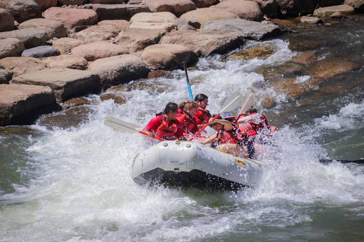
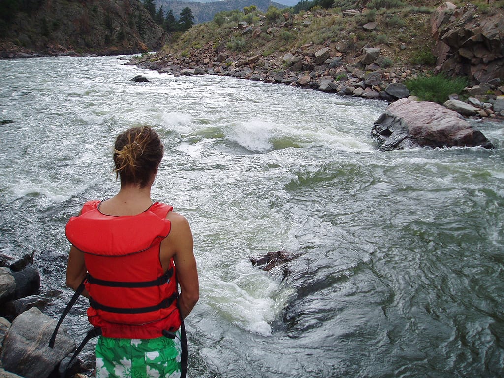
Rapids in this Run (11)
 Rapid
II+
Rapid
II+
Paradox Canyon Rapid
 Rapid
III
Rapid
III
Lost Oar Rapid
 Rapid
III
Rapid
III
Trap Rapid
 Rapid
II
Rapid
II
Red Canyon Rapid
 Rapid
II
Rapid
II
Mesa Canyon Access (private)
 Rapid
III-
Rapid
III-
Peregrine Rapid
 Rapid
II
Rapid
II
Maverick Canyon Rapid
 Rapid
II+
Rapid
II+
Salt Canyon Rapid
 Rapid
II+
Rapid
II+
Bullwood Rapid
 Rapid
III-
Rapid
III-
Cave Canyon Rapid
 Rapid
II+
Rapid
II+
Larsen Rapid
Difficulty
Class II+
Length
45.0 mi
Gradient
10 ft/mi
Rapids
11
Access Points
Difficulty Classes
I Easy
II Novice
III Intermediate
IV Advanced
V Expert/Extreme
VI Unrunnable
Current Conditions
5-Day Forecast
Whitewater data from
American Whitewater
American Whitewater