1.) Crawford Notch to Bartlett (along Hwy 302)
Gauge Conditions
Runnable: 650.0 – 5,500.0 CFS
This level is just an estimate at this time, as more information comes in we will update the range.
Data from American Whitewater & USGS
Run Map
Run Time Estimate
Select put-in and take-out to estimate time.
Plan This Trip
See wind-adjusted speed maps, forecast planning, and detailed time estimates.
Sign in to generate an AI timing estimate for this run.
Whitewater timing varies with scouting, portages, and group pace. Use as a planning baseline.
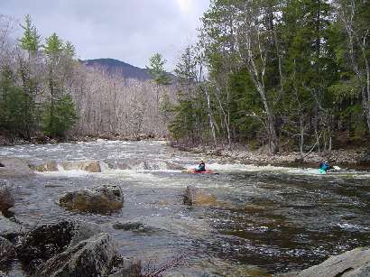
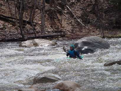
Description
The Saco runs through the highest mountains in the northeastern US. It cuts through a steep valley called Crawford Notch (a NH state park). Outside of the sustain spring melt off the Saco rises and falls rapidly due to steep terrain in its headwaters. If snow is not present it will be necessary to catch the river during or shortly after a heavy rainfall.
This section starts out at the base of an impressive gorge. This gorge is runable at certain levels but should be scouted. Below the river is consistant class III at low levels. At higher levels this section should be considered class IV due to its consistant gradient. Further down river the consistant gradient turns to more of a pool drop nature with the pools getting larger as one heads down. There is a couple of portions in this lower section where the difficulty increases namely Sawyers rock and Tweedledum Tweedledee rapid. Both these rapids are visible from route 302 when there is no foliage on the trees (mid Oct. thru mid May).
### Technical info
```
Put in elevation........958'
Take out elevation......657'
Total drop..............301'
Average drop/mile.......49'
1st mile................78'
2nd mile................43'
3rd mile................47'
4th mile................40'
5th mile................35'
6th mile................50'
6.2 mile................8' (40' average)
Distance................6.2 miles
River width average.....35'
River geology...........Granite ledge, small to medium boulders
River water quality.....Excellent, clarity: excellent.
Scenery.................Good to excellent mountain scenery, a few homes and
camps on the lower reaches, route 302 occasionally
visible on river right.
Wildlife................occasional deer, moose, perrigrine falcons, hawks.
```
## Directions
### Put in
Interstate 95 to Spaulding turnpike (NH rt 16).
North through Conway up to the intersection 302/16 in Glenn (approximately 75 miles).
Go straight through the intersection and continue on route 302.
Approximately 12 miles look for a small parking area next to a grey house on the right about a mile past the Sawyer River crossing.
Or continue another mile past an area where route 302 crosses Nancy Brook just after the Notchland inn
Note: putting in here requires you to run or portage the class IV gorge just downstream.
### Take out
Head back to the town of Bartlett on route 302.
Take a left at the blinking light.
Approximately .3 miles to the bridge. Take out located across the bridge on upstream river left. The gauge is located on river right downstream side of bridge.
Rapids in this Run (3)
Difficulty
Class III-IV
Length
6.3 mi
Gradient
49 ft/mi
max 78
Rapids
3
Access Points
Difficulty Classes
I Easy
II Novice
III Intermediate
IV Advanced
V Expert/Extreme
VI Unrunnable
Current Conditions
5-Day Forecast
Whitewater data from
American Whitewater
American Whitewater