19. Lee's Ferry to Lake Mead
Gauge Conditions
Runnable: 4,000.0 – 48,000.0 CFS
Runnable: 4,000.0 – 48,000.0 CFS
Runnable: 4,000.0 – 48,000.0 CFS
Data from American Whitewater & USGS
Run Map
Run Time Estimate
Select put-in and take-out to estimate time.
Plan This Trip
See wind-adjusted speed maps, forecast planning, and detailed time estimates.
Sign in to generate an AI timing estimate for this run.
Whitewater timing varies with scouting, portages, and group pace. Use as a planning baseline.
Description
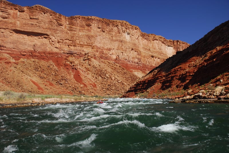
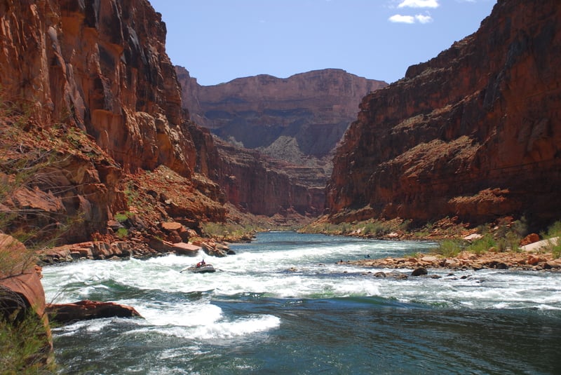
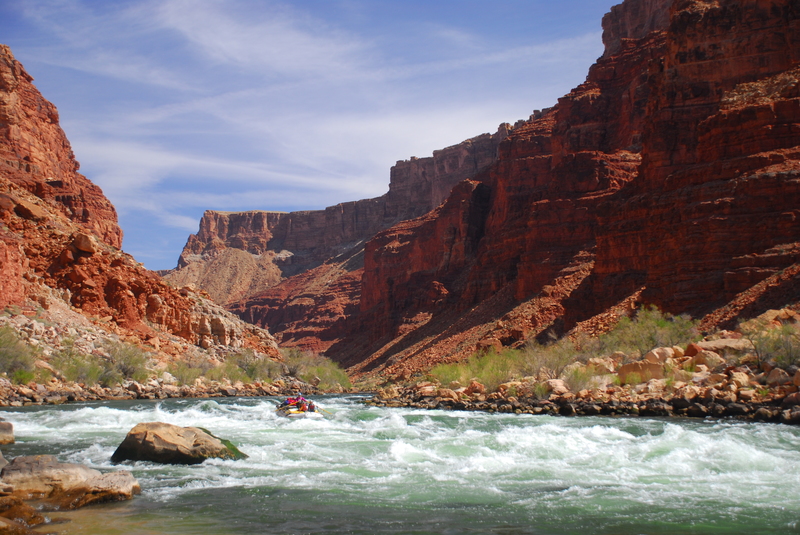
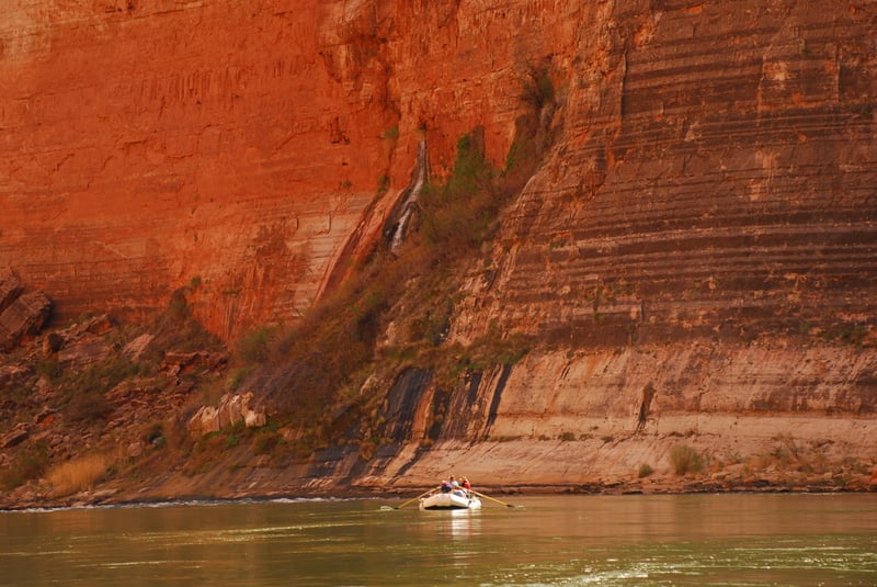
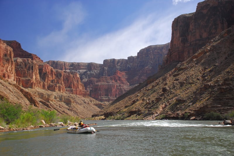
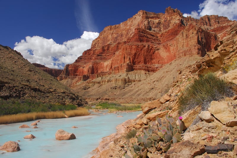
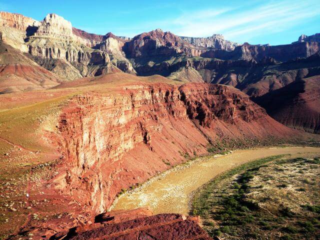
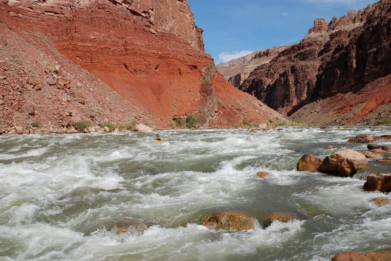
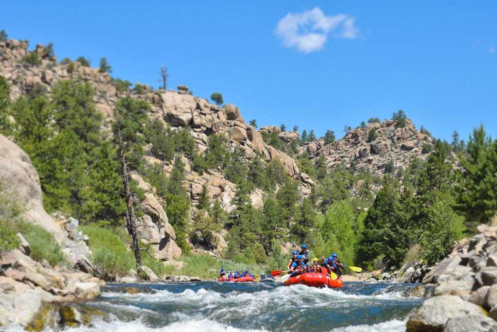
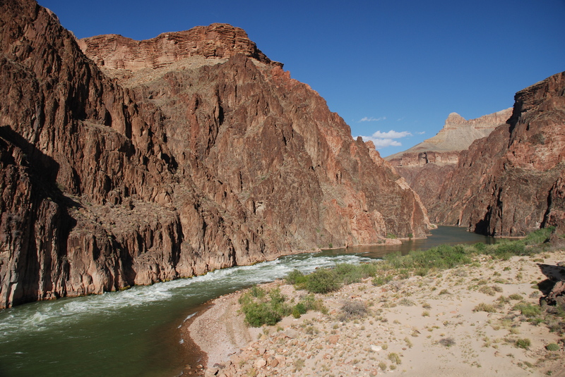
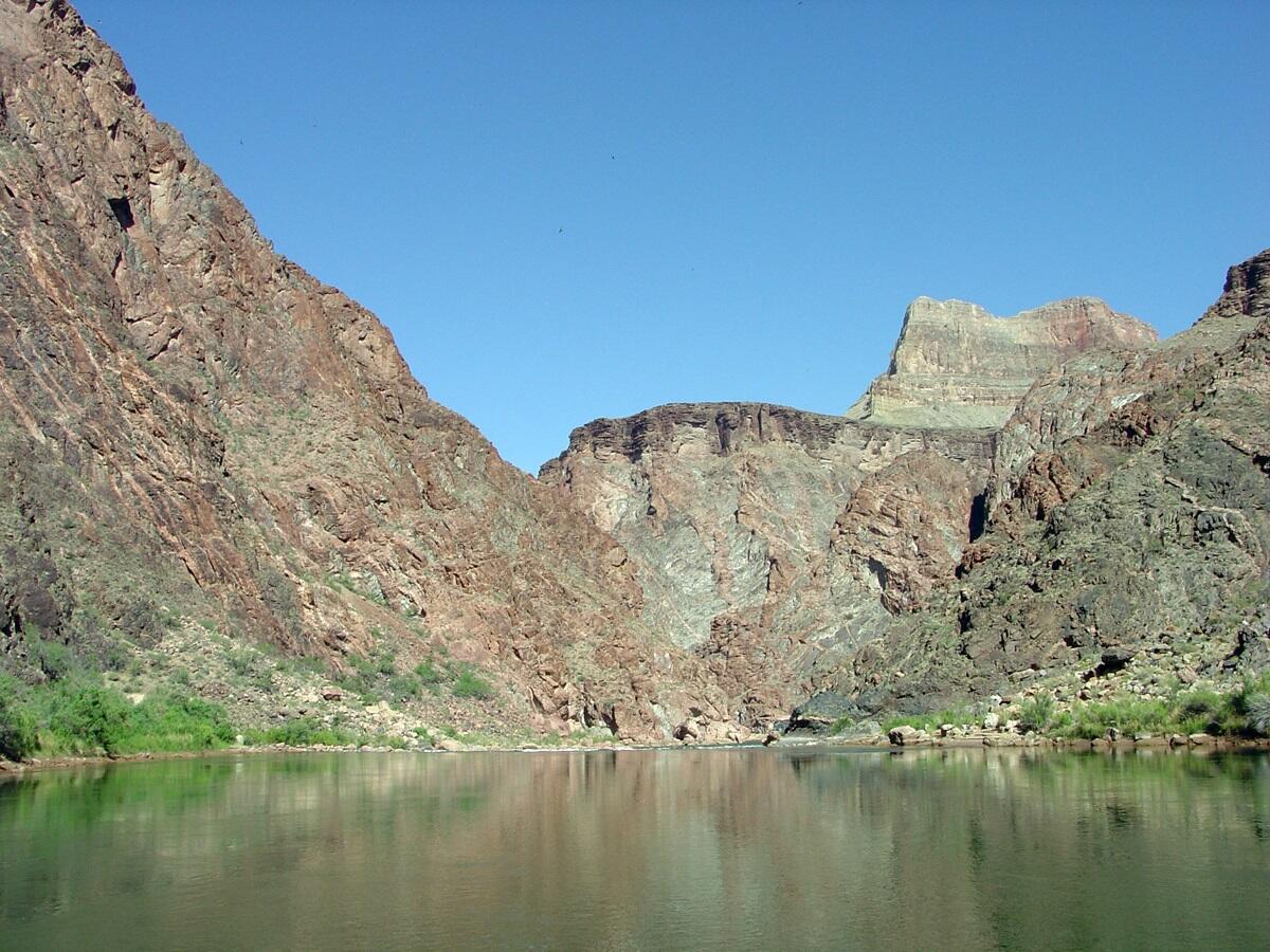
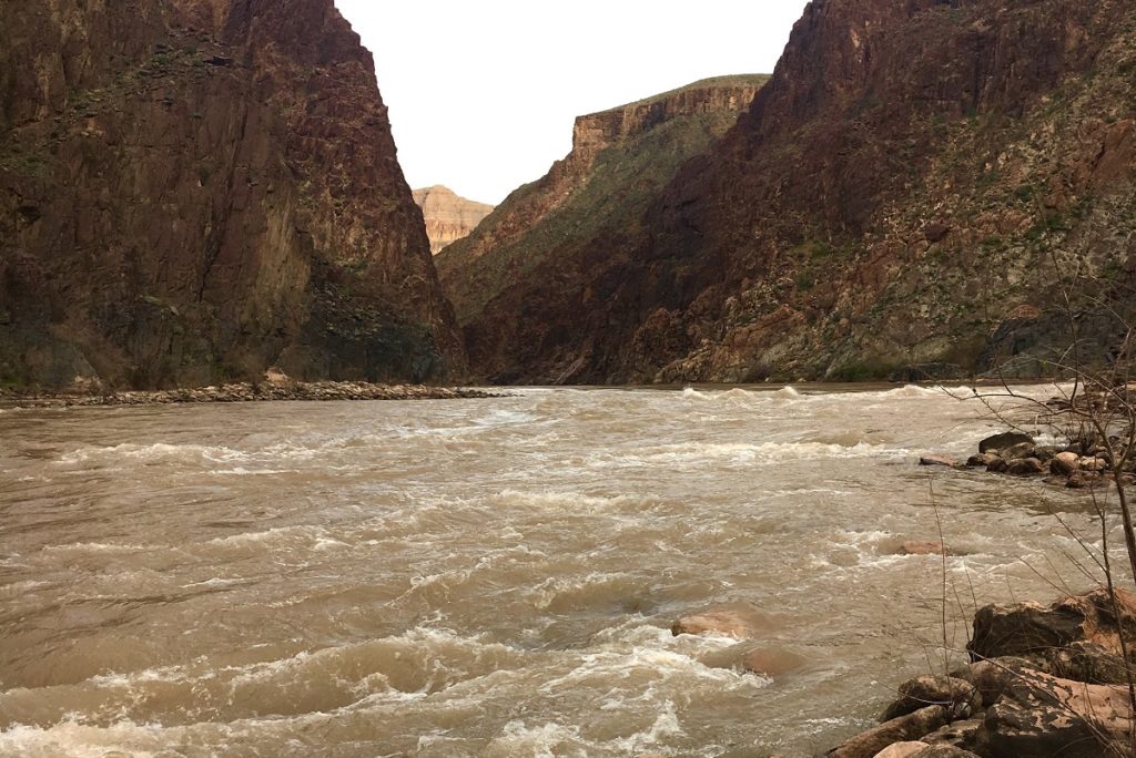
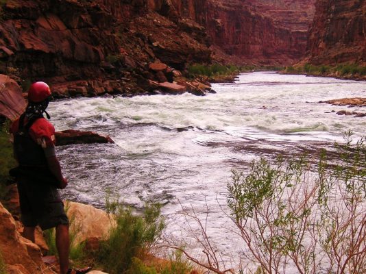
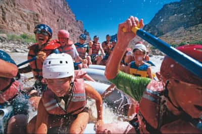
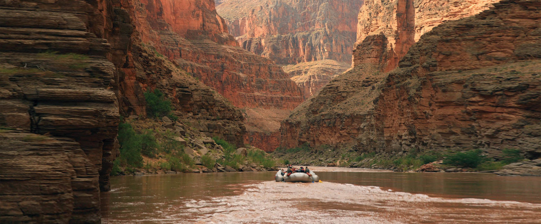
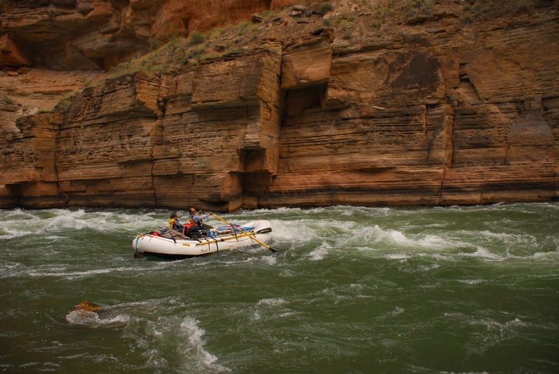
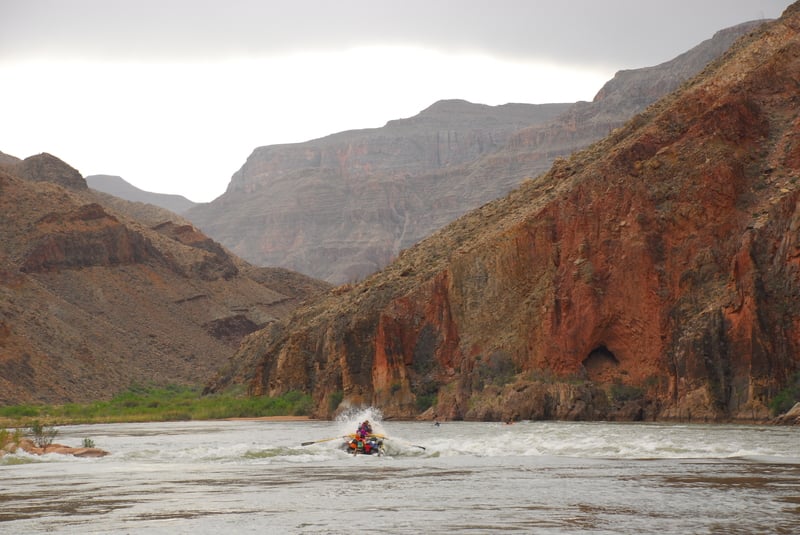
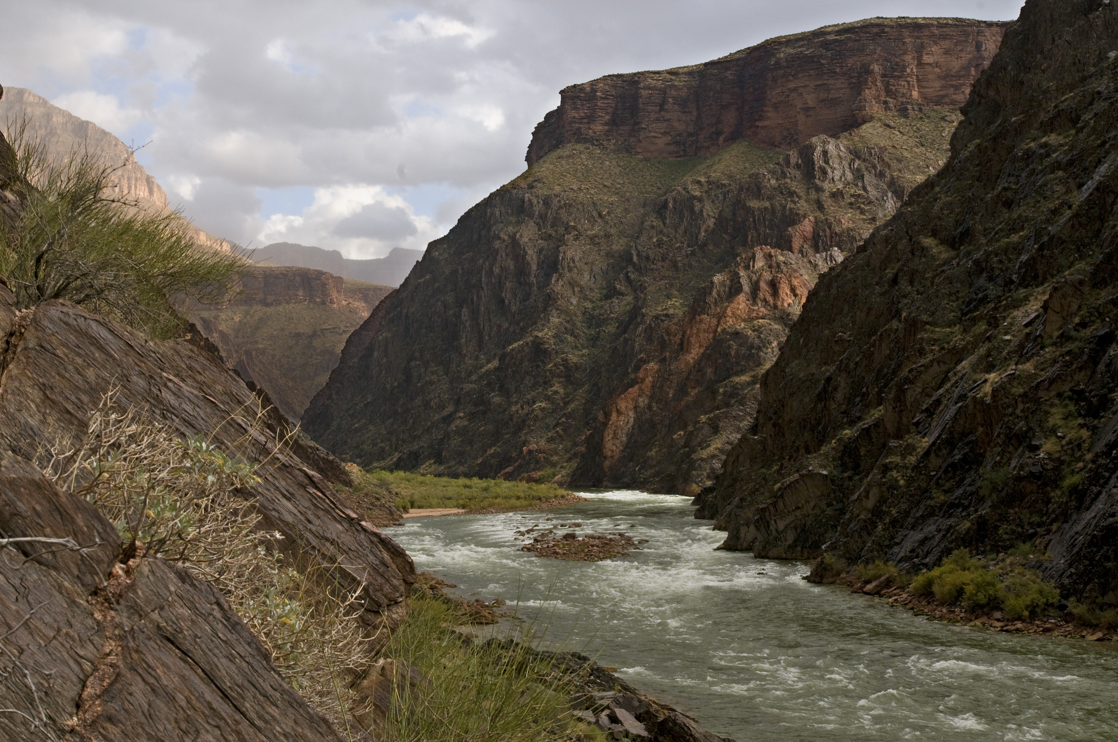
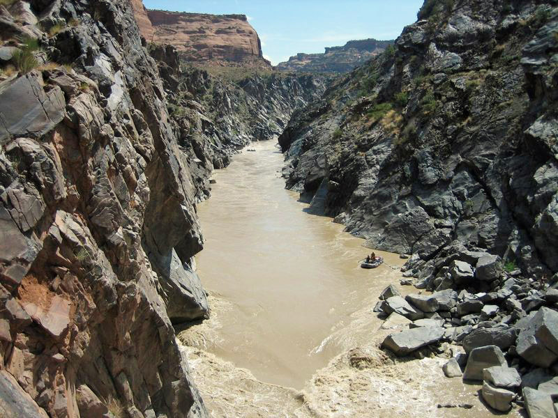
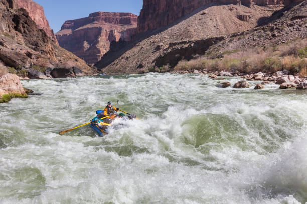
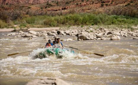
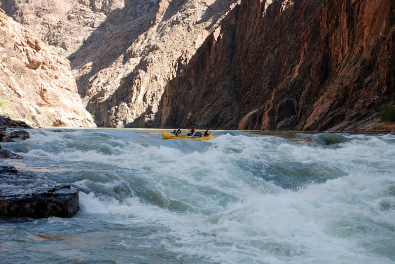
The Grand Canyon is one of the seven Wonders of the World. Magnificent views of the geological record are on prominent display throughout a journey through this canyon. Every day that passes reveals new eras of time and new aspects of creation.
The long history and lore of the Grand Canyon have built the whitewater up to heroic proportions in the public mind. However, river running knowledge, skill, and equipment have improved tremendously in the century that boaters have been running this section of the Colorado River. By modern outdoor sports risk standards the Grand Canyon is a very reasonable adventure.
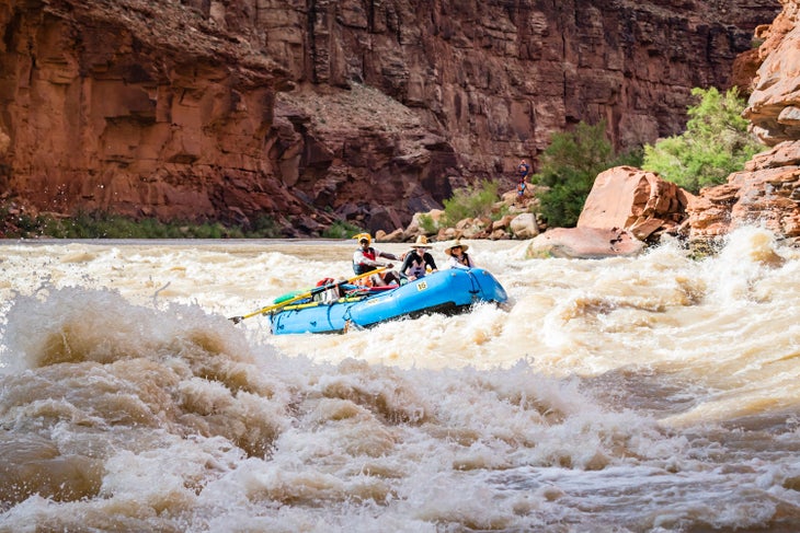
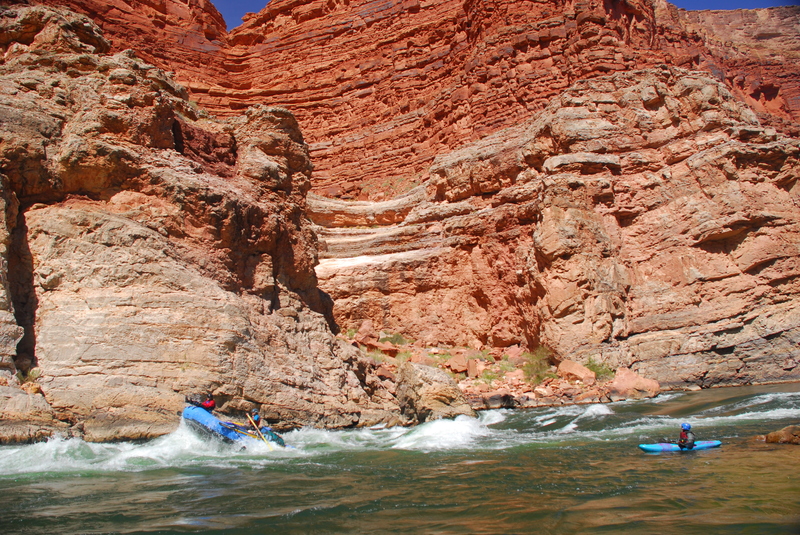
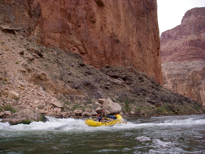
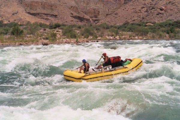
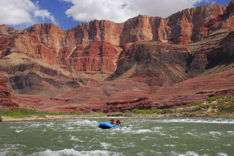
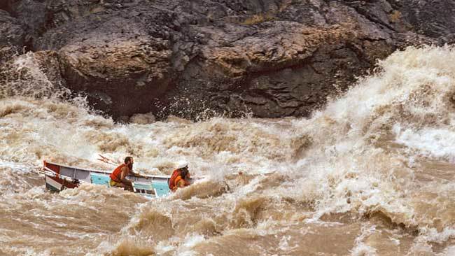
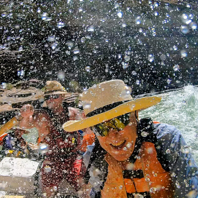
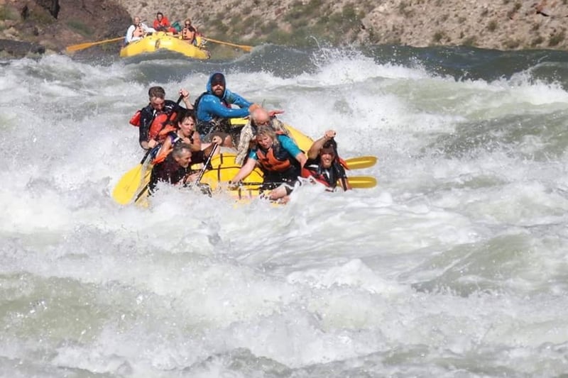
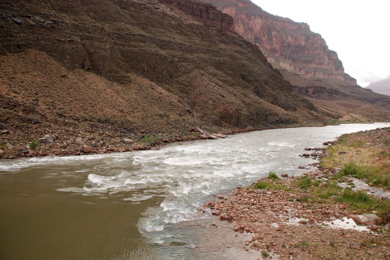
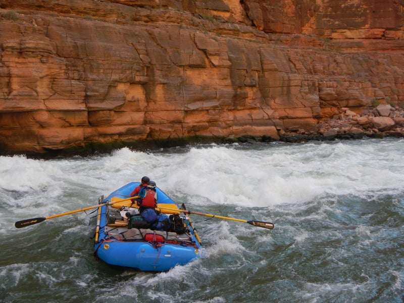
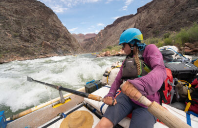
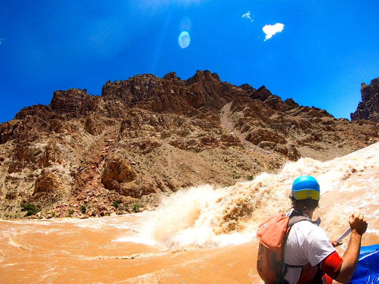
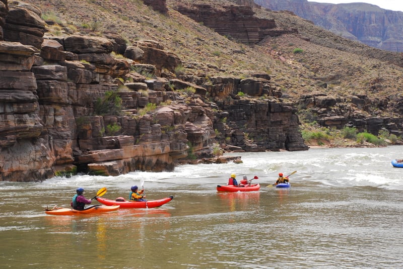
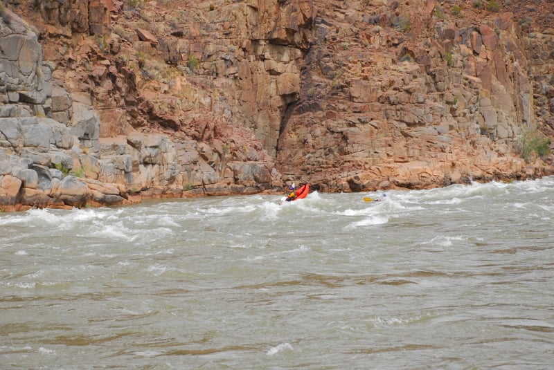
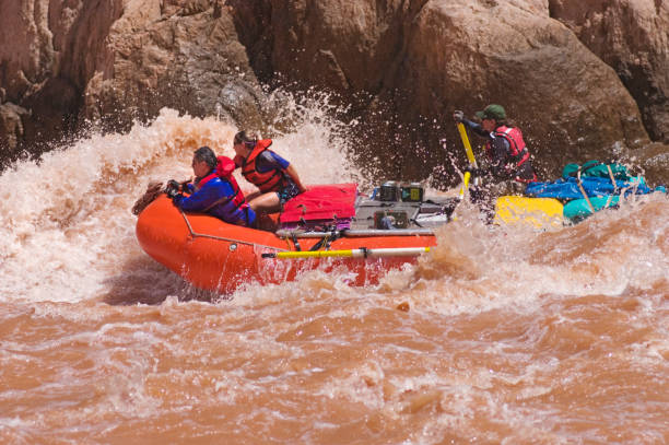
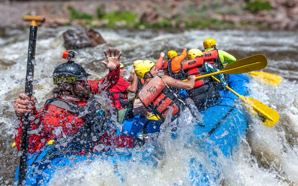
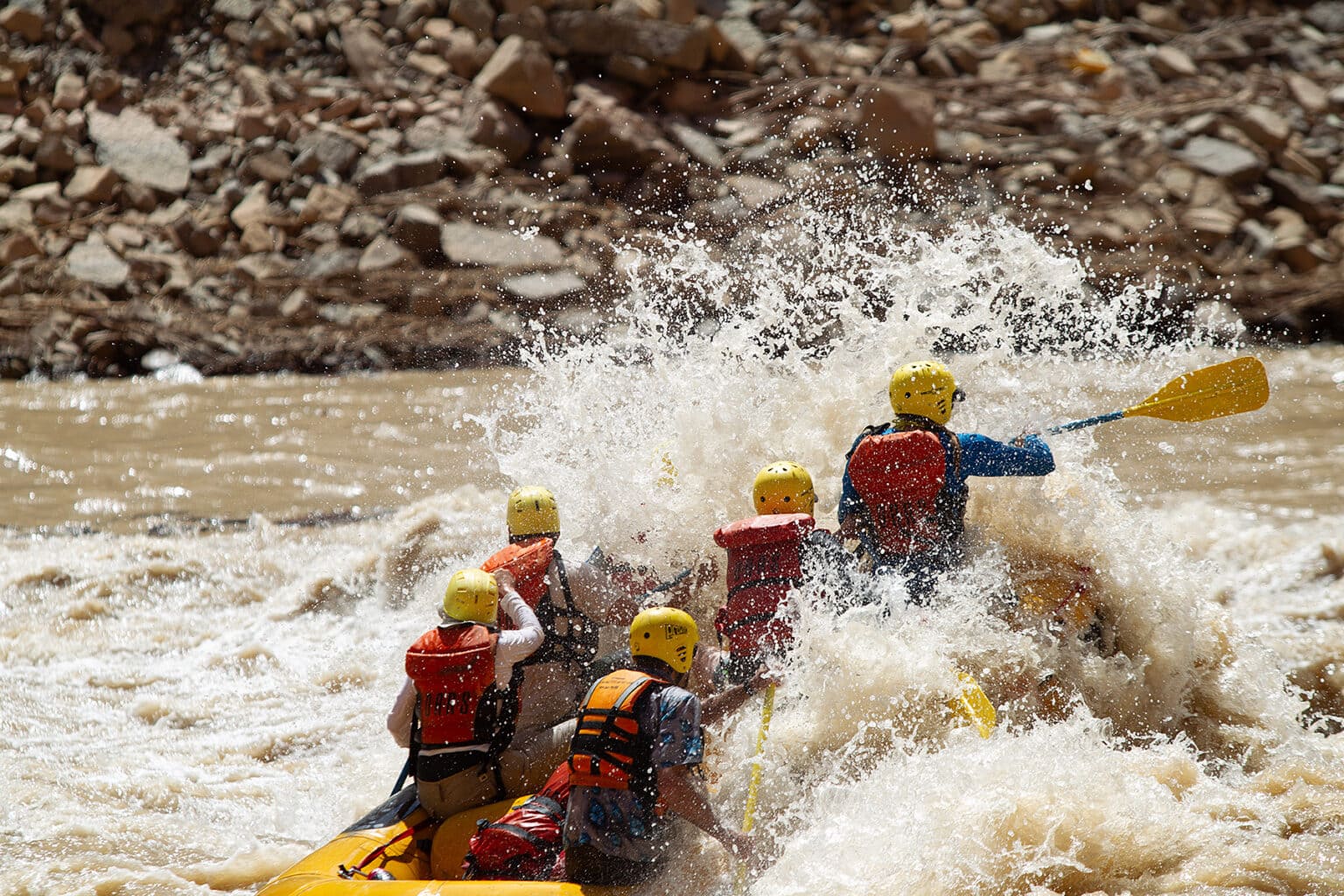
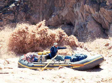
The gradient tells the tale as most of Grand Canyon is flat water. The infamous 1 to 10 rating system does not mean that these rapids are harder than class 6. The hardest rapids on the run were simply given a 10 rating and everything else was rated respectively lower. A Grand Canyon 10 corresponds approximately to a class IV rating on the international scale. The 1 to 10 rating was system developed for heavily loaded large rafts, and a 10 on this scale might not require a single stroke from a kayaker (though perhaps a lot of bracing and rolling if one wanted to try that!). Experienced river runners can apply their usual river-running judgement.
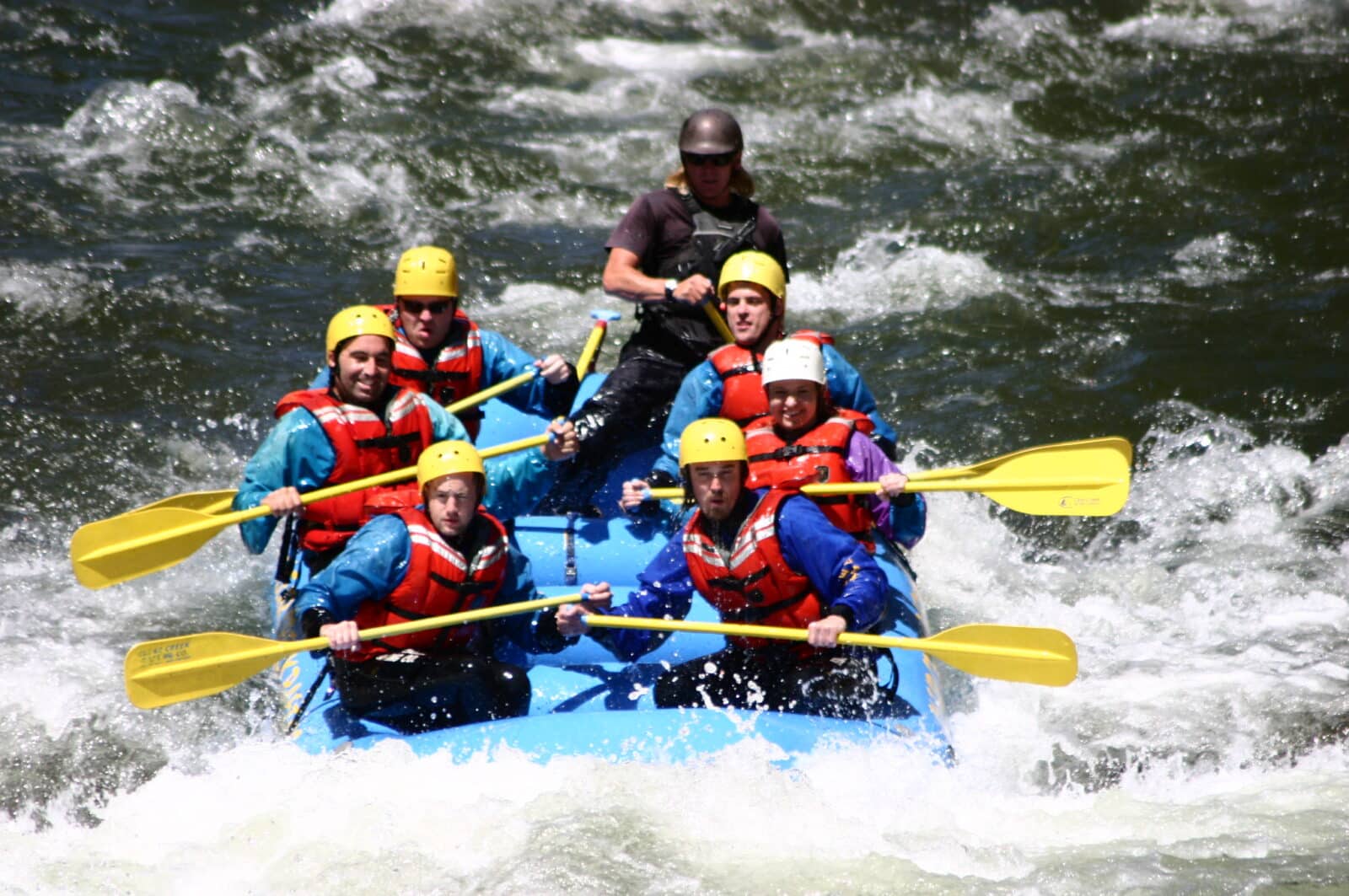
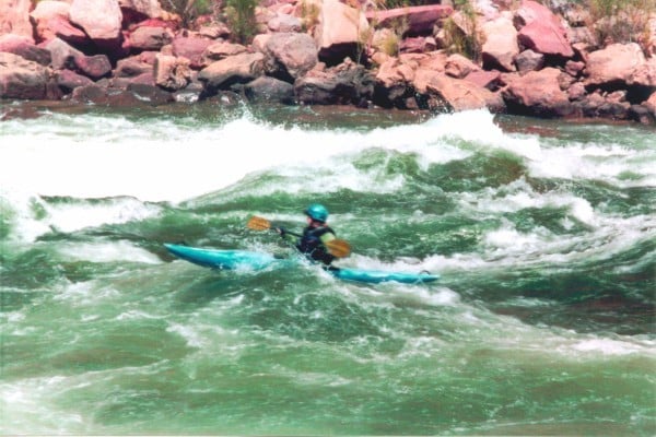
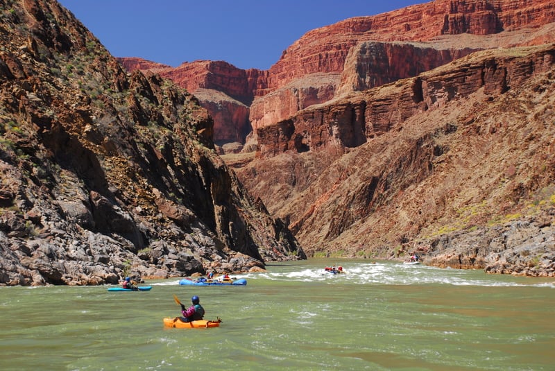
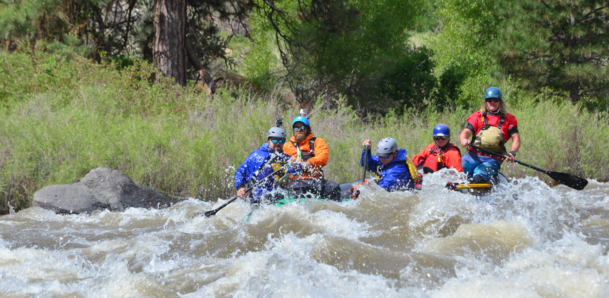
The skills required for a kayaker to negotiate Grand Canyon include:
1\. A bomber roll. The water is cold and the river is so wide that swimming to shore is difficult.
2\. The ability to turn sideways to a big wave train and paddle out of it.
3\. The ability to keep your balance and your cool in sustained funny water (whirlpools and boils occur at the bottom of many rapids and along eddy lines).
4\. The ability to scout and choose a big-water line and smash it.
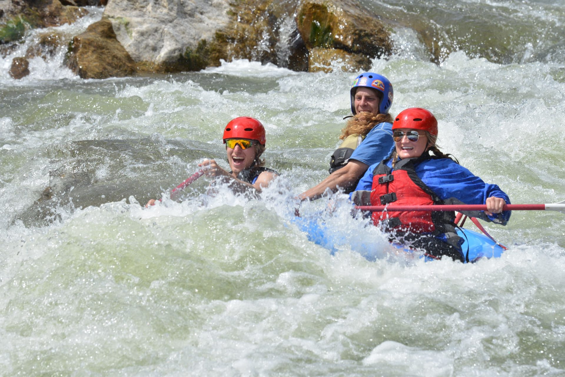
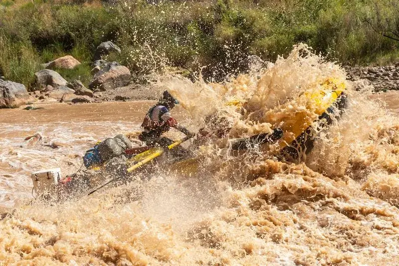
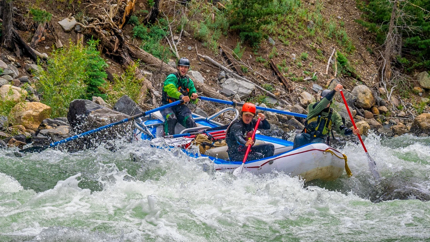
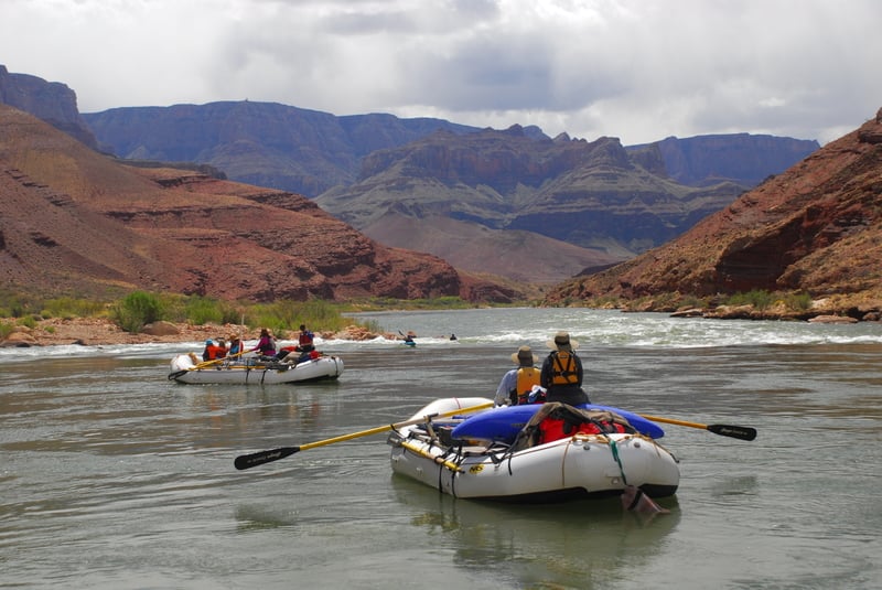
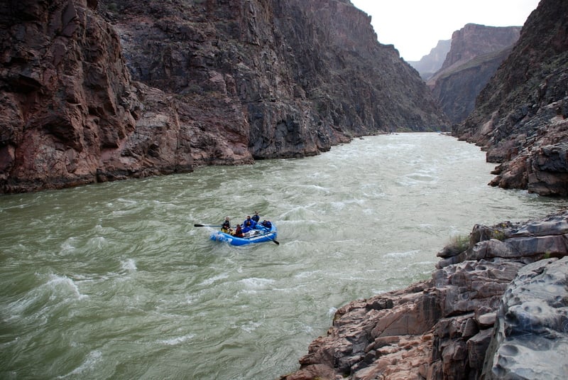
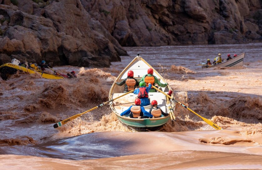
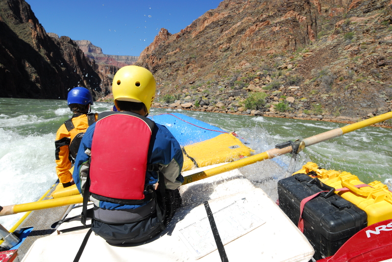
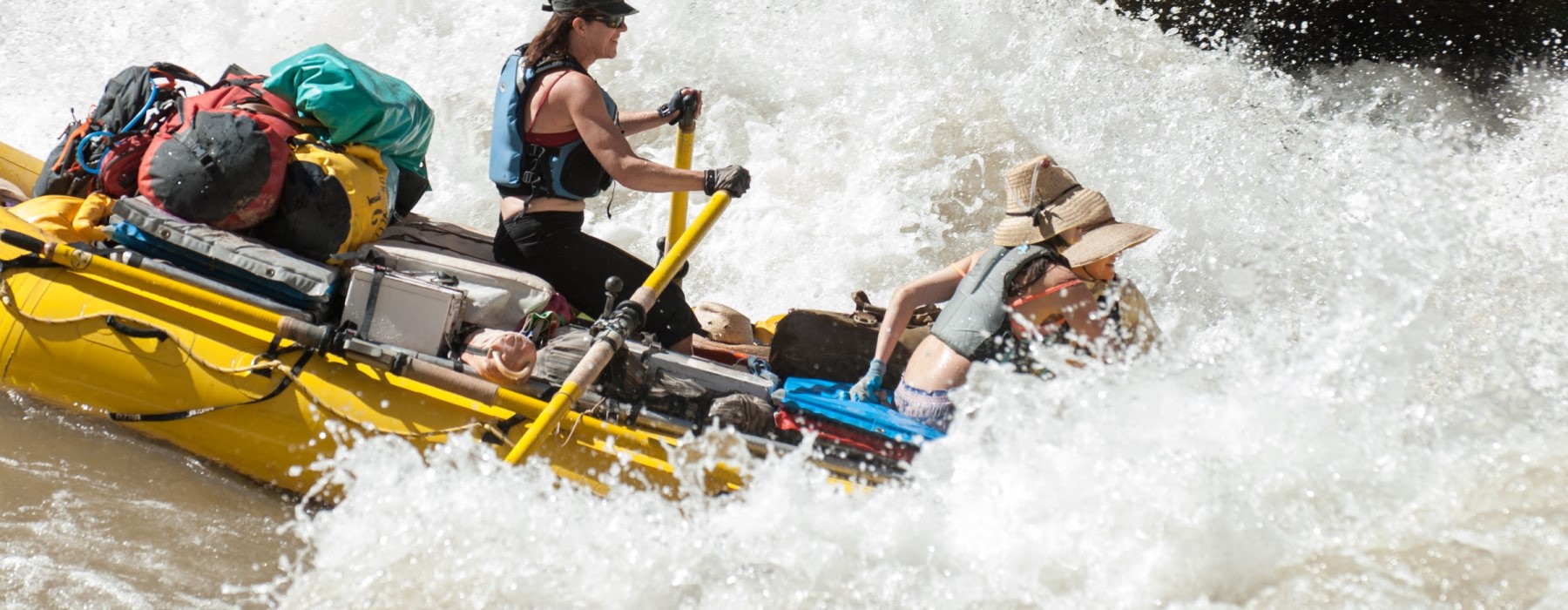
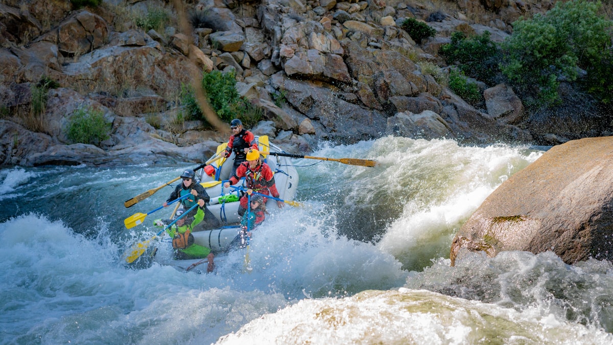
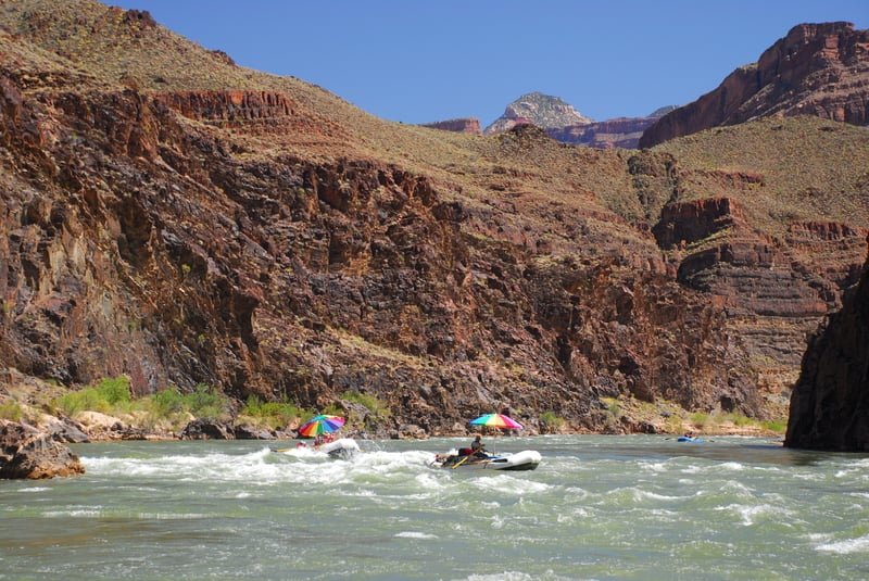
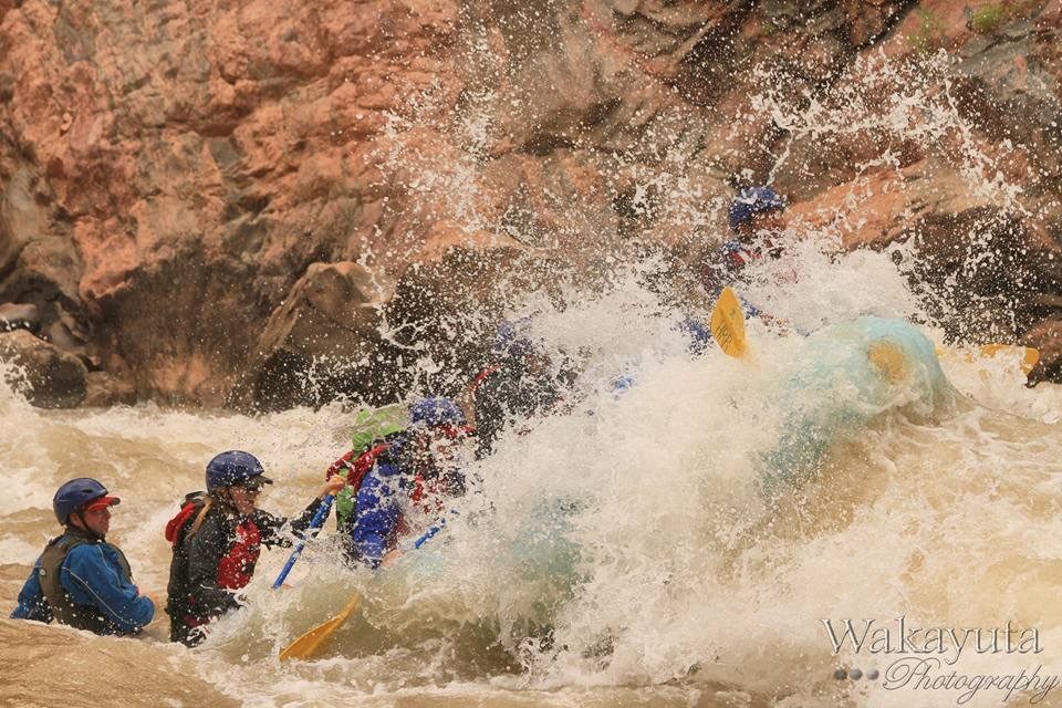
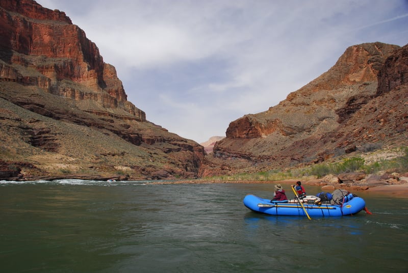
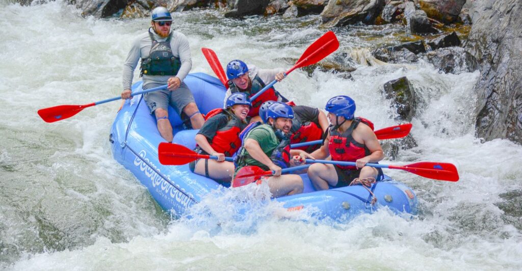
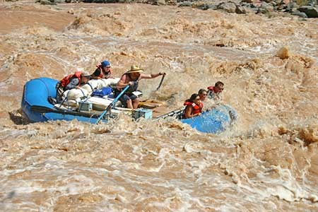
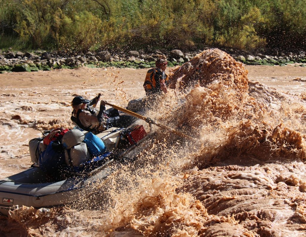
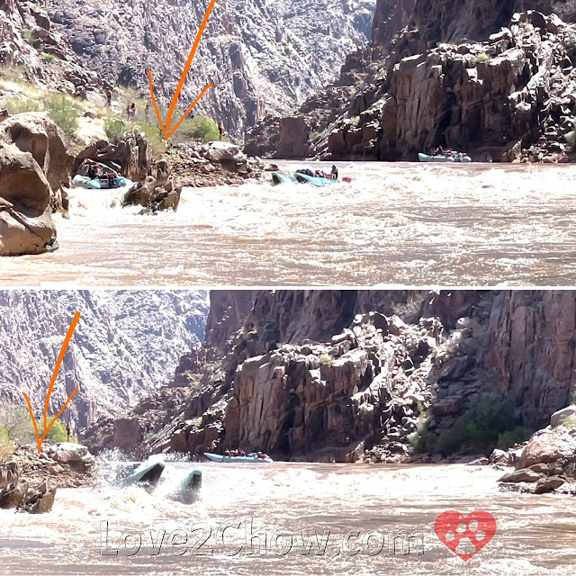
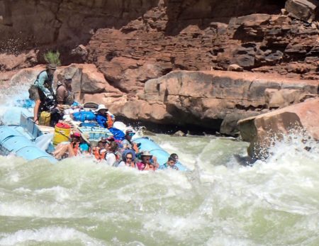
The skills required for an oarboatman in the Grand Canyon are in some ways much more difficult. Rafts are typically overburdened and heavy. It takes a good understanding of the rapids, early decision making and positioning at the top, and a lot of hard work to get a raft to the right place in a rapid. The risk to a baggage boat is much greater than for other river runners. A swimmer can flush through the biggest rapids. A kayaker can get flipped and easily roll back up. But if a baggage boat flips, it will take a long time to get it to shore and a lot of manpower to got it flipped back over, upright. A flip can cost hours of effort and important supplies can be lost or ruined.
Boatmen need the ability to:
1\. Tie great knots and secure boats overnight
2\. Hang on to the oars in heavy water, the ability to manuver with only one oar if needed and the ability to quickly replace an oar.
3\. Maintain or recover a ferry angle in heavy water.
4\. Catch eddies at the bottom of rapids and the ability to break out across big eddy lines.
5\. Keep rowing when you miss a line, straighten out and push when facing a big hole, and get back in the seat when knocked off.
6\. Rig very well and maintain your anchor lines through changing night time water elevations.
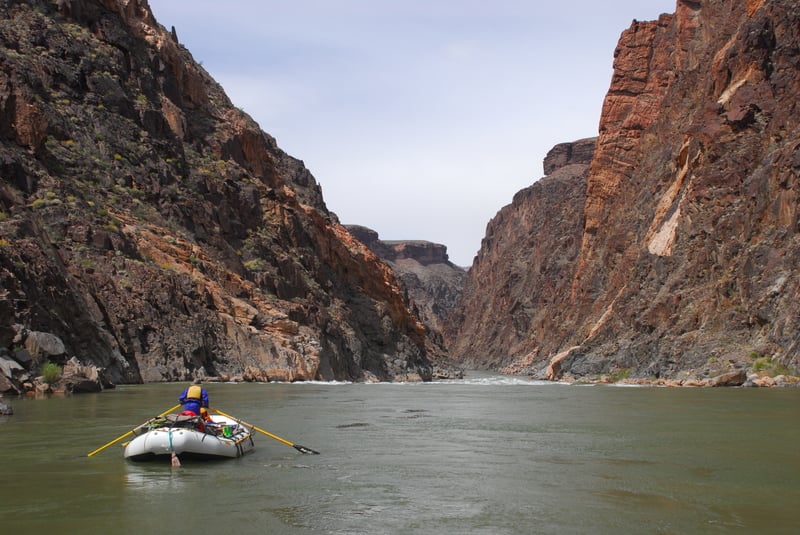
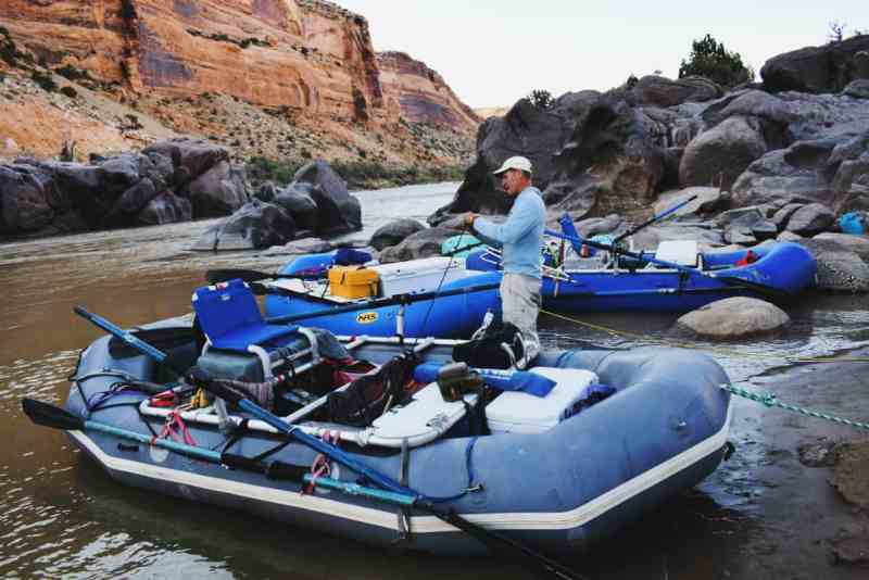
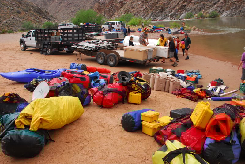
Putting together an expedition that meets National Park Service requirements and keeps a group of river runners well fed and happy for 18 or more days requires strong leadership skills.
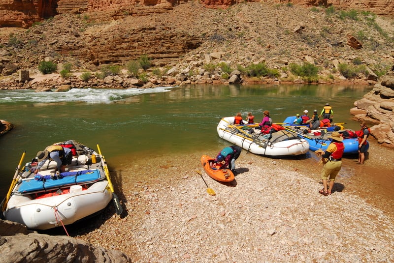
Put-in:
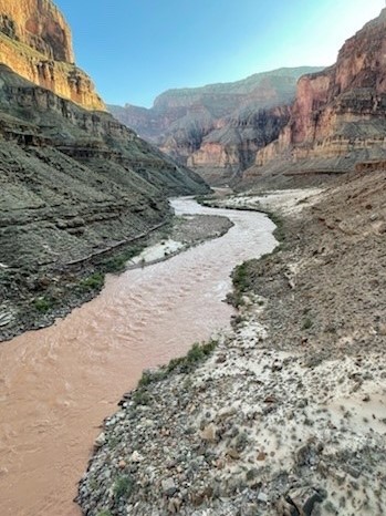
The launch point is Lee's Ferry, which is measured as mile zero.
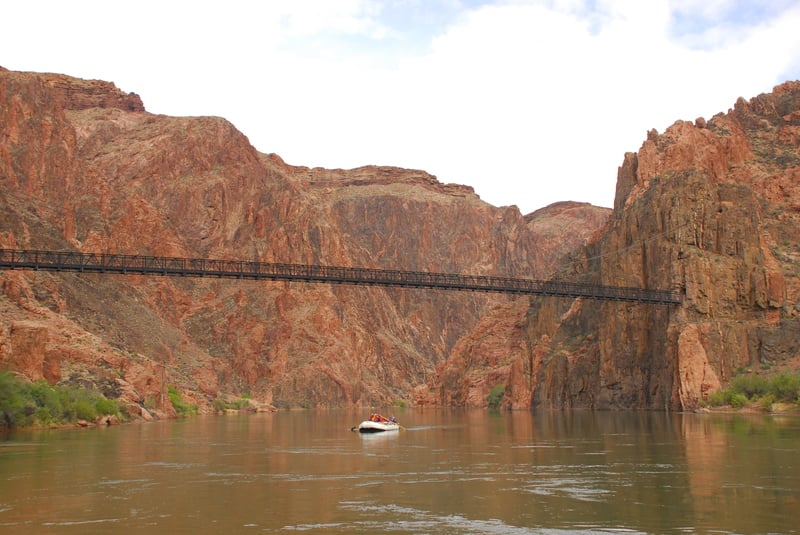
Trip participants can arrange to hike in or out at a variety of trails in the mid-section of the run. The most common location to exchange participants is Phantom Ranch (mile 89). Trip exchanges allow people to do the upper or lower half of the run even if they do not have the time to do the full trip. National Park Service fees are about the same whether you do a full or half trip and these arrangements must be made prior to your launch.
Take-outs:
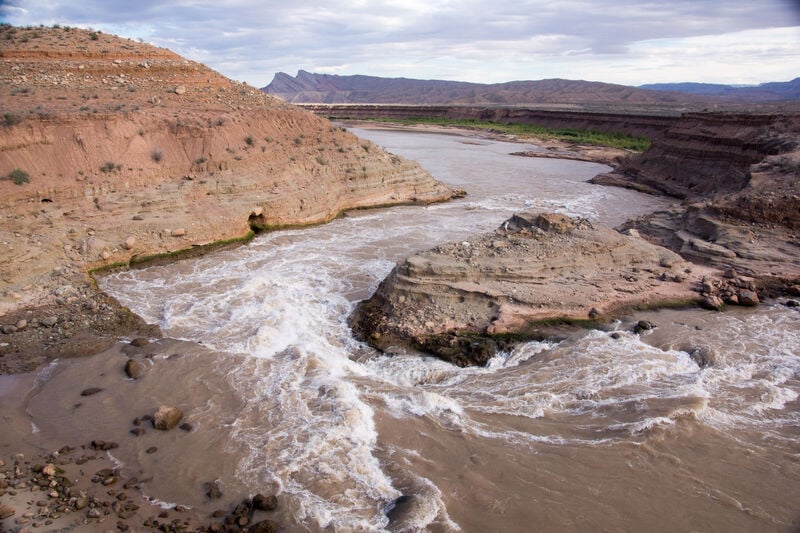
The majority of trips in Grand Canyon travel 226 miles to Diamond Creek as the whitewater ends about 10 miles downstream of this point. Diamond Creek is an intermittent stream that doubles as a roughshod road and is adminstered by the Hualapai Tribe who regrades it after floods. Those continuing on downstream past Diamond have another 50 miles of floating (typically done over 2 days), to reach Pearce Ferry. This option gives you the option to experience the entirety of the Grand Canyon but requires floating through flatwater (but with swift current) where reservoir sediments have buried many rapids. The Pearce Ferry access is administered by the Department of Interior, at the upper end of Mead Reservoir (mile 279). The access has been rehabilitated and re-opened after being closed from 2001 to 2010 due to low reservoir levels. The next access point to the Colorado River is South Cove, which is 17 miles farther downstream through Iceburg Canyon into Mead Reservoir. Few groups take this option due to the challenge of navigating Pearce Ferry Rapid and the need to paddle across the reservoir to reach the ramp at South Cove.
Diamond Creek access information:
The Hualapai Tribe charges a fee for each driver, person, and vehicle that accesses Diamond Creek Beach. In 2018, that fee is $67.50. You can arrange for a shuttle service to pick you up or you can make arrangments with the Tribe for shuttle between the river and Peach Springs. This creek sometimes has a road in it. Flashflooding is regular.
Hualapai River Runners
P.O. Box 246
Peach Springs, AZ 86434
(928) 769-2210 / (800) 622-4409
Boaters may also launch at Diamond Creek and travel 54 miles to Pearce Ferry Boat Ramp. The permit for doing this section is much easier to obtain than for launching at Lee's Ferry: Grand Canyon NP: Diamond down information.
Grand Canyon Weather links:
Weather and Road Conditions for Grand Canyon National Park
NOAA Forecast for Page, AZ, just upstream of the put in.
NOAA Zone Area Forecast for Marble and Glen Canyons, AZ
NOAA Zone Area Forecast for Grand Canyon Country, AZ
NOAA Forecast for Phantom Ranch, is about half way through.
NOAA Forecast South Cove, Mead Reservoir
Grand Canyon Sunrise/ Sunset
Other information Sources:
Grand Canyon National Park: River Trips and Permits information
Grand Canyon Private Boaters' Organization. Non-profit organization with a mission 'to protect access to and enhance an individual’s experience of a float trip through the Grand Canyon while protecting the resource.'
River Runners for Wilderness wiki
Grand Canyon River Guide's Association
USGS Grand Canyon Monitoring and Research Center
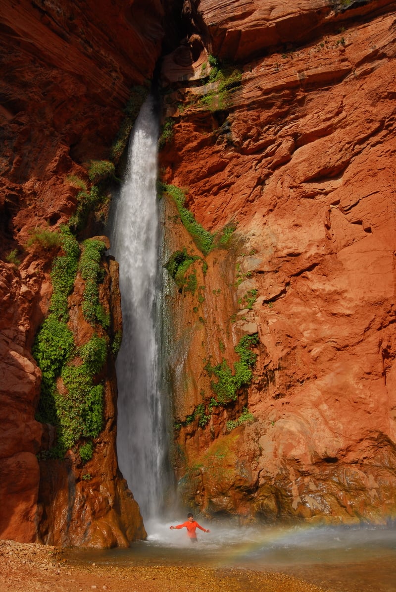
Grand Canyon Favorite Hikes
Packing for Grand Canyon Trip
Durango Bill's 3D tour
There are many videos on youtube videos referencing rapids of the Grand Canyon. Search for grand canyon, rafting, kayaking, whitewater and similar, or by rapid names.
Outfitters who provide gear, food packs, and shuttle service for river trips:
PRO - Professional River Outfitters
Canyon REO
Moenkopi Riverworks
River Runner's Shuttle Service
Ceiba Adventures
Interesting water facts:
Lee's Ferry is the dividing point between the Upper and Lower Colorado Rivers for water rights politics. Water for the South Rim Village flows through a pipe from near the north rim, down right Angel Canyon, across a bridge and then back up to the south rim. It is all gravity fed. Pumpkin Springs water contains arsenic.
Other Reaches of the Colorado River:
01\. Hot Sulphur Springs to Hwy 40 bridge (Byers Canyon) (CO, IV)
02\. Gore Canyon (CO, IV-V)
03\. Pumphouse campground to Rancho Del Rio (Pumphouse) (CO, III)
04\. Hanging Lake Exit 125 (I-70) to Shoshone Power Plant Exit 123 (I-70) (Barrel Springs) (CO, IV-V \[V+\])
05\. Shoshone Power Plant, Exit 123 (I-70) to Grizzly Creek, Exit 121 (I-70) (Shoshone) (CO, III-IV)
06\. Cameo Dam (Big Sur / Lucky 7) (CO, III)
07\. Loma to Westwater (Ruby / Horsethief Canyons) (CO-UT, II)
08\. Westwater to Rose Ranch (Westwater Canyon) (UT, I-IV)
09\. Cisco (Rose Ranch) to Moab (Professor Valley) (UT, I-III)
10\. Moab to Powell Reservoir (Cataract Canyon) (UT, I-IV)
11\. Lees Ferry to Lake Mead (Grand Canyon) (AZ, I-IV)
12\. Black Canyon (AZ-NV, I)
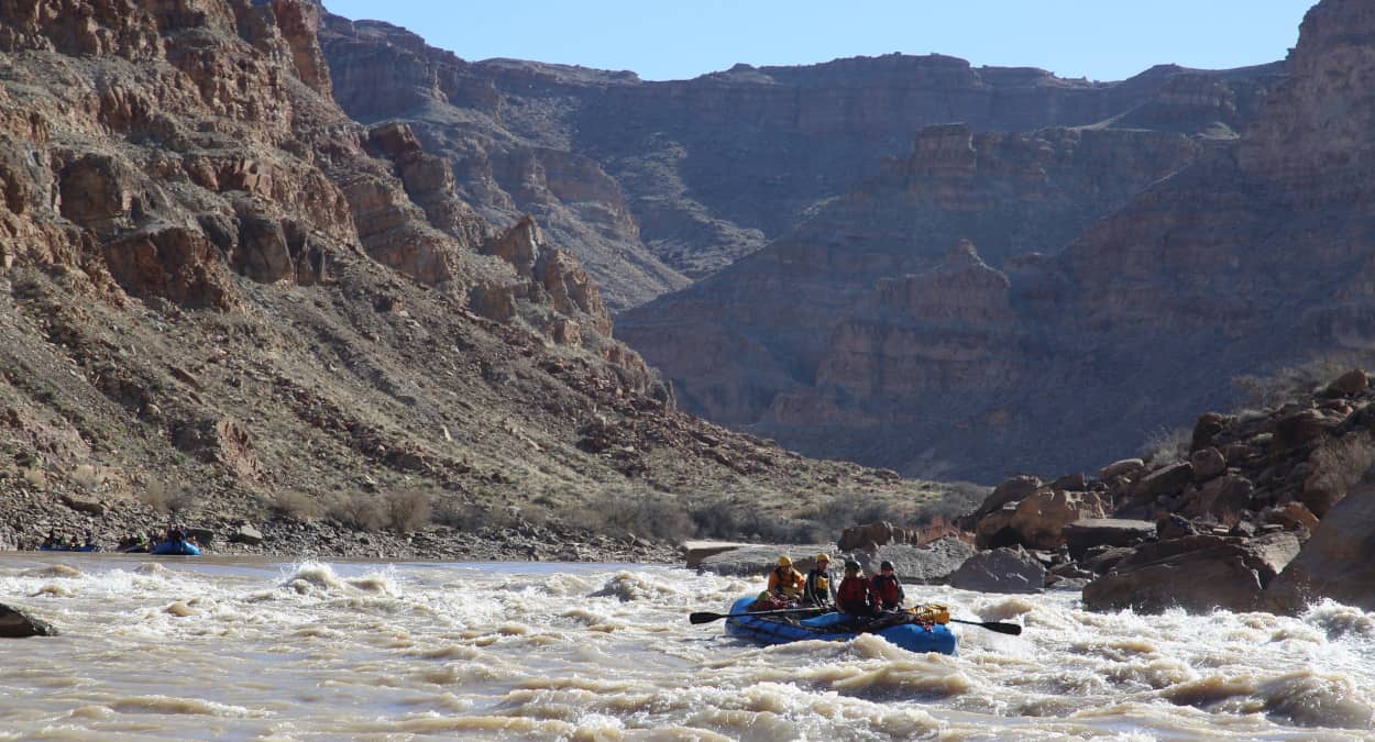
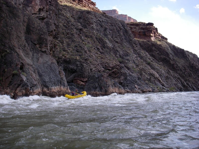
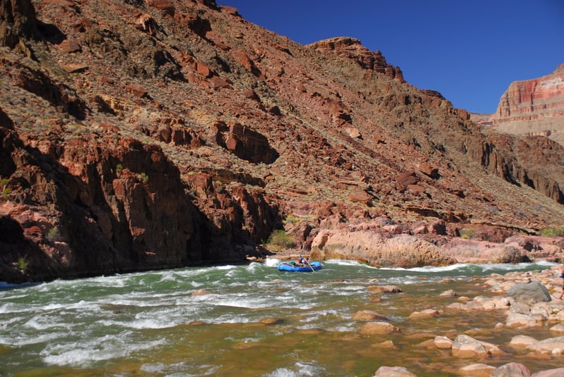
Rapids in this Run (111)
 Rapid
Rapid
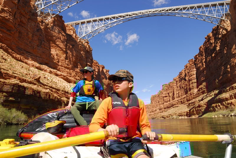
Navajo Bridge
 Rapid
III
Rapid
III
Badger Rapid (5)
 Rapid
III
Rapid
III
Soap Creek Rapid (5)
 Rapid
II+
Rapid
II+
Sheer Wall Rapid (2)
 Rapid
IV-
Rapid
IV-
House Rock Rapid (7)
 Rapid
III
Rapid
III
North Canyon Rapid (5)
 Rapid
III
Rapid
III
21 Mile Rapid (5)
 Rapid
III
Rapid
III
23 Mile Rapid (4)
 Rapid
III-
Rapid
III-
23-1/2 Mile Rapid (4)
 Rapid
III+
Rapid
III+
24 Mile Rapid, Georgie (6)
 Rapid
III+
Rapid
III+
24-1/2 Mile Rapid (6)
 Rapid
III+
Rapid
III+
25 Mile Rapid (6)
 Rapid
III
Rapid
III
Cave Springs Rapid (5)
 Rapid
III
Rapid
III
27 Mile Rapid, Tiger Wash (5)
 Rapid
II+
Rapid
II+
29 Mile Rapid (2)
 Rapid
Rapid
Vasey's Paradise
 Rapid
Rapid
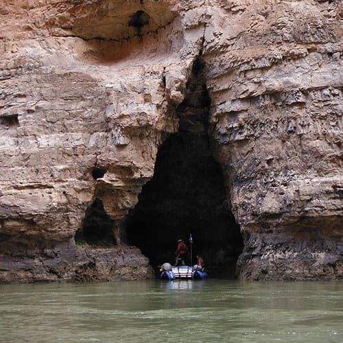
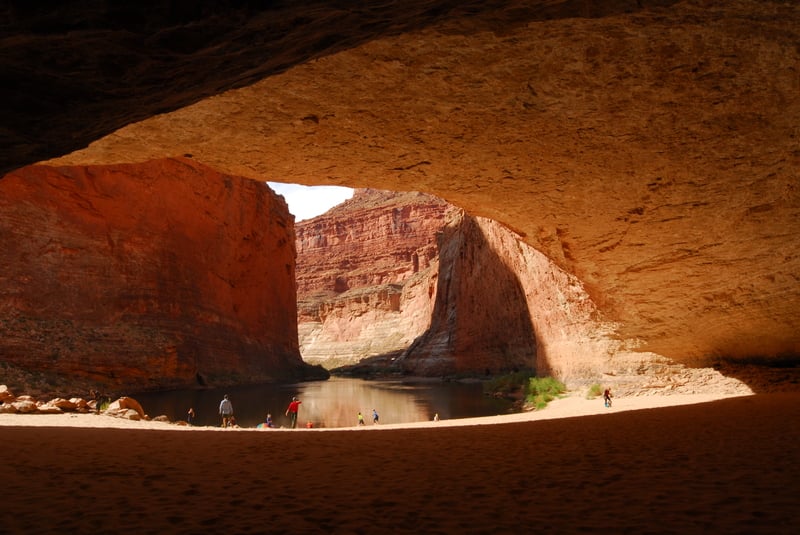
Redwall Cavern
 Rapid
III
Rapid
III
36 Mile Rapid (4)
 Rapid
III
Rapid
III
President Harding Rapid (4)
 Rapid
Rapid
Saddle Canyon
 Rapid
III-
Rapid
III-
Nankoweap Rapid (3)
 Rapid
III
Rapid
III
Kwagunt Rapid (5)
 Rapid
III
Rapid
III
60 Mile Rapid (4)
 Rapid
Rapid
Mouth of the Little Colorado
 Rapid
III
Rapid
III
Lava Canyon Rapid, Chuar (4)
 Rapid
III
Rapid
III
Tanner Rapid (4)
 Rapid
III+
Rapid
III+
Unkar Rapid (6)
 Rapid
III+
Rapid
III+
Nevill's Rapid (6)
 Rapid
IV+
Rapid
IV+
Hance Rapid (8)
 Rapid
IV-
Rapid
IV-
Sockdolager Rapid (7)
 Rapid
IV-
Rapid
IV-
Grapevine Rapid (7)
 Rapid
III-
Rapid
III-
83 Mile Rapid (4)
 Rapid
III
Rapid
III
Zoroaster Rapid (5)
 Rapid
III-
Rapid
III-
85 Mile Rapid (3)
 Rapid
Rapid
Bright Angel Canyon and Trail
 Rapid
II+
Rapid
II+
Bright Angel Rapid (3)
 Rapid
II+
Rapid
II+
Pipe Creek Rapid (3)
 Rapid
II+
Rapid
II+
Salt Creek Rapid (3)
 Rapid
IV
Rapid
IV
Granite Rapid (8)
 Rapid
IV
Rapid
IV
Hermit Rapid (8)
 Rapid
III-
Rapid
III-
Boucher Rapid (4)
 Rapid
III+
Rapid
III+
Tuna Creek Rapid (6)
 Rapid
III
Rapid
III
Lower Tuna Rapid, Willies Necktie (4)
 Rapid
III-
Rapid
III-
Agate Rapid (3)
 Rapid
III+
Rapid
III+
Sapphire Rapid (6)
 Rapid
III-
Rapid
III-
Turquoise Rapid (3)
 Rapid
III
Rapid
III
Emerald Rapid (5)
 Rapid
III
Rapid
III
Ruby Rapid (5)
 Rapid
IV-
Rapid
IV-
Serpentine Rapid (7)
 Rapid
II+
Rapid
II+
Bass Rapid (4)
 Rapid
III-
Rapid
III-
Shinumo Rapid (4)
 Rapid
II+
Rapid
II+
110 Mile Rapid (3)
 Rapid
III-
Rapid
III-
Hakatai Rapid (4)
 Rapid
III+
Rapid
III+
Walhenberg Rapid (6)
 Rapid
Rapid
Elves Chasm
 Rapid
II-
Rapid
II-
119 Mile Rapid (2)
 Rapid
II+
Rapid
II+
Blacktail Rapid (3)
 Rapid
II+
Rapid
II+
122 Mile Rapid (4)
 Rapid
III
Rapid
III
Forster Rapid (5)
 Rapid
III
Rapid
III
Fossil Rapid (5)
 Rapid
II+
Rapid
II+
127 Mile Rapid (3)
 Rapid
II+
Rapid
II+
128 Mile Rapid (3)
 Rapid
III+
Rapid
III+
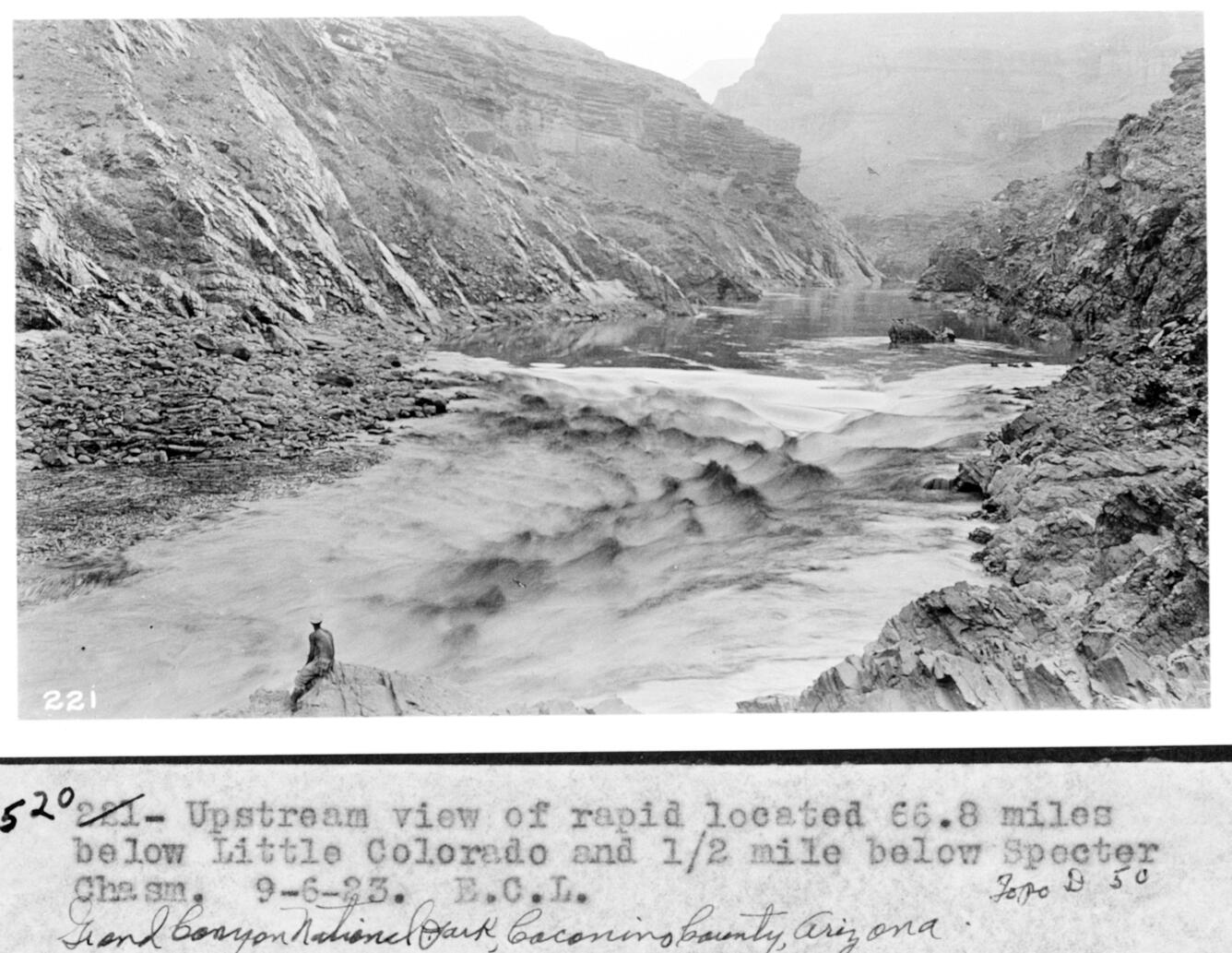
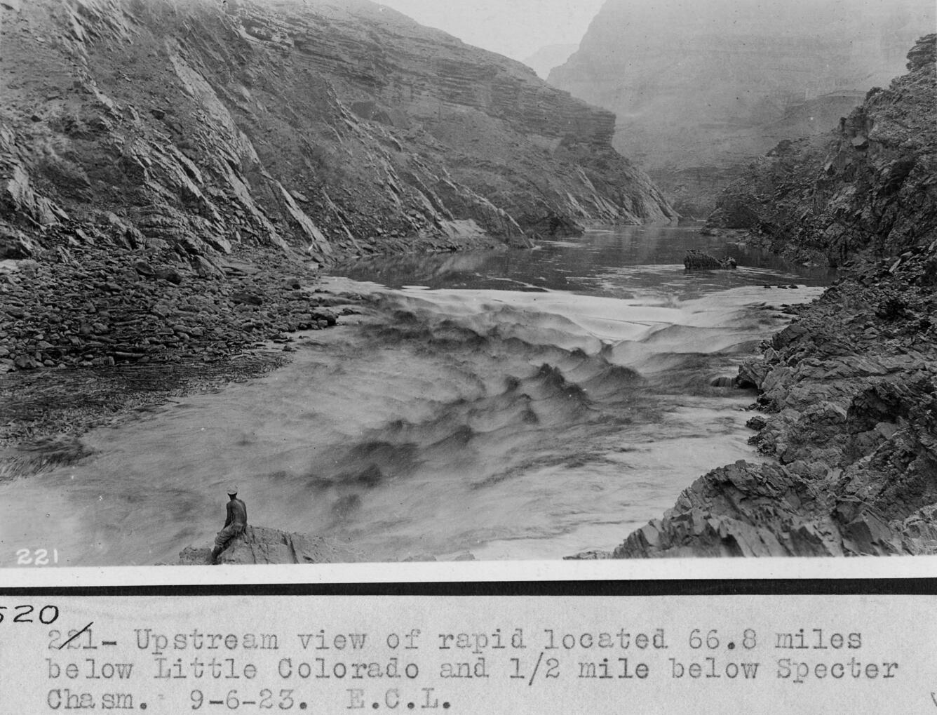
Specter Rapid (6)
 Rapid
IV-
Rapid
IV-
Bedrock Rapid (7)
 Rapid
IV-
Rapid
IV-
Deubendorff Rapid (7)
 Rapid
III
Rapid
III
Tapeats Rapid (5)
 Rapid
III-
Rapid
III-
135 Mile Rapid (3)
 Rapid
Rapid
Deer Creek
 Rapid
II-
Rapid
II-
Matkatamiba Rapid (1)
 Rapid
IV-
Rapid
IV-
Upset Rapid (6)
 Rapid
II
Rapid
II
Sinyella Rapid (2)
 Rapid
II+
Rapid
II+
Havasu Rapid (3)
 Rapid
II
Rapid
II
Tuckup Rapid (2)
 Rapid
II
Rapid
II
National Rapid (2)
 Rapid
II
Rapid
II
Fern Glen Rapid (2)
 Rapid
II+
Rapid
II+
Gateway Rapid (3)
 Rapid
III
Rapid
III
Lower Lava (4)
 Rapid
II
Rapid
II
185 Mile Rapid (2)
 Rapid
II+
Rapid
II+
Whitmore Rapid (3)
 Rapid
III+
Rapid
III+
Kolb Rapid (6)
 Rapid
III+
Rapid
III+
209 Mile Rapid (5)
 Rapid
II+
Rapid
II+
Little Bastard Rapid (3)
 Rapid
Rapid
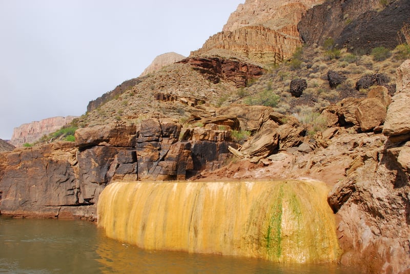
Pumpkin Springs
 Rapid
II
Rapid
II
Three Springs Rapid (2)
 Rapid
III
Rapid
III
217 Mile Rapid (5)
 Rapid
II-
Rapid
II-
Trail Canyon Riffle (1)
 Rapid
II+
Rapid
II+
Granite Spring Rapid (2)
 Rapid
II+
Rapid
II+
224 Mile Rapid (3)
 Rapid
Rapid
Diamond Creek takeout
 Rapid
III
Rapid
III
Diamond Creek Rapid (4)
 Rapid
II+
Rapid
II+
Travertine Rapid (2)
 Rapid
III
Rapid
III
231 Mile Rapid (5)
 Rapid
IV-
Rapid
IV-
232 Mile Rapid, Killer Fang Falls (6)
 Rapid
III
Rapid
III
234 Mile Rapid (5)
 Rapid
III
Rapid
III
Bridge Canyon Rapid (4)
 Rapid
III
Rapid
III
Gneiss Canyon Rapid (5)
 Rapid
III
Rapid
III
237 Mile Rapid (5)
 Rapid
I+
Rapid
I+
Separation Rapid (1)
 Rapid
I+
Rapid
I+
Surprise Rapid
 Rapid
I+
Rapid
I+
240 Mile Rapid (1)
 Rapid
I+
Rapid
I+
241 Mile Rapid (1)
 Rapid
I+
Rapid
I+
Lava Cliff Rapid (1)
 Rapid
I+
Rapid
I+
Lost Creek Rapid (1)
 Rapid
I+
Rapid
I+
Reference Point Rapid (1)
 Rapid
I+
Rapid
I+
Last Chance Rapid (1)
 Rapid
I+
Rapid
I+
Devils Slide Rapid (1)
 Rapid
I+
Rapid
I+
Triumphal Arch Rapid (1)
 Rapid
I+
Rapid
I+
Waterfall Rapid (1)
 Rapid
I+
Rapid
I+
Wards Cave Rapid (1)
 Rapid
Rapid
Columbine Falls
 Rapid
II
Rapid
II
Iceberg Canyon Rapid
Playspots (1)
Hazards & Portages (4)
Caution: The following locations may require scouting or portaging. Always check current conditions.
Difficulty
Class III-IV
Length
300.0 mi
Gradient
9 ft/mi
max 35
Rapids
111
4 Hazards
Access Points
Shuttle Info
Lee's Ferry Campground is located 128 miles North of Flagstaff, Arizona on HWY 89.
Difficulty Classes
I Easy
II Novice
III Intermediate
IV Advanced
V Expert/Extreme
VI Unrunnable
Permit Required
Permits for the Grand Canyon are required and available through a weighted lottery system in February (additional dates may be distributed throughout the year).
Get Permit
Current Conditions
5-Day Forecast
Whitewater data from
American Whitewater
American Whitewater