2 - Deadwood River to Danskin Station (The Canyon)
Gauge Conditions
Runnable: 800.0 – 4,000.0 CFS
Approximate reading: This gauge is 20.0 miles away on South Fork Payette River. Use as a general reference only.
Data from American Whitewater & USGS
Run Map
Run Time Estimate
Select put-in and take-out to estimate time.
Plan This Trip
See wind-adjusted speed maps, forecast planning, and detailed time estimates.
Sign in to generate an AI timing estimate for this run.
Whitewater timing varies with scouting, portages, and group pace. Use as a planning baseline.
Description
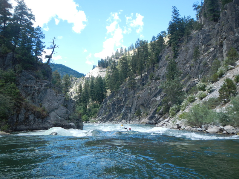
The canyon section of the South Fork Payette is an Idaho classic. It is a beautiful III-IV run, in a deep remote canyon. Best of all is its long season and clean, clear water.
The standard put-in for this run is the Deadwood River Access. If you put in here it allows for a couple miles of warm up with good class II and a couple of class III rapids that are easy read and run. Some run this section as a continuation of a run that begins upstream at Mountain View.
You approach the 'point of no return' when passing Pine Flats Campground. There are excellent hot springs on river right and this is your last chance to easily abandon the run. After a long, calm stretch of flatwater you will enter Gateway (III+). Enter right of center and work your way to river right.
The real action begins soon enough as you enter S Turn, a big class IV read and run with lots of waves and a few holes to avoid including a big one at the bottom left.
Some fun class II-III read-and-run follows, ending with Hard Hat, a big wave train and a large hole in river center.
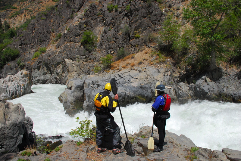
Next up is Big Falls, a class V to VI drop which is a portage for most. It has been run a few times (a couple times inadvertently), but at spring flows some enormous holes form in the bottom half of this intimidating drop. The rapid comes up quickly after Hard Hat and is marked by a couple of warning signs (the first on river right and then a second marking the start of the portage on river left). The lead in class II is not hard but be sure to make the eddy on river left just before the river drops off the edge into the abyss of Big Falls. Anyone who has the skills for this run should not have a problem making the move, but it can be a little intimidating as the consequences of missing the eddy would be severe.
The portage trail on river left is well worn and although it is not an easy portage for rafts, some people do it including outfitters who run trips on this section. A little scrambling on the rocks at the bottom takes you to a nice seal launch into the pool at the base of the falls. On a sunny day this is a nice spot to break for lunch and take it all in; the whole scene is pretty cool.
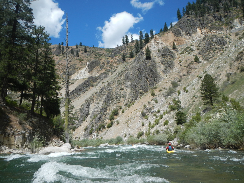
Once you are in the pool below Big Falls you are in the most scenic section of the inner gorge. Shortly after the exit rapids from this pool you will find yourself at the horizon line for Blackadar. This is a great rapid that you run left of center down a nice tongue, but be prepared for a couple of big hits at the bottom.
Next is Lower Blackadar. The current pushes you left toward a large outcrop, then drops you into a curling, powerful wave at the bottom that flips about half of all paddlers who take it on. There is a nice pool beneath to recover, roll, and/or rescue, but it is not advised to swim the next long section of class II water.
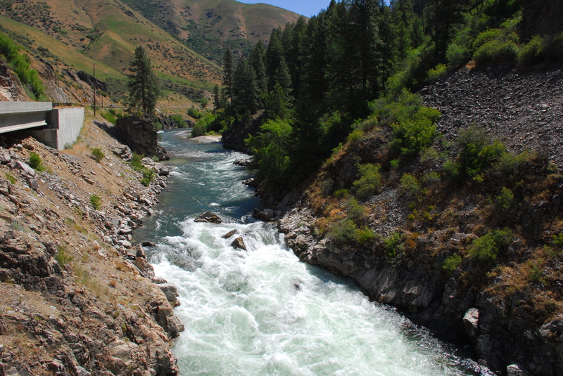
More fun whitewater continues as the gorge walls slowly descend and the highway comes into view on the right. Lone Pine is the next significant drop, recognized by the lone pine on a rock on river right and the concrete retaining wall along the highway. Grab the eddy on river right at the top of the drop, then make a right to center move through a fun wave train.
Little Falls is the next major rapid. Kayaks should never go down the center at Little Falls to avoid recirculating in the center hydraulic. Either take the far right line or nail the nice boof on far river left. One landmark that tells you Little Falls is coming is the steel netting to catch rockfall along the road, which has shiny big washers that can be seen from the river. Check it out on the drive up.
Immediately below Little Falls is The Crease (III). This snaking rapid takes up much of river center/left about 50m below the falls. Sneak it right or make the hero moves to maneuver from left to center.
Surprise is the final big drop which is a fun wave train that ends in a big hole at the bottom on the right side. You can start out on the tongue but be sure to exit to one side or the other to avoid the hole at the bottom.
Keep your eyes open for a small bedrock island that marks the kayaker take-out or continue on down through easier whitewater to the formal access at Danskin Station.
Jet boats have been able to run all the way up the South Fork to below Big Falls, above 5000 cfs.
Logistics:
The Banks-Lowman Road parallels the river but is hundreds of feet above the river in most places.
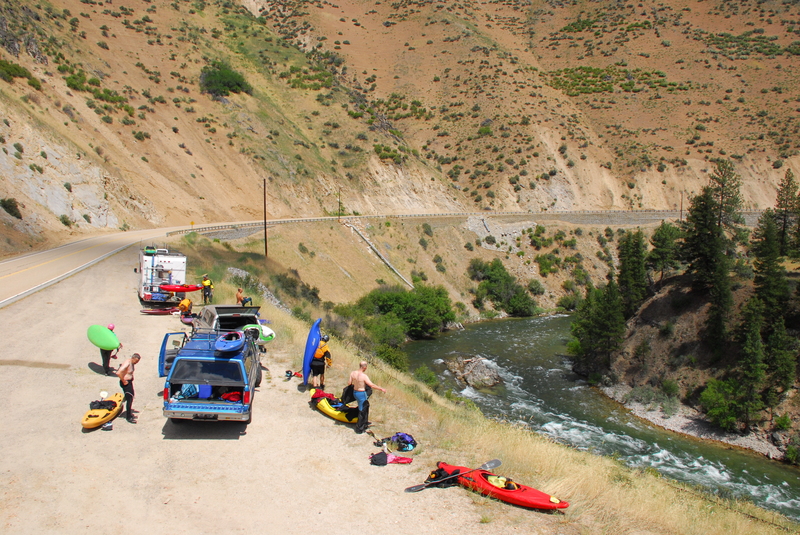
The primary put-in for this run is at Deadwood River Access at road mile 29.9. Kayakers sometimes use the alternate put-in access at Pine Flat Campground at road mile 27.9 which cuts off the first couple miles of warm up class III.
If doing a road scout you can see Little Falls at road mile 22.7, Big Falls from the overlook at road mile 25.0, and S Turn from the pull out at road 25.7.
The Kayaker Access which is an alternate take-out used by kayakers is at road mile 21.9. It is an unmarked roadside pull-out with a decent trail down to the river. You can recognize it by the small bedrock island on the river right side of the channel that is just upstream of the access trail. Eddy out at the downstream end of this island and make the strong ferry across to river right to hit the take-out.
The primary take-out is at Danskin Station River Access at road mile 19.5. This is a formal access site with a set of steep stairs from the river to the parking lot. For the rafters, there is a wooden ramp at Danskin but it is steep and involves carrying the boat up the bank about 100 vertical feet, another reason to load rafts lightly for this trip.
Rapids in this Run (9)
Waterfalls (1)
Hazards & Portages (1)
Caution: The following locations may require scouting or portaging. Always check current conditions.
Difficulty
Class III-IV
Length
12.0 mi
Rapids
9
1 Hazard
Access Points
Shuttle Info
The Banks Lowman road follows the river but is often high above.
Difficulty Classes
I Easy
II Novice
III Intermediate
IV Advanced
V Expert/Extreme
VI Unrunnable
Current Conditions
5-Day Forecast
Whitewater data from
American Whitewater
American Whitewater