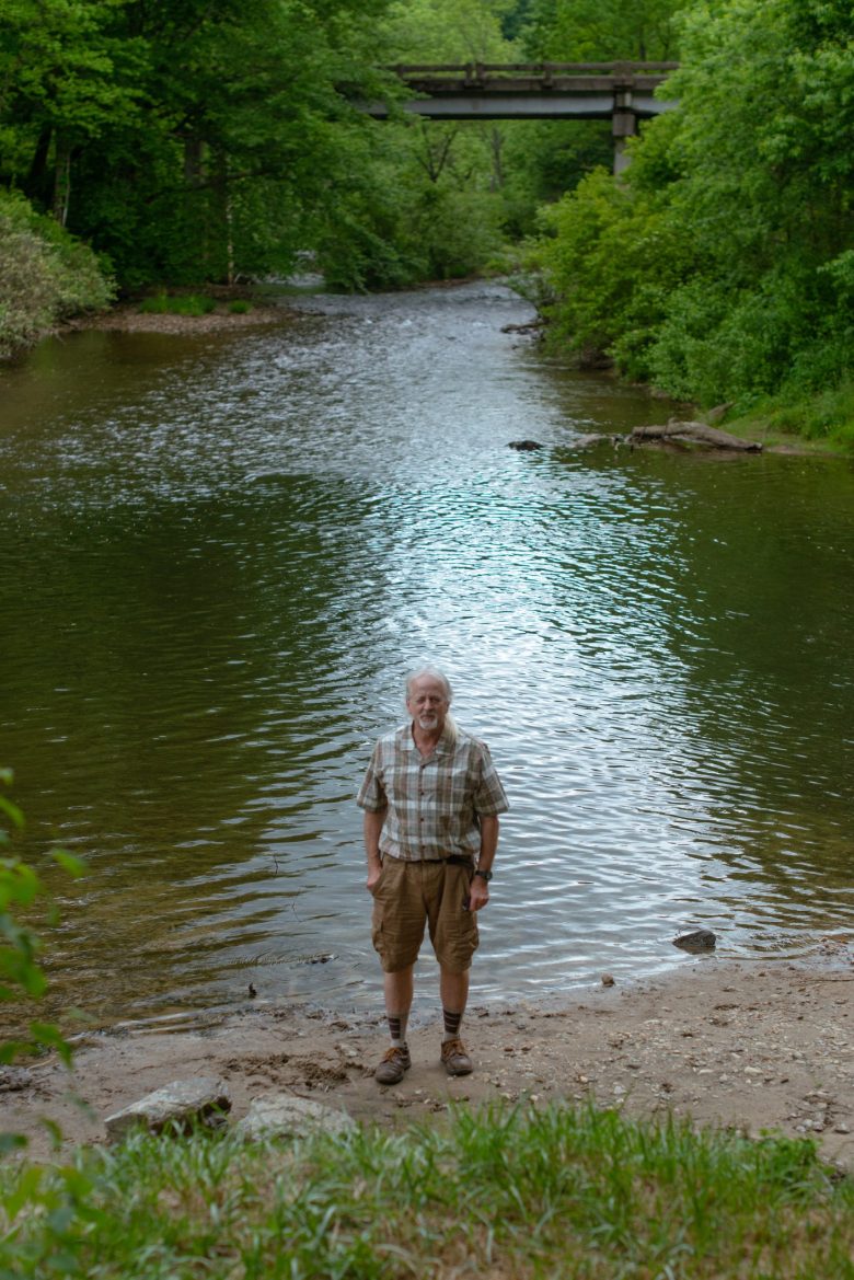
2) Route 1326 Bridge to US Route 64 Bridge
Gauge Conditions
Runnable: 350.0 – 1,000.0 CFS
Data from American Whitewater & USGS
Run Map
Run Time Estimate
Select put-in and take-out to estimate time.
Plan This Trip
See wind-adjusted speed maps, forecast planning, and detailed time estimates.
Sign in to generate an AI timing estimate for this run.
Whitewater timing varies with scouting, portages, and group pace. Use as a planning baseline.
Description
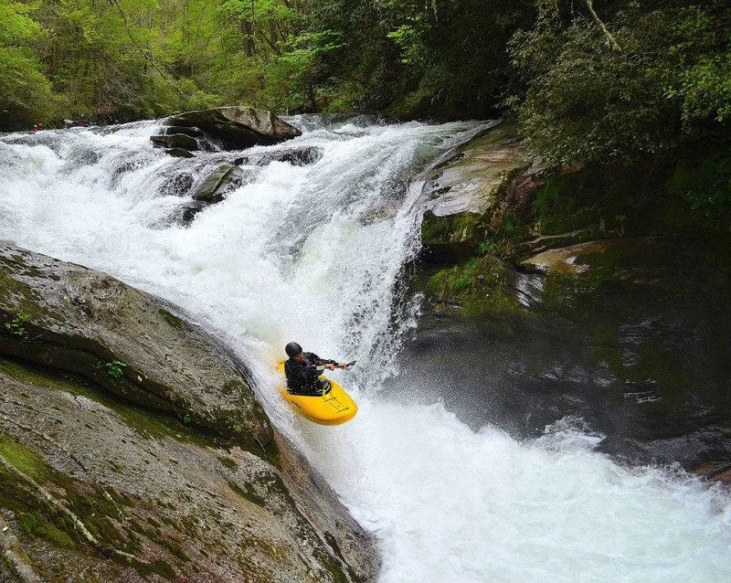
The North Fork is a classic North Carolina intermediate/advanced creek. At moderate flows below 6 inches the majority of the run is class 4, with a big class 5 in Boxcar Falls. From Boxcar to about a mile below Submarine the rapids are continuous with lots of class 3 boat scoutable boogie water between the bigger drops. The run is probably a notch easier than the Watauga and a lot easier than the Green Narrows. With the right water levels and some creative shuttle work you can run the nearby West Fork of the French Broad on the same day. _Local Expert Harrison Metzger says:_ I've probably seen you on the N.Fork since I've run it probably 75 times over the past 11 years. I can help with the rapid names. Also I think the size and difficulty of a few of the rapids may not be quite right. The first slide is known as Sandpaper. I don't think it is 20 feet tall. I would say more like 12 feet. Most local boaters call the left side of Boxcar 'Blind Date.' It is considerably meaner than the right. The first set of rapids below Boxcar is called Island Rapid. There is a huge log that creates the boof on the right. It can be avoided by threading through the boulders at the top of the island and running a set of drops on that side.
The next rapid downstream needs a name. This is the double drop with the slide into the big diagonal hole. Benner's old book referred to the rapid after this as Razorback, but I think that would be a good name for the big slide. I would rate this a III+ to low IV, not IV+ It is pretty easy if you catch the eddy on the right between drops and hit the hole square.
The next rapid downstream was called Razorback in Benner's old book and he rated it a Class VI for some unknown reason. This one is called Water Cannon and I would also rate it Class III-IV. I don't think it is 12 feet tall...I would say about 6 to 8 feet total.
The Clog, yes it is definitely class IV+ with some class V consequences. The worst is the sucking sieve that you have to cross above when moving left after the first 5-foot drop. This can be avoided by running through a tight chute top left, which puts you right into the large eddy partway down. This left hand eddy is a good place to set ropes and scout the bottom half of the rapid. The drop just below here tends to shoot paddlers to the right where there are numerous pinning possibilities at lower water. The hole at the bottom is called the Black Widow and it becomes a keeper at higher levels.
There is a significant rapid missing from the AW description, the next one below the Clog. It is called Vortex, a set of three drops. The first one, about five feet, is run on the left into a left eddy. The second, a shallow scrape of about four feet, feeds the main drop but you can catch another left eddy. The main drop is a series of holes funneling down into a 5-foot slot at the bottom (the vortex) with good eddies on both sides.
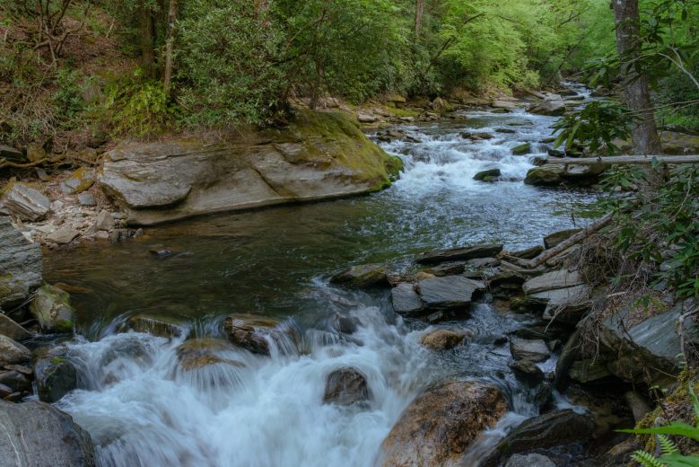
Below here is about a quarter mile of fun Class III boogie water to Submarine. Submarine is about 9 feet high, and changed significantly in 2021, making it more difficult and dangerous. Scout and/or portage on the left, and note that the hole is deceptively retentive. It has surfed good paddlers both in and out of their boats.
The only other comment I have is on water levels. I painted the gauge correlating it to the old Benner gauge which was on the old U.S. 64 bridge that DOT removed a few years ago. Like the Benner gauges it is intended to be read from the bottom of the numbers. So the bottom of 0 is zero, the minimum for a fun run. This equals about 350 or 3 feet on the Rosman gauge. It can be run several inches below 0 but it is not much fun and hard on equipment. I like to have at least 4 or 5 inches to run Boxcar because it gets so rocky at lower levels. Hope this helps.
Also see Chris Bell's Asheville-Area Canoeing and Kayaking Page.
Shuttle info: Take out: You can take-out at the outfitters store at the intersection of Hwy 64 and Hwy 215, but most people just stop in for a quick gauge check. The standard takeout is a wide pull-off on the side of the road near alligator rock. Look for alligator rock to be dangling over the road as you drive upstream. If the river gets out of sight of the road you have gone too far. Put-In: The easy put-in is at the SR 1326 bridge. There is a large gravel area for parking. There is also a short put-in that elminates the flat water at the top of the run, and one large slide. Using the Alligator rock take-out knocks about a mile and half off of the run, bringing it down to 5.5 miles. Using the short put-in takes off another mile, getting the run down to 4.5 miles. The locals use that combo and run multiple laps down the river.
Gauge Description: There is a gauge painted on the US 64 bridge piling. 6 inchs below 0 is about as low as you want to go. The Rosman USGS gauge is the combined flows of the North Fork and the West Fork. Depending on which stream is putting the most flow in, 350 cfs is roughly equal to about 0 in the US 64 gauge.
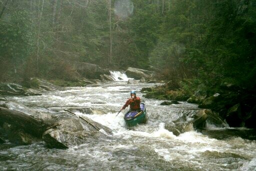
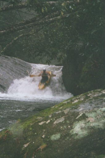
_Photo of unknown kayaker in Boxcar Rapid , courtesy of Julie Keller (_ _www.juliekeller.com_ See _Carolina Whitewater_, B.Benner.
Rapids in this Run (9)

Waterfalls (2)
Playspots (1)
Difficulty
Class III-IV+
Length
7.2 mi
Gradient
55 ft/mi
max 145
Rapids
9
Access Points
Difficulty Classes
I Easy
II Novice
III Intermediate
IV Advanced
V Expert/Extreme
VI Unrunnable
Current Conditions
5-Day Forecast
Whitewater data from
American Whitewater
American Whitewater