2. Upper Two to Eberhart Point
Gauge Conditions
Runnable: 175.0 – 3,500.0 CFS
Data from American Whitewater & USGS
Run Map
Run Time Estimate
Select put-in and take-out to estimate time.
Plan This Trip
See wind-adjusted speed maps, forecast planning, and detailed time estimates.
Sign in to generate an AI timing estimate for this run.
Whitewater timing varies with scouting, portages, and group pace. Use as a planning baseline.
Description
The Upper Two while not quite as hard as the Suicide section above it is chock full of high quality rapids.The last mile of the run from Humpty Dumpty to the Chair Lift is the most continous section of whitewater in LRC, and that makes it a very high quality delightful mile of whitewater indeed .
After a few class 2 and 3 rapids you arrive at Rock Jumble \[Screaming Right Hand Turn \]this long class 4 rapids bops down through a low angle boulder bed making a sharp right turn at the bottom.
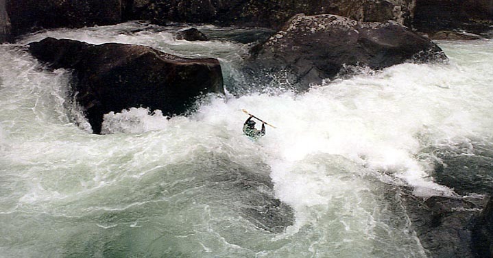
Below here the river slowly winds though big spooky boulders to Road Block a 100 yds below.Road Block is a one move rapid ,a boof off a 5 foot ledge,that is very clean and simple as long no mistakes are made. The left side outflow of the hole is obtructed by a sloping rock wall that pushes the backwash back into the hole this makes the hole extremely sticky.Boats have been stuck in it for hours and swimmers often get recirculated in it for uncomfortable periods of time.There have been many incidents and a death here in the last few years so be alert particularly at higher waterlevels .
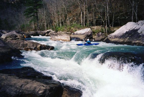
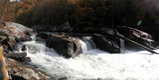
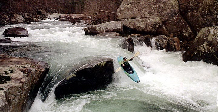
Humpty Dumpty follows quickly.This beautiful photogenic rapid drops between car and house size boulders in two big leaps.The boof at the top drop is an Alabama classic and the hole at the base of the second drop gets bigger and bigger as the water gets higher.
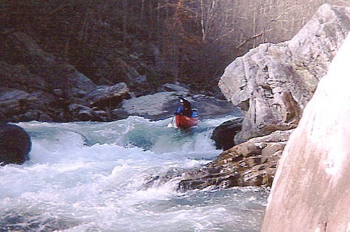
Below here the pace contiues unabated,the next mile throws up closely spaced class 3 and 4 rapids right down to Eberhart Point.Most are unnamed but a few names in order are Mr. Bubble,Roostertail,Whiplash, Empire State,and Deep Throat.This last mile is fast paced read and run and there is nothing that is normally scouted.The hardest rapid is Deep Throat which has some horrible looking pin rocks in the middle of it's bottom drop.Ugly as they are there never seem to be any real problems there.
To get to the takeout, take hwy 35 east from Interstate 59, cross over Little River. There is a gauge on the SE pyling and an overlook of the falls on the east side of the river. Follow hwy 35 east to hwy 273 and turn right (south). After you cross over Little River, about 1/4 mile, take the first paved road to the right to Canyon Mouth Park. The park is now operated by the National Park Service an opens at 8:00 am. Bathrooms are available. The USGS gauge is behind the bath house.
To the put in, go back the way you came to the hwy 35 bridge. Just past the bridge, turn left (south) on hwy 176. You will pass mushroom rock (a rock in the middle olf the road).The park service has put up a sigh, "Lower Two" put-in. Park here, and follow the trail down to the river. About 100' down the trail is a small trail off to the right, about 50' and you'll be on a nice overlook of the river. There is plenty of warm up before getting to Screaming Right Turn.
If you are staying overnight, a good place to camp is Desota State Park. Five miles north of hwy 35 on hwy 89. Primitive camping is $8/night for 2, or improved campsits for $15/night, one tent, additional charge for additional tents, 8 persons max per site. Improved sites have heated bathrooms and hot showers. Call 256-845-5075 for the camp store, or 800-568-8840 for reservations. Cabins and motel rooms are also available, and a restaurant.
There is also free camping at some very primative hunters camping sites in the wildlife managment area across highway 35 .Turn north off Highway 35 about a mile east of Little River Falls on to CR 103, camping site is on the right.There is no water or toilets but it is very close to the Canyon.
Break-in occured 11-13-04 at Canyon Mouth Park
Rapids in this Run (4)
Hazards & Portages (2)
Caution: The following locations may require scouting or portaging. Always check current conditions.
Difficulty
Class III-IV(V)
Length
5.9 mi
Gradient
76 ft/mi
Rapids
4
2 Hazards
Access Points
Difficulty Classes
I Easy
II Novice
III Intermediate
IV Advanced
V Expert/Extreme
VI Unrunnable
Current Conditions
5-Day Forecast
Whitewater data from
American Whitewater
American Whitewater