3. Bottom: Fowlersville to Lyons Falls
Gauge Conditions
Runnable: 2.0 – 8.0 FT
Data from American Whitewater & USGS
Run Map
Interactive run map
Loads as you approach this section.
Run Time Estimate
Select put-in and take-out to estimate time.
Plan This Trip
See wind-adjusted speed maps, forecast planning, and detailed time estimates.
Sign in to generate an AI timing estimate for this run.
Whitewater timing varies with scouting, portages, and group pace. Use as a planning baseline.
Description
2020 Release Dates:
**Spring: April 19\*, 26\* May 3\*, 9-10\*\*, 16-17, 23-24, 30-31 June 6-7
Fall: October 4, 11, 16-18, 24-25
\*Currently cancelled releases due to Covid concerns: 4/16, 4/23 and 5/3
\*\*The weekend release of 5/9-5/10 will be re-evaluated as necessary
## Bottom Moose River Guide Video Bottom Bottom Moose River Guide Video
Moose Festival Page
All boaters planning to paddle the Bottom Moose Releases are required to sign-in at the power station office (located between Agers Falls and the take-out overlooking the right left side of Crystal) before accessing the river. On release days a sign reading "Whitewater recreation sign-in" is placed by the side of the road at the entrance to the office. Click here for the details.
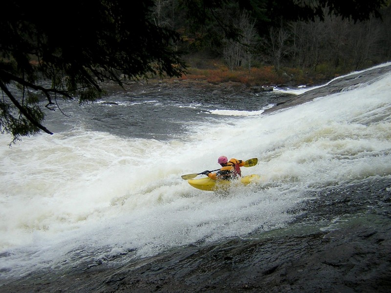
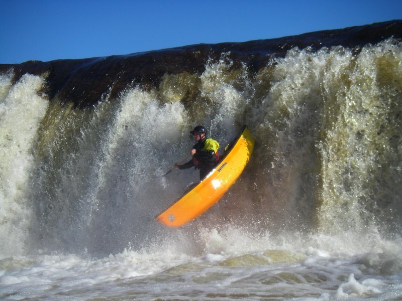
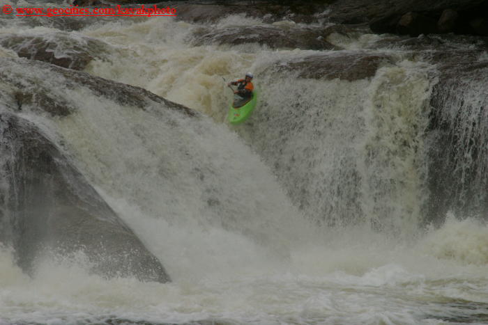
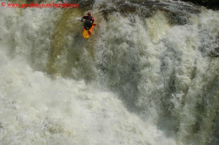
OVERVIEW
Paddlers should have Class 4 skills if they want to have fun on the Bottom Moose at normal and Class 5 at higher flows.
Releases occur on weekends in October and April-May.
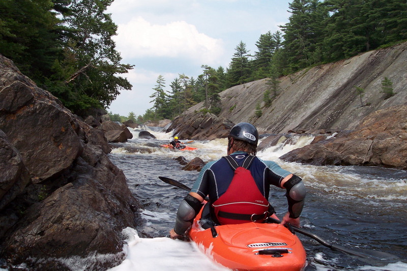
Summer time on the Moose is a local favorite. The river becomes more like a traditional creek at low water, opening new lines, and giving beginners a chance to learn on warm reliable class 4-5. The run stops after double drop without the releases once the river is below 4-4.5 feet, but with more and different lines this is not a problem. Once the river drops below traditional levels the power company is unable to produce power and river is low but runnable from below Agers Falls to Magilla.
DIRECTIONS
From the West:
From the NY Thruway, take Exit 33 (Rome). Head right from the ramp, taking Rte. 365 East, toward Rome.
In Rome, follow the signs for Rte. 26 North.
Follow 26 for about 31 miles into Collinsville.
In Collinsville, you'll come to an intersection where Rte. 26 bangs Left. Don't follow 26 here; instead, head Straight onto Rte. 12D.
You'll cross Rte. 12 and follow the road you're on through town. You're now on Center St.; follow it as it curves to the Right.
After you curve around, take your first Left. Cross the Black River and bear right onto Laura St.
After about half a mile, bear Left onto Lyonsdale Rd.
To get to the takeout from here, simply take a left after about 0.3 miles onto Shibley Rd.; after crossing the Moose River, take your first Right onto the dirt road. Follow it around and park in the parking areas on River Right.
To get to the putin from Lyonsdale Rd., click on the Map or Directions tab in this page. Follow Lyonsdale Rd., bear Left onto Hunkins Rd., and take a Left at the T-intersection onto Fowlersville Rd.
You can park in the sandy parking area on River Left or cross the bridge and take the funky sandy road to putin on River Right.
If you're coming up via Rte. 12, zoom in on Port Leyden to see the roads in that area; if you're coming via Rte. 26 and 12D, zoom in on Lyons Falls. Then click on the Map tab in this page to get to the putin.
_Latitude/longitude data are verified by GPS._
SAFETY WARNING: Beware of logs and stumps with huge root balls, specifically at Agers Falls and the Alpine Line at Crystal. You can scout both prior to the release. Alpine Lumber can only be detected from downstream (a short walk up from the takeout). Agers Lumber can be seen from river left by the fence. There is wood throughout, which can be easily missed but would be dangerous for a swimmer. (Thanks to AW Safety Chair Tim Kelley for this warning.)
TROUBLEMAKERS
And now for something completely different: ZoneDoggyDogg runs Lyon's Falls!
Click here for Karl Gesslein's view of the Bottom Moose. (Clicking will open up a new browser window.)
If you like that, check out some more drawings here, here, and here.
OTHER NEARBY RIVERS
Lower Moose (Class III-IV)
Middle Moose (Class III)
Black (Class III)
Independence (Class II-V+)
Otter Creek (Class III-IV\[V+\])
Tug Hill - Old Forge Area Reaches
Beaver (1. Moshier)Beaver (2. Eagle) Beaver (3. Taylorville)
Black (1.) Black (2.) Black (3.)
Black (4.) Black (5.) Black, S. Branch
Cincinnati Creek Crystal Creek Deer River (Section 1)
Deer River (Section 2) Fish Creek, E. Branch Independence River (1. Upper)
Independence River (2. Main) Indian (S.Br. Moose trib.) Little Black Creek
Little Woodhull CreekMad River Mill Creek
Mohawk (1.) Moose (1. Middle) Moose (2. Lower)
Moose (3. Bottom)Moose, Middle Branch Moose, S. Branch (1.)
Moose, S. Branch (2.) Negro Brook Otter Creek
Roaring Brook (Brokeback Gorge) West Canada Creek (1.) West Canada Creek (2. Ohio Gorge)
West Canada Creek, S. BranchWoodhull Creek (Upper) Woodhull Creek (Middle)
Woodhull Creek (Miracle Mile)
Google Map of New York Whitewater
New York Whitewater Paddlers Facebook Group**
Rapids in this Run (4)
Waterfalls (5)
Hazards & Portages (3)
Caution: The following locations may require scouting or portaging. Always check current conditions.
Difficulty
Class V
Length
4.0 mi
Gradient
72 ft/mi
max 90
Rapids
4
2 Hazards
1 Portage
Access Points
Shuttle Info
DIRECTIONS
From the West:
From the NY Thruway, take Exit 33 (Rome). Head right from the ramp, taking Rte. 365 East, toward Rome.
In Rome, follow the signs for Rte. 26 North.
Follow 26 for about 31 miles into Collinsville.
In Collinsville, you'll come to an intersection where Rte. 26 bangs Left. Don't follow 26 here; instead, head Straight onto Rte. 12D.
You'll cross Rte. 12 and follow the road you're on through town. You're now on Center St.; follow it as it curves to the Right.
After you curve around, take your first Left. Cross the Black River and bear right onto Laura St.
After about half a mile, bear Left onto Lyonsdale Rd.
**To get to the takeout**
from here, simply take a left after about 0.3 miles onto Shibley Rd.; after crossing the Moose River, take your first Right onto the dirt road. Follow it around and park in the parking areas on River Right.
**To get to the putin**
from Lyonsdale Rd., follow Lyonsdale Rd., bear Left onto Hunkins Rd., and take a Left at the T-intersection onto Fowlersville Rd.
You can park in the sandy parking area on River Left or cross the bridge and take the funky sandy road to putin on River Right.
If you're coming up via Rte. 12, zoom in on Port Leyden to see the roads in that area; if you're coming via Rte. 26 and 12D, zoom in on Lyons Falls. Follow the directions above to get to the putin.
_Latitude/longitude data are verified by GPS._
Difficulty Classes
I Easy
II Novice
III Intermediate
IV Advanced
V Expert/Extreme
VI Unrunnable
Current Conditions
5-Day Forecast
Whitewater data from
American Whitewater
American Whitewater