3 - Douglas Fir Campground to Mt. Baker Highway milepost 27
Gauge Conditions
Runnable: 400.0 – 2,000.0 CFS
Data from American Whitewater & USGS
Run Map
Run Time Estimate
Select put-in and take-out to estimate time.
Plan This Trip
See wind-adjusted speed maps, forecast planning, and detailed time estimates.
Sign in to generate an AI timing estimate for this run.
Whitewater timing varies with scouting, portages, and group pace. Use as a planning baseline.
Description
Glaciers on the slopes of Mt. Baker keep this run flowing from late spring to early fall. The river provides year around paddling opportunities and is often a good run in late summer or early fall when other runs are too low. Paddlers should note however that with the 2000 paddling season, the Forest Service initiated management actions for salmon that affect paddler use of the river. The Nooksack River is an important river for Chinook salmon which are protected under the Endangered Species Act. These fish are particularly vulnerable when spawning (August thru September). American Whitewater has developed the following guidelines with the US Forest Service for recreational activities on the North Fork Nooksack for the protection of these fish:
1) Avoid recreational activities that include contact access on the water (e.g. paddling, fishing, wading) from August 15th to October 15th. During this period of low water, which occurs during the Chinook spawning period, fish are particularly vulnerable to disturbance from boats that pass overhead or individuals wading in the river. An exception is allowed at higher flows above 1000 cfs (as measured by the USGS gauge).
2) Following the completion of spawning in mid October, eggs in gravel are vulnerable through the end of March. Do not get out of your boat or wade in the river in areas where the substrate is smaller than the size of a grapefruit as you could crush eggs by walking in areas with gravel.
By following these voluntary guidelines we can protect fish and provide recreational opportunities. By demonstrating cooperation with these guidelines we can avoid mandatory river closures and retain this more flexible alternative.
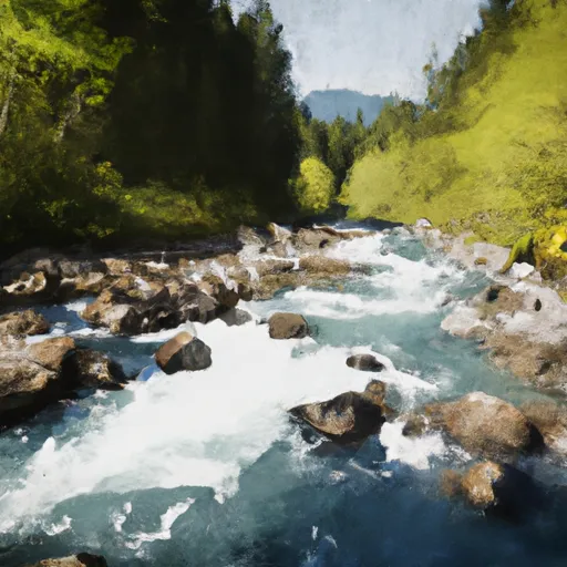
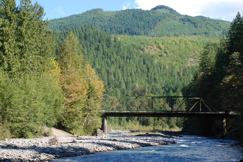
This run is characterized by several class III rapids formed by bedrock features and boulders through a nice canyon section. This canyon starts just downstream of the Douglas Fir Campground. As you reach Glacier Creek approximately 1.5 miles into the run the river spreads out across broad gravel bars. The rapids loose their punch but its still a beautiful river. If you're here mainly for the rapids in the canyon section then you can exit the river at Gallop Creek or Glacier Creek and make your way up the trail to the town of Glacier. Both creeks offer access points. You can continue on downstream to the access point at Warnick Bridge where Highway 542 Bridge crosses the river (the 4.5 mile run), and enjoy a couple class II-III rapids and opportunities to explore the fossil beds on river right. Continuing on past Warnick Bridge the river opens up into a wider valley with some spectacular views of Mt. Baker and more class II. An access at Boulder Creek is ~2 more miles downstream. The take-out for the full 8 mile run is in the vicinity of milepost 27 (see access notes below). Stay alert for logs on this lower segment of the run as it is not uncommon to have them completely blocking the channel.
Access Logistics:
Access continues to be a challenge on the North Fork Nooksack. While the put-in is located on Forest Service land, no formal take-out exists but several options are available.
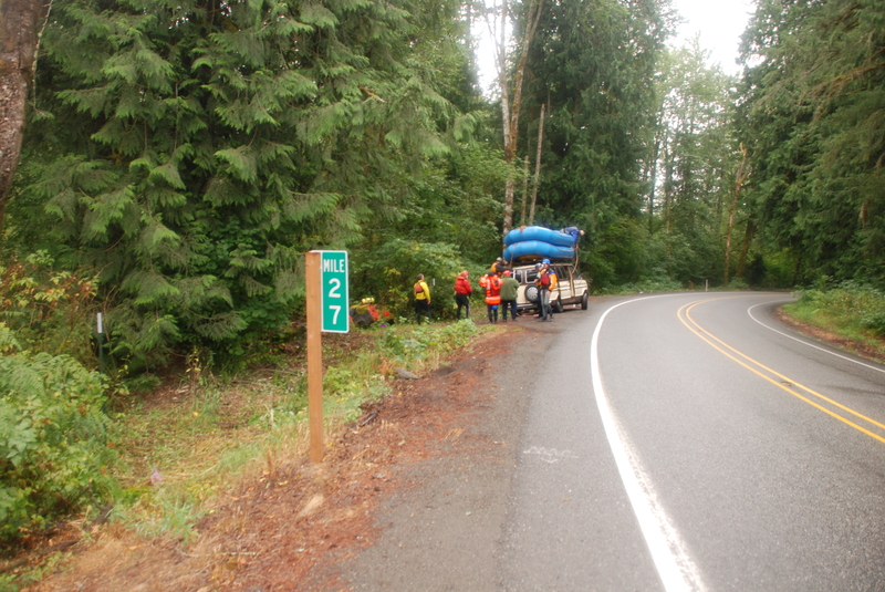
This run is approximately 30 miles from Bellingham, east of the town of Maple Falls on Highway 542. As you make the drive towards Mt. Baker, the traditional take-out for this run is in the vicinity of Highway 542 milepost 27.
Access points near milepost 27 are all on private property, with the exception of a small parcel of DNR land that could offer some opportunities. At mile 26.4 you will see a drive with a chain across it that opens into a small clearing (you will need to park along the highway but from the clearing it is a short walk to the river). This is the DNR site and is the only public land in the area. At mile 26.8 there is a paved drive (gated) that leads into a good site that outfitters have used with permission of the landowner. At mile 27.0 (upstream side of the milepost marker) there is another site which has also been used by outfitters. Both of these sites are closed off to the public and offer no parking unless you have the key. Some have used the access at mile 27.1 which has space for a car off the highway.
The next potential access is at the Highway 542 Warnick Bridge. Parking near the bridge is limited but Whatcom County owns a small parking area at mile 30.7. A gate prevents vehicles from driving on the old railroad grade (owned by the County and part of the Bay to Baker Trail that is under development) but you can hike upstream towards the bridge where a good eddy and beach on the downstream river right side of the bridge provides good access.
For those who wish to access the river at the end of the canyon section the best access is Vaughn Ave located at mile 33.3 in Glacier. You can take this street one block north, turn right on Forest Street, and park in front of the Forest Service house. If you walk 100 yards east beyond the Forest Service house at the corner of Vaughn Ave. and Forest Street you will see an access trail headed north along the west bank of Gallop Creek that is a 1/4 mile hike to the confluence where Gallop Creek joins the North Fork Nooksack. This is the preferred access during the most sensitive time of salmon spawning (mid August to mid October) and paddlers are requested to use this access during that time which avoids the best salmon habitat located in lower gradient sections downstream.
Alternativly you can access the river 100 yards upstream of the town of Glacier at he mouth of Glacier Creek. Park and hike in at the river right side of Glacier Creek.
Continuing on Highway 542, the next access is the put-in at the bridge at mile 35.4. This is Douglas Fir Campground and there is parking for river day-use on the upstream river right side of the bridge. Sign in at the put-in (at the top of the steps that go down from the road) as this is important for documenting river use. For those who want to add an additional challenging section, see the description for the Horseshoe Bend section just upstream.
Difficulty
Class II-III
Length
9.2 mi
Gradient
53 ft/mi
Rapids
5
Access Points
Difficulty Classes
I Easy
II Novice
III Intermediate
IV Advanced
V Expert/Extreme
VI Unrunnable
Current Conditions
5-Day Forecast
Whitewater data from
American Whitewater
American Whitewater