5. Head of Hopeville Canyon to Hopeville
Gauge Conditions
Data from American Whitewater & USGS
Run Map
Interactive run map
Loads as you approach this section.
Run Time Estimate
Select put-in and take-out to estimate time.
Plan This Trip
See wind-adjusted speed maps, forecast planning, and detailed time estimates.
Sign in to generate an AI timing estimate for this run.
Whitewater timing varies with scouting, portages, and group pace. Use as a planning baseline.
Description
Tony Allred Jr.: October 15, 2018. The approach to the right side ledge described below has silted in, diverting more water to the channel to the left of the ledge. As a result there is much less water in the ledge at moderate levels and at low levels the ledge may be dry.
Robert Farmer beta'ed:
March 19, 2007. At the 2nd island, the left looked rocky, so I went right, over a 3-4-ft ledge. This was no problem, but I recommend staying centered, as the sides looked a bit junky. Also, after you pass an impressive, overhanging pinnacle-kind of formation on river left, just downstream there is a tree leaning down into the water at a 45-degree angle; this would be alarming enough, but in avoiding this obstacle, one tends to get pushed toward a partially-submerged, roostertail-kind of rock that could really be quite painful etc. The level was 5.7/1100 cfs--a nice level, by the way. And the scenery is first-rate, as well. Cliffs virtually all of the way. The snow was fresh on river right, and gone on river left--quite scenic!! Only one or two places felt low; the rest of the river felt well-above minimum.
There are no tedious, flat spots on this section, just pleasantly moving slower spots between enjoyable rapids. Also, "the former Dolly Campground" is a grassy area between the road and the river just downstream of Dolly Town Rd. (28/1). Alternatively, there is a large pull-off just upstream, near a long rock ridge on river right. The popular takeout is where the road and the river come together again, 1/4 mile upstream of Jordan Run Rd. (28/7). An excellent run!
John Hefti testified:
I ran it for the first time after the flood of '85, and was very surprised to see that landslide rapid was entirely gone! I had not run the canyon in over 25 years, so I though I had not yet gotten to landslide until I was exiting the canyon. It seems that the spot where it used to be is now a flat pool, backed up behind a new garvel bar. I thought my memory was just being flaky.
john duke shared:
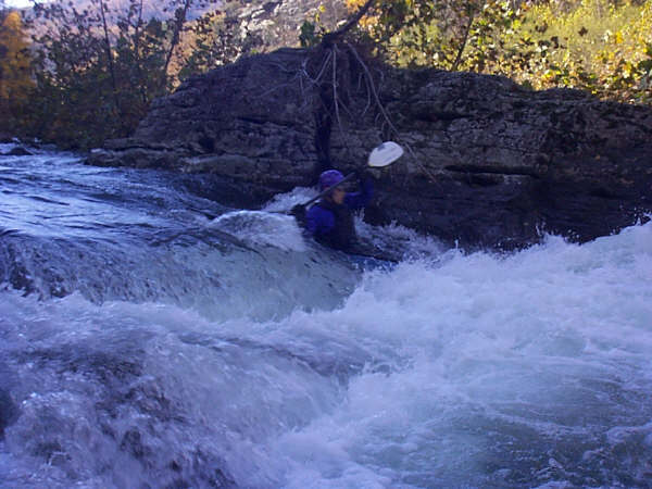
When you get to the second or third island, stay to the right for a nice ledge drop.. There is a small eddy on river right just above the drop (worth scouting on your first run). The center is a stern-bustin- 4-foot pourover; the left is a twisting ominous drop. This could get pretty hairy at over 1000 cfs Cabins gauge for the unexpecting. There is a sneak route to the left.
Rapids in this Run (2)
Hazards & Portages (1)
Caution: The following locations may require scouting or portaging. Always check current conditions.
Difficulty
Class II-III
Length
4.5 mi
Rapids
2
1 Hazard
Access Points
Difficulty Classes
I Easy
II Novice
III Intermediate
IV Advanced
V Expert/Extreme
VI Unrunnable
Current Conditions
5-Day Forecast
Whitewater data from
American Whitewater
American Whitewater