7) Merced Falls to Snelling Diversion Dam
Gauge Conditions
Runnable: ? – ? CFS
Approximate reading: This gauge is 0.6 miles away on Merced. Use as a general reference only.
Data from American Whitewater & USGS
CDEC Flow Data California
Data from California Data Exchange Center (CDEC)
Run Map
Description
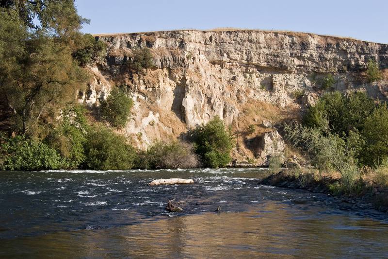
This is a very pretty section that has dependable irrigation flows through the summer. It is mostly flat water paddling, but there is steady current for the first half of the trip. There are two small riffles early on, then one nice class 1 rapid near the halfway point. The last one third to one half of the trip is on the slow water impounded by the Snelling diversion dam.
Highlights of the trip are the interesting scenery and frequent sightings of osprey, herons, egrets and various waterfowl.
The total on water distance of the trip from Hornitos road to Snelling Diversion dam (Crocker Huffman dam) is about 3.4 miles. A portage around the left side of Merced Falls dam is about 1/10 of a mile.
Put in:
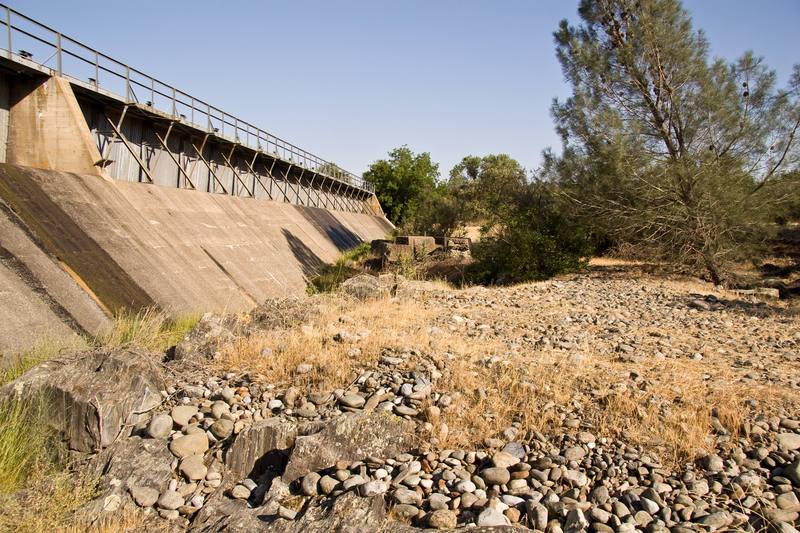
Launch at large turnout next to the Hornitos Road bridge, on the north side of Merced Falls forebay. Paddle down and across the lake to the left side of the Merced Falls dam. Do an easy but fairly long portage around the end of the dam and back to the right side where the river emerges from the small powerhouse.
Take out:
As you approach Snelling diversion dam, (officially called the Crocker-Hoffman Diversion Dam), stay to the far right, especially at higher flows. Take out on the bank to the right of the dam and carry a couple hundred yards to the Crocker-Hoffman Dam fishing access parking area. Alternatively, portage the dam with some difficulty and take out a few hundred yards downstream where the highway comes close to the river.
Other Information Sources:
Merced River Hatchery can be open to the public, weekdays from 8 AM to 5 PM. They raise salmon and steelhead. However, the drive in is a couple miles of rough gravel road without direction signs. The fish pens are locked up and there may not be anyone there unless you call ahead. It is easier to paddle across the river from the take-out, especially during periods of low flow.
Merced Irrigation District
Merced Irrigation District Parks Department
9090 Lake McClure Road
Snelling, CA 95369
209-378-2521
Merced River Watershed Library
Lower Merced River and Mustang Creek Watersheds Study
MERCED RIVER PLANNING UNIT pdf
FERC Information:
Merced Falls Project: FERC # P-2467, license expires in 2014, so PG&E is probably starting or getting ready to start their relicensing process. It is a small run of the river project, but in water year 2005-2006, this project generated 13,806,300 KWH of electricity.
The National Marine Fisheries Service claims that, "Although the P-2467 project is owned by PG&E, it is operated by the Merced Irrigation District (MID), the Licensee for the Merced River Hydroelectric Project (P-2179), which is located just upstream of P-2467. MID operates the Merced River (P-2179) and Merced Falls (P-2467) Projects, including the New Exchequer and McSwaln dams (P-2179), Meroed Falls I Dam (P-2467), the Northside Canal on the Merced Falls Reservoir, the Crocker-Huffman Dam, and the Main Canal on the Crocker-Huffman Reservoir, as an integrated water and power complex to provide consumptive water and power generation (MID 2008). " 20091116-0200 FERC PDF (Unofficial) 11/10/2009
NMFS also state that they will try to require improved fish ladders at this dam.
To search for documents related to this project go to the FERC E-library. Enter P-2467 into the Docket number box.
Merced River Hydroelectric Project, Federal Energy Regulatory Commission (FERC) Project No. 2179, also has effects on this reach and also expires in 2014. " The Project is located on Merced River in Mariposa County, California, and consists of 2 reservoirs (Lake McClure and McSwain Reservoir), 2 powerhouses (New Exchequer and McSwain powerhouses) and various recreation facilities on Lake McClure and McSwain Reservoir. The Project does not include any transmission lines, canals or open conduits. The installed capacity of the Project is 103.5 megawatts. "
Both of these projects are starting the relicensing proces in 2008.
Rapids in this Run (2)
Hazards & Portages (1)
Caution: The following locations may require scouting or portaging. Always check current conditions.
Difficulty
Class I
Length
3.5 mi
Gradient
2 ft/mi
max 3
Rapids
2
1 Portage
Access Points
Difficulty Classes
I Easy
II Novice
III Intermediate
IV Advanced
V Expert/Extreme
VI Unrunnable
Current Conditions
5-Day Forecast
Whitewater data from
American Whitewater
American Whitewater