A) FR144 to FR149 (10 miles)
Gauge Conditions
Runnable: ? – ? CFS
Approximate reading: This gauge is 10.6 miles away on Flambeau. Use as a general reference only.
Data from American Whitewater & USGS
Run Map
Description
Put-in is FR144/Shady Knoll (Fish Trap Campgrounds).
Take-out is FR149/Ten Mile Road/Cedar Rapids Road.
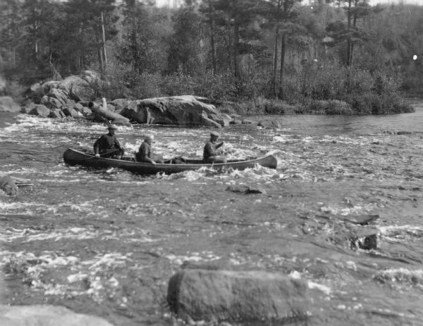
There are only two marked, named rapids on this reach: Smith Rapids and Cedar Rapids.
(This is not to say that there are no other rapids, only that those are the only ones marked and named on topo maps.)
Rapids in this Run (3)

Difficulty
Class I-II
Length
9.9 mi
Gradient
3 ft/mi
max 10
Rapids
3
Access Points
Difficulty Classes
I Easy
II Novice
III Intermediate
IV Advanced
V Expert/Extreme
VI Unrunnable
Current Conditions
5-Day Forecast
Whitewater data from
American Whitewater
American Whitewater