Rapid
WI
Smith Rapids
Save this feature with the run it belongs to.
Gauge Conditions
Runnable: ? – ? CFS
Approximate - nearest available gauge. Use as general reference only.
Data from American Whitewater & USGS
Photo
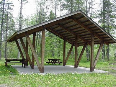
Photo courtesy of American Whitewater
Description
There are only two marked, named rapids on this stretch -- this one and one at the very end of the run. (That is not to say these are the only rapids, only that they are the only ones noted on topo maps.) From the satellite views, there is not much in evidence here, so it seems it is a very minor rapids. Access is available (via Smith Rapids Road) right nearby, and there is a campground marked on topos here as well.
Location
Interactive river map
Loads as you approach this section.
Other Rapids on This Run (4)

View Full Run
A) FR144 to FR149 (10 miles)
Flambeau, S.Fk.
I-II
9.9 mi
Current Conditions
5-Day Forecast
Whitewater data from
American Whitewater
American Whitewater