A) Leist Road to Cnty.Rd.S (PnP or 4.5 miles)
Gauge Conditions
Runnable: 600.0 – 3,000.0 CFS
Flatwater float, but gradient will be grungy (likely portage).
Data from American Whitewater & USGS
Run Map
Run Time Estimate
Select put-in and take-out to estimate time.
Plan This Trip
See wind-adjusted speed maps, forecast planning, and detailed time estimates.
Sign in to generate an AI timing estimate for this run.
Whitewater timing varies with scouting, portages, and group pace. Use as a planning baseline.
Description
Quick Facts:
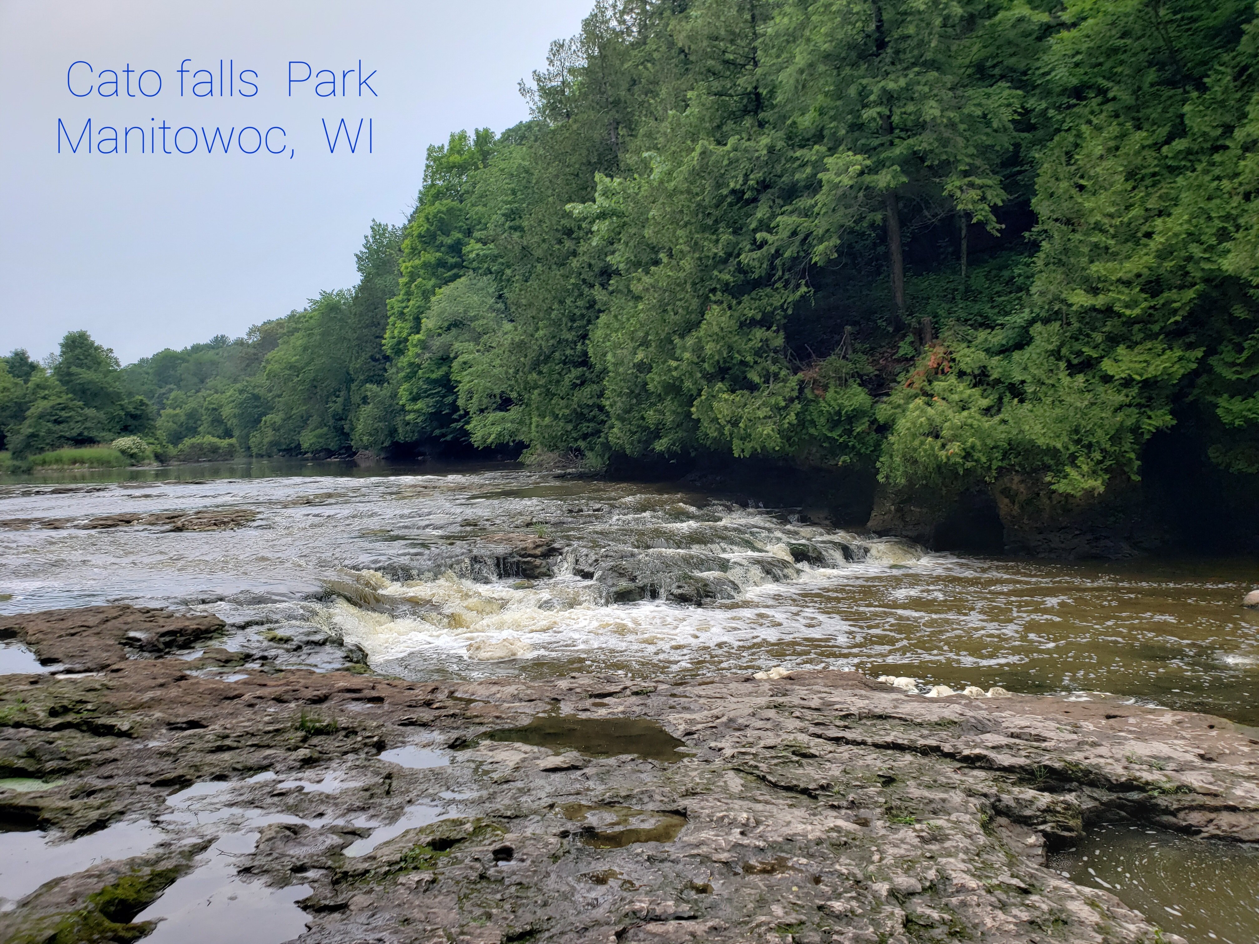
Location: Clarks Mills, approximately 10 miles due west from Manitowoc.
Shuttle Length: 4.2 miles (or just PnP at one or both of the 'falls')
Parking for (Upper) Cato Falls: Sportsman's Park: 44.0943, -87.8888
Parking for Lower Cato Falls: Lower Cato Falls County Park: 44.0903, -87.8439
Take-out: Manitowoc County Park and Game Protective Area (Hwy.S): 44.0991, -87.8223
Character: Two areas of bedrock ledges, and a few random boulder-bed rapids.
Drainage area at listed put-in: ~390 sq.mi.
Put-in is approximately 795' elevation.
Take-out is approximately 650' elevation.
Thus total elevation change is approximately 145'.
General Overview
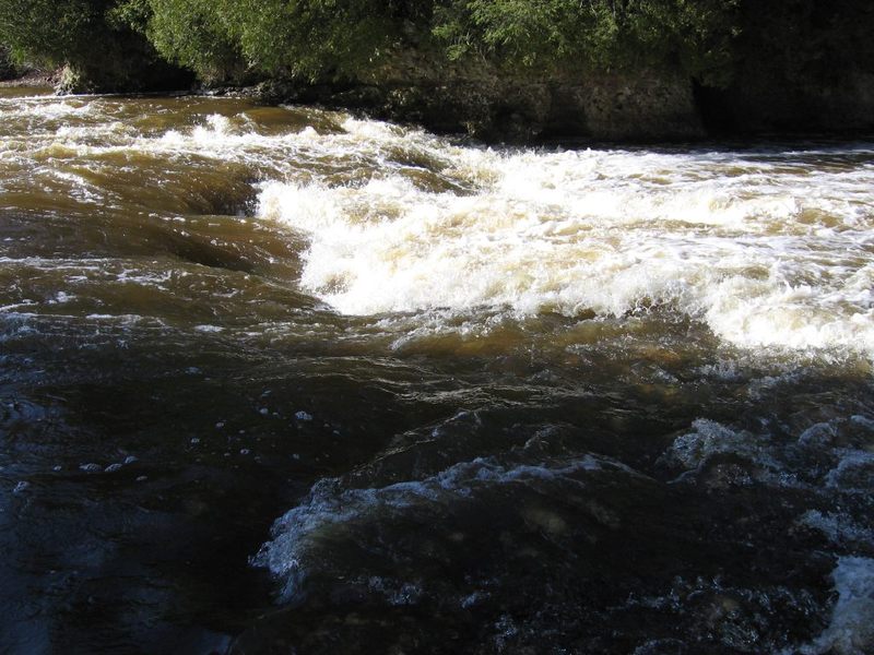
There are two main areas of whitewater interest on the 'upper Manitowoc'. The first, Cato Falls, lies just downstream of Leist Road. The second, Lower Cato Falls, lies in a county park which bears its name.
Whitewater playboaters tend to favor the latter of the two as a park-and-play wave/hole, and have taken the shorthand of just referring to it as 'Cato Falls' (or just 'Cato'). Unfortunately, this may cause some confusion, since Cato Falls is the proper name of the upstream feature (and in the unincorporated village near it!), and 'Cato' is the name of town about four miles to the north.
Neither of these is anything close to a 'falls'. Each is simply an area of bedrock intrusions/ledges, creating rapids and play potential. Cato Falls (the upper) is a longer stretch, and offers more variety with opportunities for 'working' the river. Lower Cato falls is the more significant concentrated drop, offering a few small 'set up' waves, a significant sliding drop into a pool in a rocky grotto, and (at flows above 1000-1200 cfs) one main wave/hole feature.
While some folks argue the contrary, I find water quality on this river to be quite 'iffy'. The drainage is dominated by cattle farms (a number of 'industrial farms', packing unusually large numbers of cattle in inordinately small space). I'm not entirely convinced that the age-old practice of 'manure spreading' into the fields has ceased. Thus, it stands to reason that the runoff (especially in early spring) will contain significant amounts of fecal matter. Changes in DNR rules regarding farm practices should help, but I wouldn't expect miracles.
Note: this is not intended as a criticism of agricultural practices or the farmers in the area. It is just an advisory for those who pursue recreation on this river. When the river flows high for days on end, it is likely to flush the worst problems out in the early going, thus may run quite respectably 'clean' (as these boaters assert). I would still strongly advise you do your best to keep your mouth closed if you flip (or get some significant splash) and make sure to shower and thoroughly rinse all gear (ASAP) after being in/on this river to avoid some major river-funk!
Rapids in this Run (2)
Hazards & Portages (1)
Caution: The following locations may require scouting or portaging. Always check current conditions.
Difficulty
Class I-II(III)
Length
4.6 mi
Gradient
12 ft/mi
max 44
Rapids
2
1 Hazard
Access Points
Shuttle Info
Serious whitewater playboaters are more likely to pursue park-and-play at (upper) Cato Falls (with access through the Sportsman's Club), and/or at Lower Cato Falls (via the county park which it lies within).
Difficulty Classes
I Easy
II Novice
III Intermediate
IV Advanced
V Expert/Extreme
VI Unrunnable
Current Conditions
5-Day Forecast
Whitewater data from
American Whitewater
American Whitewater