Above Brandeberry Creek to Hyas Creek
Gauge Conditions
Runnable: 2,000.0 – 4,000.0 CFS
Data from American Whitewater & USGS
Run Map
Run Time Estimate
Select put-in and take-out to estimate time.
Plan This Trip
See wind-adjusted speed maps, forecast planning, and detailed time estimates.
Sign in to generate an AI timing estimate for this run.
Whitewater timing varies with scouting, portages, and group pace. Use as a planning baseline.
Description
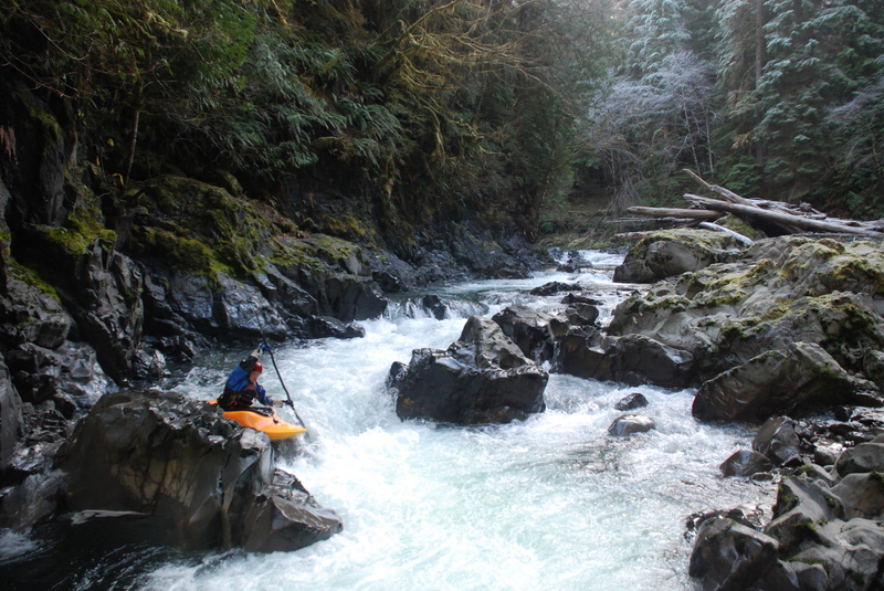
The Sitkum can be divided into four sections on its way to the confluence with the South Fork Calawah: a class IV/V section, a class V section, a class IV section, and a class II/III section. In theory you could run all of these together but it would make for a long day, particularly during the short days of winter when the river is generally flowing.
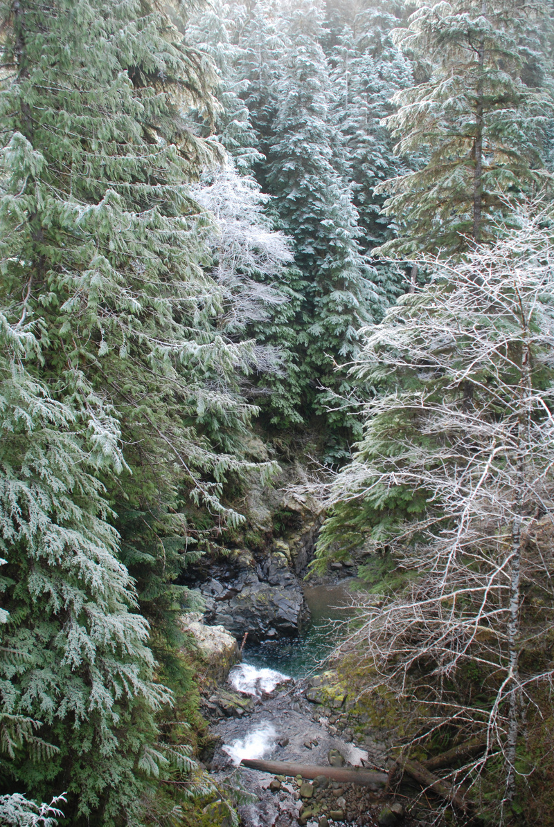
_Upper Upper Sitkum, 2.5 miles_
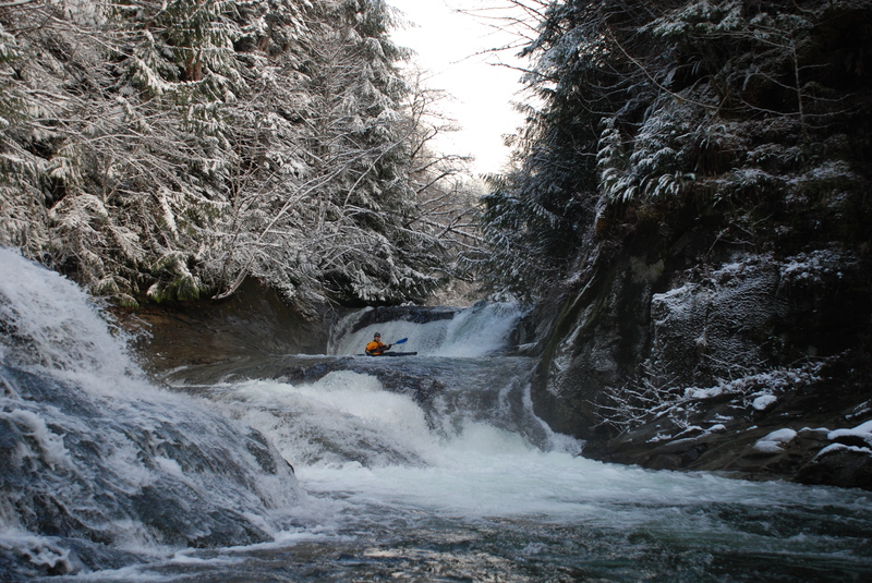
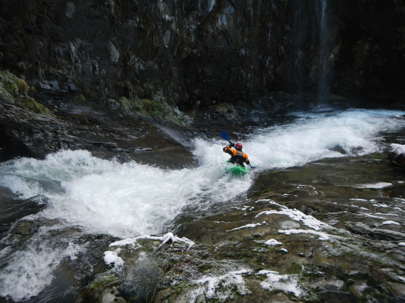
This run is a class IV-V with at least three clean 10-15 foot vertical waterfalls, multiple slides, and holes to punch. While it’s not featured in the Korb guidebook, it’s one of the best creek runs on the Olympic Peninsula. The run is short but can take a full day on your first descent. Once you’ve learned the lines, you can lap it.
The run starts with a fun flume on the right, leading to the first horizon line: a beautiful double-drop waterfall that’s tricky to scout. For the first drop, aim for the right of center, then follow the main tongue on the left for the second, smaller drop. Shortly after, you’ll encounter a second waterfall that’s easily scouted from the right. Scout carefully and choose your line, or opt for a portage down the slippery rocks on the right.
The next feature, 50/50, is a fun flume that banks off the right wall into a tricky hydraulic, which can be more challenging than it appears. The drop continues through a narrow mini-gorge. Be alert in the drop below 50/50, as the boil pushes to the right into a shallow cave. In 2017, the right wall of 50/50 collapsed, creating a messy rapid. It can be portaged on the left; with time, the debris may settle, making the rapid more runnable.
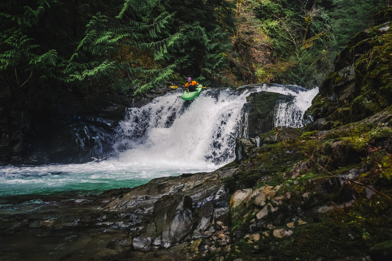
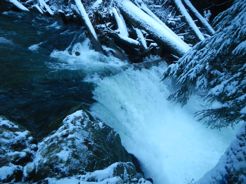
Next is a great 10-foot waterfall with a nice boof, which you can run down the center. It’s an easy scout on the left, but portaging would be difficult. Afterward, another fun slide awaits, and if it’s been raining, waterfalls will cascade off the bedrock wall to the left.
After the main whitewater section, the river opens up, and the whitewater tapers off. Keep an eye out for elk in this section. You’ll pass a potential take-out where the road is visible. A couple more fun rapids follow before you enter the gorge of the Upper Sitkum, where another waterfall marks the end of the run. If you’re done for the day, you can follow a game trail up to the road from the lip of this woody falls. Alternatively, you can run or portage the falls and continue through the final drops to the Brandeberry Creek confluence.
_Upper Sitkum, 3.5 miles_
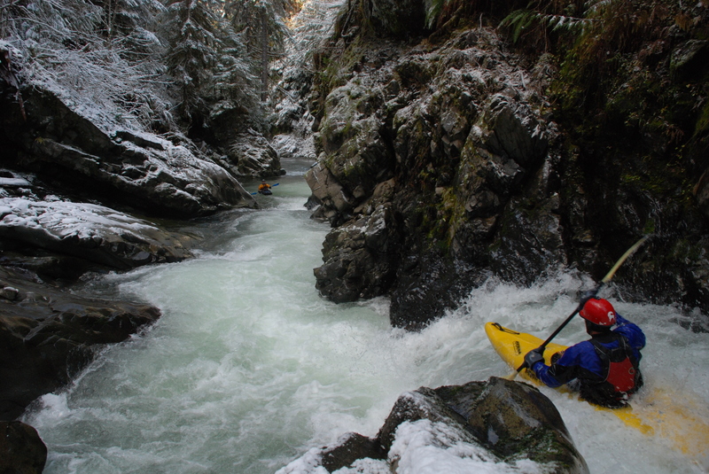
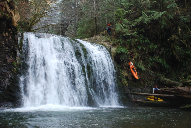
The run starts out at Brandeberry Creek with about 3.5 miles of intermittent class V creek action, a couple of which you may want to portage. Korb notes numerous undercuts, potholes, and pinning opportunities in his description of the run, but it is a great run for experienced creek boaters and all the drops can be run if they're clean.
The river starts off with some fun drops before you reach Severe Reality a challenging class V section that can be portaged if you want. The river opens up a bit providing some more fun rapids before you reach the entrance to a gorge and Claustrophobia. Within a few more drops you'll be at the Boulder Factory which is a half mile section that starts with The Big Ugly. The rapids taper off a bit as you pass through a scenic canyon section upstream of the North Fork confluence.
_Middle Sitkum, 3 miles_
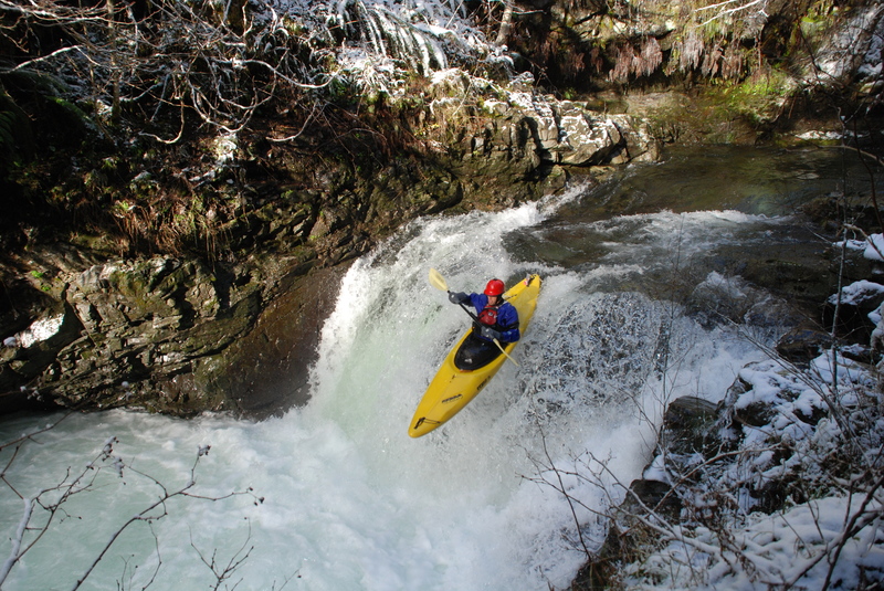
An entry point to the canyon just upstream from the North Fork Sitkum confluence marks the start of the intermediate 6 mile run which typically includes the middle and lower sections. While some people hike the trail in, the better option is usually to put in at the bridge over the North Fork Sitkum for more class IV action. Just before the confluence with the main Sitkum is a 25-30' waterfall that can be run, or portaged by lowering boats on a throw-rope and scrambling down along the left bank which requires a rope assist. From the confluence with the Sitkum the river flows through class II and III rapids until you reach a canyon section lined with bedrock walls and marked by a distinct horizon line. This is the start of a fun class IV section through a beautiful little gorge (less than a mile). The first major drop is Little Pistol. The river carves its way through some fun IV- rapids, but you have plenty of time to get ready for the next major rapid, Cotton Candy which comes near the end of this section. Cotton Candy is class IV as the river drops over a 7 foot ledge into a big pool. It forms a hole at the higher range of flows.
_Lower Sitkum, 3 miles_
After the class IV gorge, the river calms down to more class II/III action. Once you reach the Sitkum Gorge Bridge (Forest Road 2900-070), the best rapids are over but the river continues its scenic course through the canyon. While paddlers looking for a scenic float without the action of the upstream reaches can put in here, the steep climb to the road makes this a very unappealing takeout. Most continue on downstream to Hyas Creek. Over the next 3 miles or so the river cuts through several class II rapids and finally one last III- rapid just beyond the confluence with the South Fork Calawah. Those who put-in at the bridge may want to continue on downstream on the South Fork Calawah to the confluence with the North Fork Calawah, but those who put-in higher will likely be ready to take advantage of the easy road access at the Hyas Creek confluence.
Logistics:
About a mile north of Forks, Forest Road 29 leaves highway 101 at mile 193.3 and heads east. The road is prone to major damage following storm events but the Forest Service is working to upgrade stream crossings to make the road more sustainable. During summer 2002, washouts on Forest Road 29 that prevented vehicle access for nearly 4 years were repaired and in 2024 repairs were again made after the road was closed for 3 years. The landslide-prone slopes of this drainage will lead to future road failures so be sure to check current road conditions particularly after a high water event. For current information on roads call the USFS/NPS Resource Information Center in Forks 360-374-7566 or the USFS Ranger District office in Forks (360)374-6522.
Several access points are available off Forest Road 29 as follows:
The first access you will reach is the take-out for the lower run at mile 8.0. This access is at the Hyas Creek confluence with the South Fork Calawah. A short road downstream river right of the confluence just before you cross the Hyas Creek Bridge provides access to a gravel bar with easy access.
From the take-out continue upstream to a couple different access points depending on what you're looking for. The first landmark is FR 2923 which splits off the left at mile 8.8. Continue on the right fork on FR 29 and at mile 11.1 you'll see the 070 spur which heads down to the right and a bridge across the river. For those who want to boat only the lower class II/III section, you can scramble down the downstream river right side of the bridge across the Sitkum (bring rope for this one).
The next potential access for those who want to add some class IV rapids, is reached by continuing upstream on FR 29. You will parrallel Rainbow Creek and cross it at mile 12.1 and then the North Fork at mile 13.9. Putting in on the North Fork is one option. Continuing on there is a small pull-out at mile 14.3. A social trail leads from this point down towards the right and the confluence of the North Fork. It's steep at the end and you will find a rope helpful for lowering the boats. An alternative shorter route (unmarked) is available by heading off towards the left (this is the access illustrated in Korb's guidebook). It too requires rope to lower the boats down. Either way don't expect the put-in to be particularly user friendly.
If you're interested in also running some class V drops, stay on FR 29 to mile 17.6 and the bridge across Brandeberry Creek. You can see the confluence with the Sitkum from this bridge and there is access to the river on the downstream river right side of the confluence.
For the Upper Upper run, continue up to mile 20 for the put-in. There are marks on the trees on river right and a few flags leading you to the river.
Rapids in this Run (12)
Difficulty
Class II-V
Length
12.6 mi
Gradient
76 ft/mi
Rapids
12
Access Points
Difficulty Classes
I Easy
II Novice
III Intermediate
IV Advanced
V Expert/Extreme
VI Unrunnable
Current Conditions
5-Day Forecast
Whitewater data from
American Whitewater
American Whitewater