B) CTH.Y to Upper Newton Road (4.5 miles)
Gauge Conditions
Runnable: ? – ? CFS
Approximate reading: This gauge is 8.0 miles away on Bad Axe. Use as a general reference only.
Data from American Whitewater & USGS
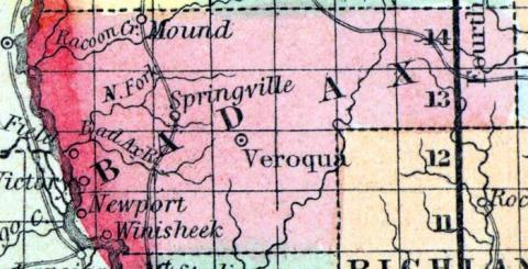
Run Map
Run Time Estimate
Select put-in and take-out to estimate time.
Plan This Trip
See wind-adjusted speed maps, forecast planning, and detailed time estimates.
Sign in to generate an AI timing estimate for this run.
Whitewater timing varies with scouting, portages, and group pace. Use as a planning baseline.
Description
Southwest Wisconsin (the area around La Crosse, in the counties of La
Crosse, Vernon and Monroe) is commonly called "The Coulee Region".
Erosion has divided the area into narrow ridges and steep-sided valleys
called coulees, from the French verb "couler," meaning to flow.
With
all its rolling terrain, any boater with any imagination who has driven
through or looked at it on topographic maps would have to surmise " _There MUST be some good whitewater here!_"
Unfortunately, there are serious downsides of all that steep coulee
terrain. By its nature, it fractures the watersheds into such small
subdivisions that where there is gradient, there is not generally much
drainage area. By the time there is decent drainage area, you are in the
'bottom lands' where there is not much gradient. Being such smaller
drainages, they have very little flow most of the year, thus are likely
to have much overhanging or encroaching shrubbery, deadfall, and snags.
All that said, the Bad Axe is one drainage which (beyond its suggestive
and colorful name) appears to have some promise. The gradient appears to be spread quite evenly, and (without encountering any
significant bedrock or narrows) the result is mostly 'swiftwater' with few true whitewater features. Doing a 'flyover' (via satellite
views) suggests this section is fairly 'open'
(I.E., not running through too much wooded area), so deadfall and snags
may not be as much a problem as otherwise might be expected for such a small watershed area.
Rapids in this Run (1)
Difficulty
Class I-II
Length
4.2 mi
Gradient
27 ft/mi
Rapids
1
Access Points
Difficulty Classes
I Easy
II Novice
III Intermediate
IV Advanced
V Expert/Extreme
VI Unrunnable
Current Conditions
5-Day Forecast
Whitewater data from
American Whitewater
American Whitewater