B) FR157/Cascade River Road to CR45/Pike Lake Road (3.5 miles)
Gauge Conditions
Runnable: ? – ? CFS
Approximate reading: This gauge is 0.0 miles away on Cascade. Use as a general reference only.
Data from American Whitewater & USGS
Run Map
Description
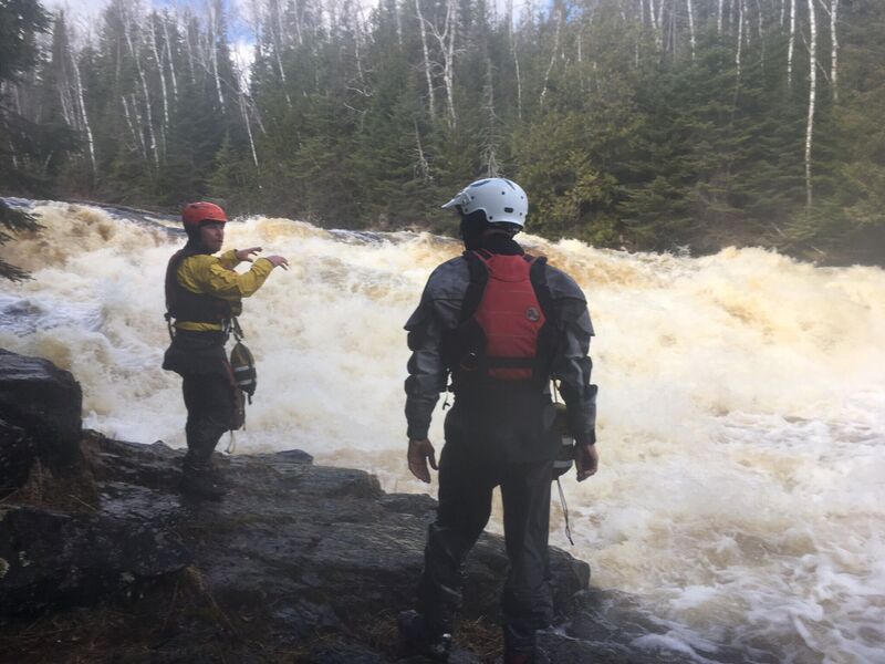
This reach consists of fairly continuous class II (+/-) boogie water. The main exception comes where a fair size island splits the flow. The left side has at least one good line, but is pretty meaty, and leaves little margin for error as the outflow heads quickly toward the lower falls. The right side begins with a short ledge (and potentially grabby hole, easily skirted tight left), then a short pool before a wide, uniform slide (with more water tight left by the island) into another pool. From here, one has plenty of room to line up for a good line down the lower falls. Just right of center, a tongue of water (and grunge-down-rock) makes an easy line into the pool at the base. (Other more gutsy routes may be possible.) Below, the river continues its continuous class II nature the rest of the way to the take-out at CR45.
(Description based on run at +2" on the Hwy.61 'hip' gauge.)
Rapids in this Run (1)
Waterfalls (1)
Difficulty
Class II(IV)
Length
3.5 mi
Gradient
63 ft/mi
max 84
Rapids
1
Access Points
Difficulty Classes
I Easy
II Novice
III Intermediate
IV Advanced
V Expert/Extreme
VI Unrunnable
Current Conditions
5-Day Forecast
Whitewater data from
American Whitewater
American Whitewater