B) Newald Tower Rd to Morgan Lake Rd (4.7 miles)
Gauge Conditions
Runnable: 200.0 – 1,000.0 CFS
Too low for reasonable whitewater. (May be paddled as a scenic float trip, but all gradient will be a scrape or carry.)
Data from American Whitewater & USGS
Run Map
Interactive run map
Loads as you approach this section.
Run Time Estimate
Select put-in and take-out to estimate time.
Plan This Trip
See wind-adjusted speed maps, forecast planning, and detailed time estimates.
Sign in to generate an AI timing estimate for this run.
Whitewater timing varies with scouting, portages, and group pace. Use as a planning baseline.
Description
With two rocky rapids (II) and one bedrock ledge (II)) making up just 8% of its length, this section is run far less often than Morgan Lake Rd to Hwy 101. However, it is most useful as an easy-shuttle extension to the downriver section. It adds 4.7 miles of river (2-3 hrs, or avg 2.5) and a mere 3.5 more miles of shuttle distance. To add even a little more length (0.2 mile) and one fun rapids, NT Rapids (II) can be run by carrying upriver from the Newald Tower Bridge.
Just 1000 feet from the put-in, behind a small island on river-right, the South Branch of the Popple joins the North Branch. There are no significant rapids on the South Branch but for anyone interested in reading about growing up in the remote lands of this area of the Popple (1950-1960) will enjoy reading “Fences in the Woods,” by Ken Hedmark.
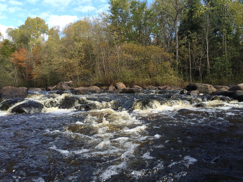
Masons Rapids (I-II) and Camp 1 Rapids (II) are relatively easy, rocky runs separated by a short pool and a signed portage (river-right) that is most useful to scout or avoid the often impenetrable, terminal bolder wall of Camp 1 Rapids (Notice tip of a swamped and mostly submerged, aluminum canoe below terminal boulder wall in the photo)
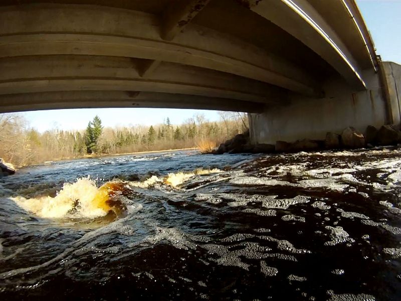
Anunson Trace Rapids: The bridge and bedrock ledge concentrate flow through this short drop. The rapids can be easily scouted from Morgan Lake Rd bridge. Earthen embankments are all that remain of the Anunson Dam built here in 1880.
Rapids in this Run (4)
Hazards & Portages (2)
Caution: The following locations may require scouting or portaging. Always check current conditions.
Difficulty
Class I-II
Length
4.6 mi
Gradient
4 ft/mi
max 7
Rapids
4
1 Hazard
1 Portage
Access Points
Shuttle Info
3.5 miles on gravel roads that are typically good enough to allow for a bike-back option. At mile 3.2, stay straight onto Newald Tower Road as Morgan Lake Rd turns right
Difficulty Classes
I Easy
II Novice
III Intermediate
IV Advanced
V Expert/Extreme
VI Unrunnable
Current Conditions
5-Day Forecast
Whitewater data from
American Whitewater
American Whitewater