Anunson Trace Rapids
Save this feature with the run it belongs to.
Gauge Conditions
Runnable: 200.0 – 1,000.0 CFS
Too low for reasonable whitewater. (May be paddled as a scenic float trip, but all gradient will be a scrape or carry.)
Data from American Whitewater & USGS
Photo
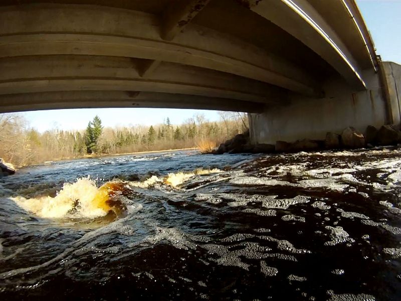
Photo courtesy of American Whitewater
Description
The bridge and bedrock ledge concentrate flow through this short drop. At high flow (>650 CFS) the center path leads to a large sucking hole directly under the bridge. At lesser flows the hole is a sweet s-shaped path past the brink of the hole. At low flow, the rapids ends in a confusing river-wide stone-field. Be prepared to stop or back-ferry immediately after s-shape drop. The best landing is on the right after the stone field. The landing on the left is often harder to get out of your boat and on to land.
Location
Interactive river map
Loads as you approach this section.
View Full Run
B) Newald Tower Rd to Morgan Lake Rd (4.7 miles)
Popple
I-II
4.6 mi
Current Conditions
5-Day Forecast
Whitewater data from
American Whitewater
American Whitewater