City of Lowell to Merrimack River
Gauge Conditions
Runnable: 400.0 – 6,000.0 CFS
Data from American Whitewater & USGS
Run Map
Description
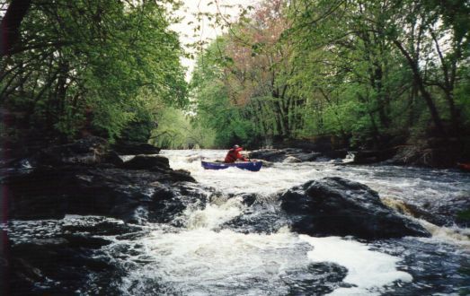
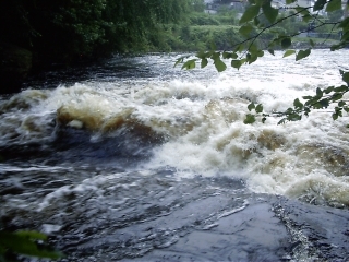
The Concord runs through the heart of downtown Lowell. While the area is highly urbanized, the city is hidden from the river by trees and thick greenery. As a result this is an attractive run even though it runs thru the heart of the city.
The Concord river has been modified, damed, and diverted into canals for hundreds of years. Most of the dams and canals have washed out or filled since the mid-20'th century, but a small hydro facility (operated by Centennial Island Hydro) was built on a 19'th century era diversion canal in the early 1980's. This newer project in the upper section diverts some of the flow from the put-in to just past Twisted Sister. The hydro facility can be seen just past Twisted Sister on the left.
Of special interest is the U.S. National Park devoted to the canal system. With special arrangement, paddlers are allowed to make use of the locks below the last rapid. Thus allowing one to use the power of the river to float oneself up to a canal for an easy paddle to your car.
The river has also been narrowed over time in an effort to gain more real estate. Therefore it does not require as much water to run as it was in its natural state. The river also has a _huge_ watershed, encircling the towns enclosed by Westford, Shrewsbury, Hopkinton, Wayland and Bedford (36 towns total). This results in a very long boating season; the river should be runnable from late Fall and Winter (after a moderate rain) thru the spring (usually into June). The large number of wetlands, swamps, and dams in the watershed also delay the effect of rain and act as a big sponge. There is usually water for a couple weeks after any substantial amount of rain. Additionally the southern New England location close to the coast means the river is usually boatable throughout the winter and early spring.
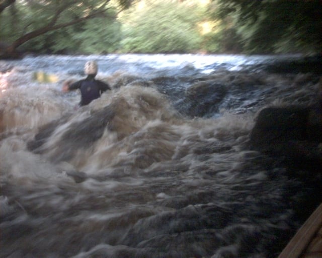
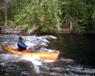
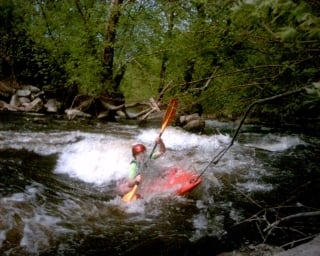
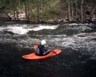
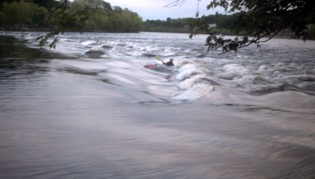
The whitewater section has only four "named" drops or rapids, however it is packed with numerous surfing and play spots. Boaters can (and do) spend hours on this river hitting the waves over-and-over again. The whole run is only about 1-1/2 miles long and passes old mill factories and neighborhoods. If you take-out at the bottom on the Merrimack River it adds another 3/4 mile to the run.
During the months of April and May the Lowell Parks & Conservation Trust runs rafting trips in cooperation with Zoar Outdoor (water dependent).
_Updated Info:_ There is a new put-in 100 yards upstream of the old one. It is a public park with a boat ramp and plenty of parking. It gets plenty of use from fishermen and flatwater boaters so security is better as well (03/2009).
The fence at the takeout below Middlesex Dam has been removed by the city for parking lot reconstruction. So it's no longer necessary to "hop" the fence to get to your car (03/2009).
## Technical info
```
Put in elevation........98'
Take out elevation......55'
Total drop..............43'
Average drop/mile.......34'
Distance................1.25 miles
River width average.....35'
River geology...........schists small boulders some ledge
River water quality.....Varies, stained dark by upstream swamps.
Scenery.................Varies, urban to trees, some trash on shore.
Wildlife................Ducks, Great Blue Herons, etc.
```
## River Paddling Season
Estimated chance (%) of finding the river runnable.
Month............% chance.................comment
```
January ............50%....Be cautious of ice.
February............50%....Be cautious of ice
March...............90%....Highest water month.
April...............80%....Water holds up well.
May ................60%
June................20%
July................10%
August...............8%
September...........20%....Tropical storms and their remains
October.............30%....Trees go dormant less water being absorbed.
November............60%
December............50%....Watch out for ice late in month.
```
Be aware this is averaged out over several years. The % chance refers to the probability of finding the river running on any given day. For instance a 10% probability for July means on average you can only expect 3 days of water. One year there could be 6 days in July with water other years none. 60% of all runnable days (>400cfs) are in the low to medium range. 30% are in the medium range. 10% in the medium high to high range. Spring levels are usually higher than fall levels. Flows on the Concord river usually peak 40 to 48 after a rain event.
Local Map - Concord river and surrounding area of Lowell
_Map of Lowell, Mass. and area surrounding the river.__Map courtesy of Google Maps_
Rapids in this Run (3)
Waterfalls (1)
Playspots (11)
 Playspot
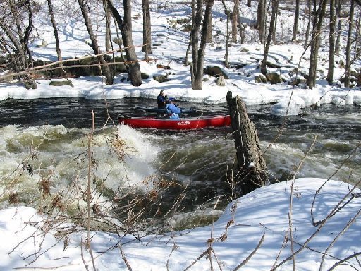
Wave above Twisted Sister
Playspot
Wave above Twisted Sister
 Playspot
Surfing Wave
 Playspot
River-Wide Surfing Wave
 Playspot
Wave at Bottom of Island
Playspot
Wave at Bottom of Island
 Playspot
Meaty Hole at top of Straight Shot
Playspot
Meaty Hole at top of Straight Shot
 Playspot
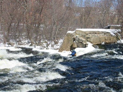
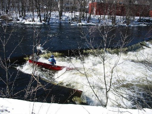
Straight Shot (AKA Massic Falls)
 Playspot
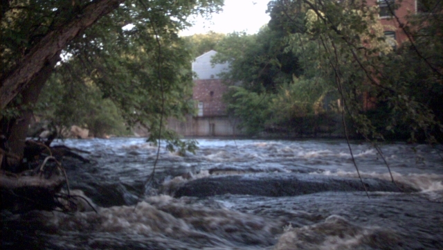
Middlesex Dam
 Playspot
Merrimack River Waves
Hazards & Portages (2)
Caution: The following locations may require scouting or portaging. Always check current conditions.
Difficulty
Class III+(IV)
Length
2.2 mi
Gradient
35 ft/mi
max 45
Rapids
3
2 Hazards
Access Points
Shuttle Info
### \[New\] Put-in
Get to the Woburn St. Exit off Interstate-495 near Lowell (Exit 37, which is one exit north of Rt. 3). Take Woburn St. to Lawrence St. and turn left. It is a five way intersection with a stop sign and blinking light. Follow Lawrence St. for a short distance. Go straight into the parking lot when Lawrence Street turns right to go under the railroad bridge.
**_For the OLD put-in_** Follow Lawrence Street under the railroad tracks, the old put-in is past the cemetery by the bridge over the Concord River. Parking is on either side before the bridge.
You can put on either at the Lawrence Street bridge (above the diversion canal and the dam), or just below the Dam. Rafts put on 100 years below the dam by a huge eddy. Just upstream of Lawrence Street there is a railroad bridge that is often used for seal launching.
### Scouting Locations
From the put-in, drive down Lawrence Street a short distance, turn right crossing over the diversion canal into an old mill parking lot. Walk around the fence or thru the gate along the river. Twisted Sister will be on the right before you reach the hydro plant.
Twisted Sister can also be scouted from river-right. Drive down Lawrence Street; turn right at the Rogers Steet light and cross the river. Take an immediate right again and drive into the parking lot of a manufacturing building. There are stairs leading down to the water next to Twisted Sister. This parking lot is only accessible during the work week.
Straight Shot can be scouted about 200 yards downstream of the Rogers Street bridge from either side of the river.
Middlesex Dam is best scouted from the island in the middle of the river, although it can be seen Warren Street takeout to verify there are no obstructions or strainers.
### Take-out
There are multiple take-outs. The favorite takeout for closed boats is river-right below Middlesex Dam; climb thru the trees and hop a small fence into a public parking lot on Chestnut Street.. When the river is running low you may wish to skip the Middlesex Dam drop and takeout above the dam on river-right on the lawn of a retirement home (adjacent to the same parking lot). (Note: As of 3/2009 the fence has been taken down while the parking lot is under construction.)
Open boats should take out directly below Middlesex Dam on river-left behind a local public parking garage along Warren Street (near the Doubletree Hotel). (Note: The parking lot behind the garage is locked on weekends.)
### Bottom take-out
Paddle downstream to the Merrimack River and takeout near the end of Stackpole Street. From the put-in drive down to the end of Lawrence Street; turn right onto Church Steet and cross the river (which is now Andover Street and Route 110). Turn left at the light onto Nesmith Street (Route 38), then turn right onto Stackpole street just before the Merrimack River bridge.
Difficulty Classes
I Easy
II Novice
III Intermediate
IV Advanced
V Expert/Extreme
VI Unrunnable
Current Conditions
5-Day Forecast
Whitewater data from
American Whitewater
American Whitewater